The Des Plaines River Trail Photos
Route 60 to Half Day Preserve
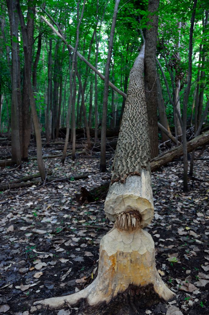
This downed tree is right off of the trail just before the Route 60 underpass and looks like the work of a beaver. I don't know enough about beavers to say for sure if this is their work but after a quick internet search I see that they do sometimes take down some larger trees.
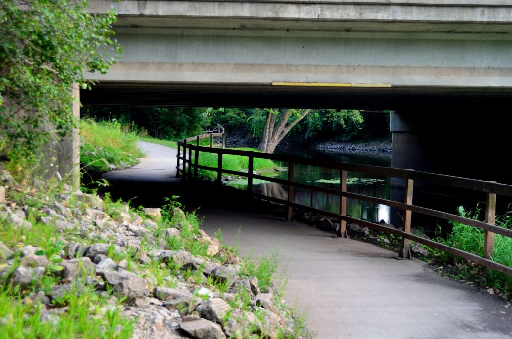
This is the Route 60 underpass as seen from the north (as I was riding south back to Half Day). As you can see there was no problem with flooding at this time although there are times when the river is high and the underpasses are wither closed completely of you get a little wet if you decided to go for it.
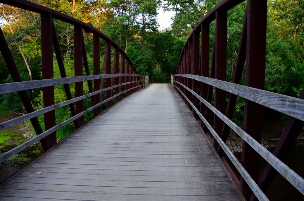
Just after the Route 60 underpass you go over the river on this bridge. You can actually see the underpass from this bridge. I shot this photo looking straight down the bridge to give the riders perspective as you cross the bridge looking straight ahead. To the right , the river is wide and there is a dam as you can see in the photo below.
 *
*
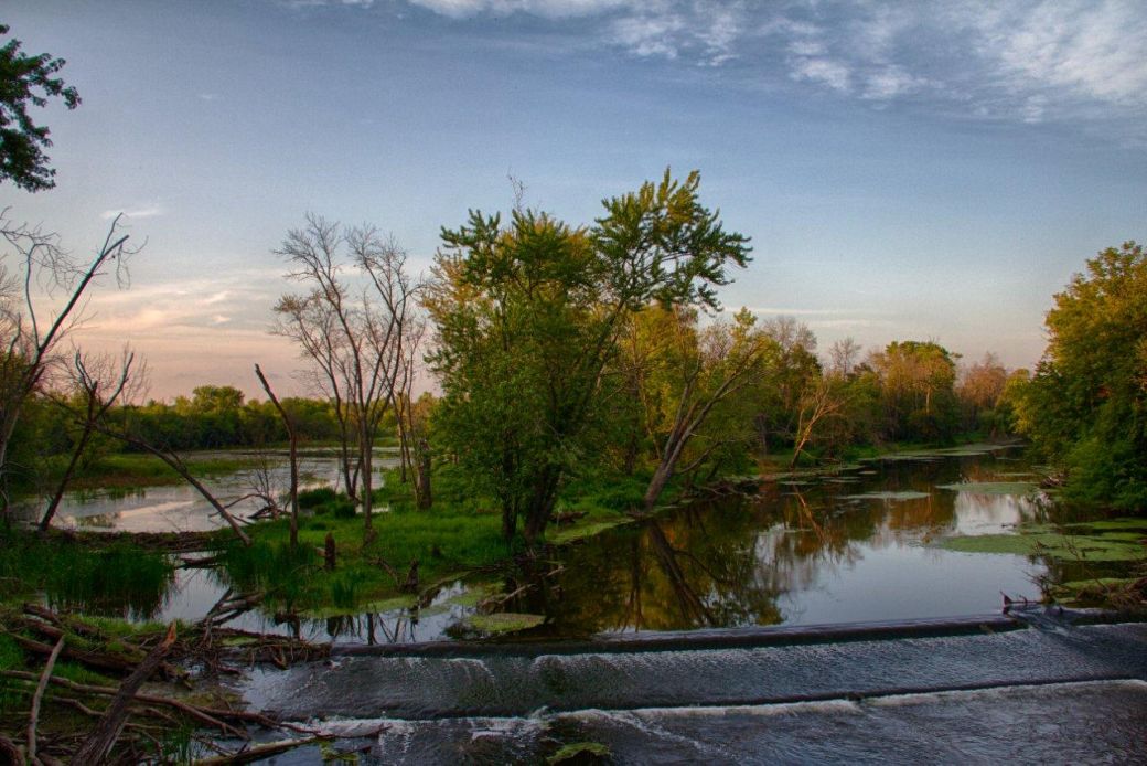
This is an HDR photo of the dam and the wider part of the river as seen from the DPRT bridge shown in the photo above. This is a fairly scenic view from the bridge and I often see people taking a break on the bridge and enjoying the view. The High Dynamic Range (HDR) photo that Dale created above gives an interesting perspective of this scene.
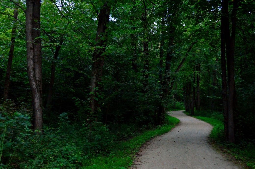
Here we are back in the woods again after the underpass and bridge scene and just before we took a ride into Wright Woods. The trails through Wright Woods (technically Captain Daniel Wright Woods) are very wooded as seen in the photo above. There are some lakes and scenic openings in the park also (as in the next photo).
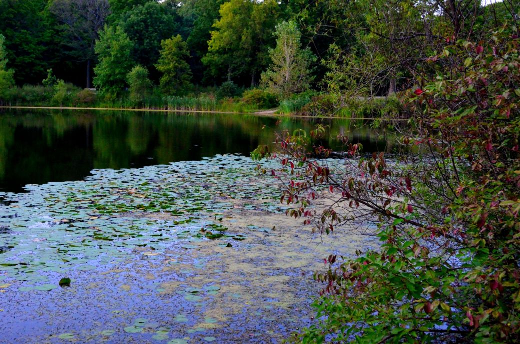
This photo shows the main lake in the park area of Wright Woods. The lake has tons of lily pads in the shallower parts as you can see in the foreground of this picture. There are also some benches and picnic tables making this an excellent place to take a break.
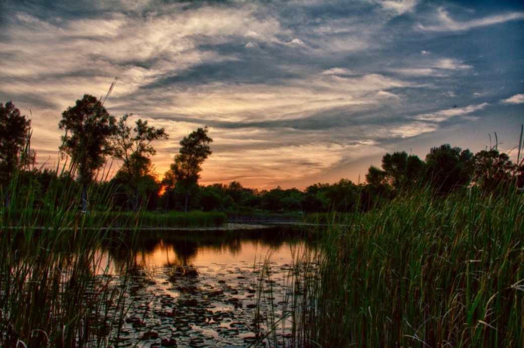
It was near sunset when we passed by the lake in the Half Day Forest Preserve. The HDR photo above shows the lake at sunset as seen from the bridge on the bike path.
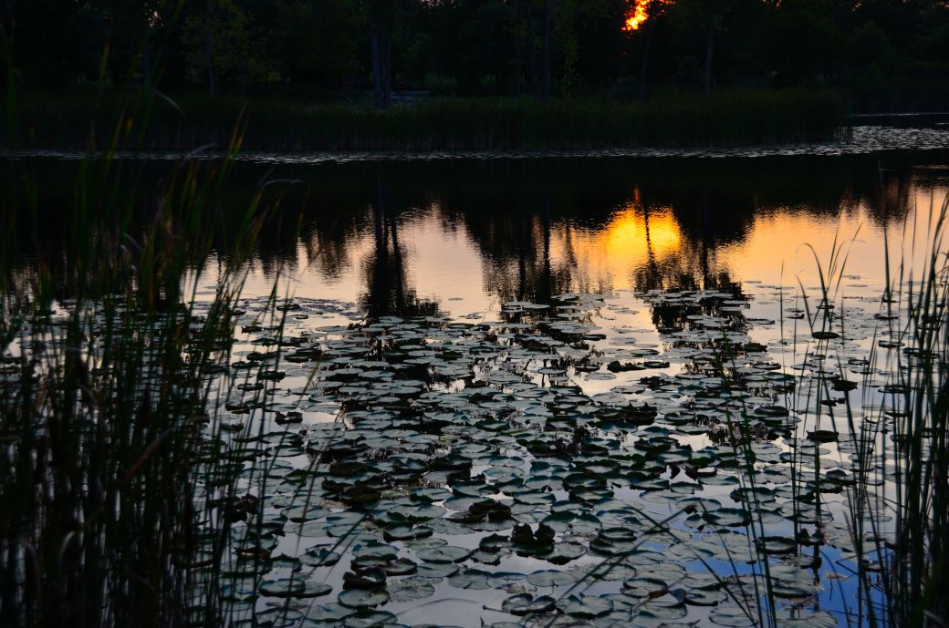
The final photo in this DPRT photo tour was also at the lake in the Half Day Forest Preserve. This one was also taken from the bike path bridge at the same location but with a lower perspective. This photo is not an HDR photo (of course) but I did boost the colors a bit to emphasize the sunset reflection in the lake.
Here's the Photo Tour of the Half Day to Old School Forest Preserve ride from August 16th, 2014. These pages include photos of the DPR Trail in this section along with some nice scenery photos (including a few HDR photos) taken from various locations on the trail.
Old School Trail and MacArthur Woods - Photos 20
Route 60, Wright Woods and Half Day FP - Photos 21 < You are here
Here's the GPS Map of the ride above.
Here are some Fall Photos of the DPRT from Euclid (or Lake Street) a little east of Prospect Heights south to Golf Road then back north to Milwaukee Ave (from October 9, 2012):
DPRT Fall Photos 17 - Just South of Lake Street
DPRT Fall Photos 18 - Branch to Beck Lake
DPRT Fall Photos 19 - North of Lake Street
Here's the GPS Map of the ride above.
Here's the photo tour of the Des Plaines River Trail from Higgins Road in Park Ridge north to Dundee Road in Wheeling (July, 2012).
The Des Plaines River Trail Photos 12 - Park Ridge Leg
The Des Plaines River Trail Photos 13 - Des Plaines Riverwalk Area
The Des Plaines River Trail Photos 14 - Big Bend Lake to Euclid
The Des Plaines River Trail Photos 15 - To Allgauers Restaurant
The DPRT Photos 16 - To Dam No 1, Wheeling
Here's the GPS Map of the ride above.
Here's the photo tour of the Des Plaines River Trail from Lincolnshire (Routes 21 and 22 going south) to Dundee Road in Wheeling, Il. (June, 2012).
The DPRT Photos 8 - Lincolnshire Marriott Area
The DPRT Photos 9 - Path along Milwaukee Road
The DPRT Photos 10 - Deerfield Road to Lake Cook Road
The DPRT Photos 11 - County Line Road to Wheeling
Here's the GPS Map of the ride above.
Here's the photo tour of the Des Plaines River Trail, from Route 22 in Half Day (going north) to Libertyville (July, 2005).
Des
Plaines River Trail Photos 4 - Lincolnshire to Wright Woods
Des
Plaines River Trail Photos 5 - Bridge Underpasses and Equestrian
Des Plaines River Trail Photos 6 - North to North Shore Path
DPRT Photos 7 - North Shore Path to Independence Grove
Here's the photo tour of the Des Plaines River Trail, from Wisconsin (going south) to Libertyville (September, 2004).
Des
Plaines River Trail Photos 1 - Van Patton Woods
Des
Plaines River Trail Photos 2 - Mile 5 South to Great America
Des
Plaines River Trail Photos 3 - Mile 11 to Adler Park in Libertyville
Note: Des Plains is a common mi s-spelling for Des Plaines (with the e near the end) so will see some references to Des Plains River Trail on these pages to help with the searches for the trail pages.
Photos © Copyright Rob Chapman, about-bicycles.com. Photos with * Copyright Dale Kiffel.
Half Day to Old School, August 2014
Fall Photos, October,2012
DPRT Photos 17
DPRT Photos 18
DPRT Photos 19
Park Ridge to Wheeling, July 2012.
DPRT Photos 12
DPRT Photos 13
DPRT Photos 14
DPRT Photos 15
DPRT Photos 16
Lincolnshire to Wheeling , June 2012
DPRT Photos 8
DPRT Photos 9
DPRT Photos 10
DPRT Photos 11
Half Day to Libertyville, July
DPRT Photos 4
DPRT Photos 5
DPRT Photos 6
DPRT Photos 7
Wisconsin to Libertyville, September, 2004
DPRT Photos 1
DPRT Photos 2
DPRT Photos 3