The Des Plaines River Trail Photos
The New Path North of Cubby Bear

This is the crushed stone part of the trail heading south with the wrought iron fence and water on the right as you continue south on the Des Plaines River Trail just before the old break in the trail.
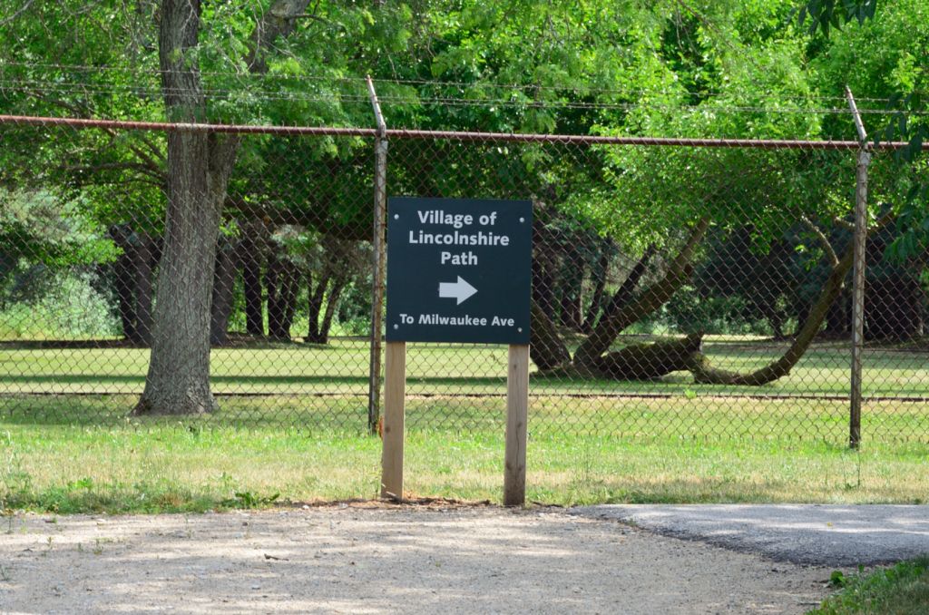
They call this the "Lincolnshire Path" and it really just goes west for a very short distance out to Milwaukee Road.
In the past, before the trail was extended, you needed to take this path out to Milwaukee Road, continue south and get back on the trail at the Cubby Bear Sports Bar / Restaurant .
See The Path Along Milwaukee Avenue Page Here
for how you had to go in the past.
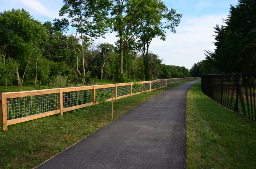
This is how the new extension looks today. This is behind the Par King miniature golf course on Milwaukee Avenue. This is actually one of the only paved parts of the DPRT.
The photo above is looking through the wrought iron fence (or sticking my camera lens between the bars). The pink building is the miniature golf course and in the foreground is what looks like a small railroad track. I'm not sure what that is for.
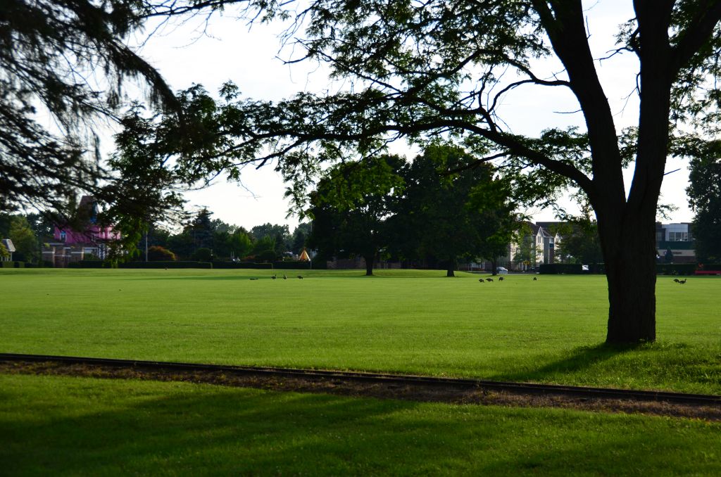
As you continue south on the trail you can see where the path branches to the right to go into the Cubby Bear parking lot where you used to have to get back on the trail after the ride out to Milwaukee Avenue.
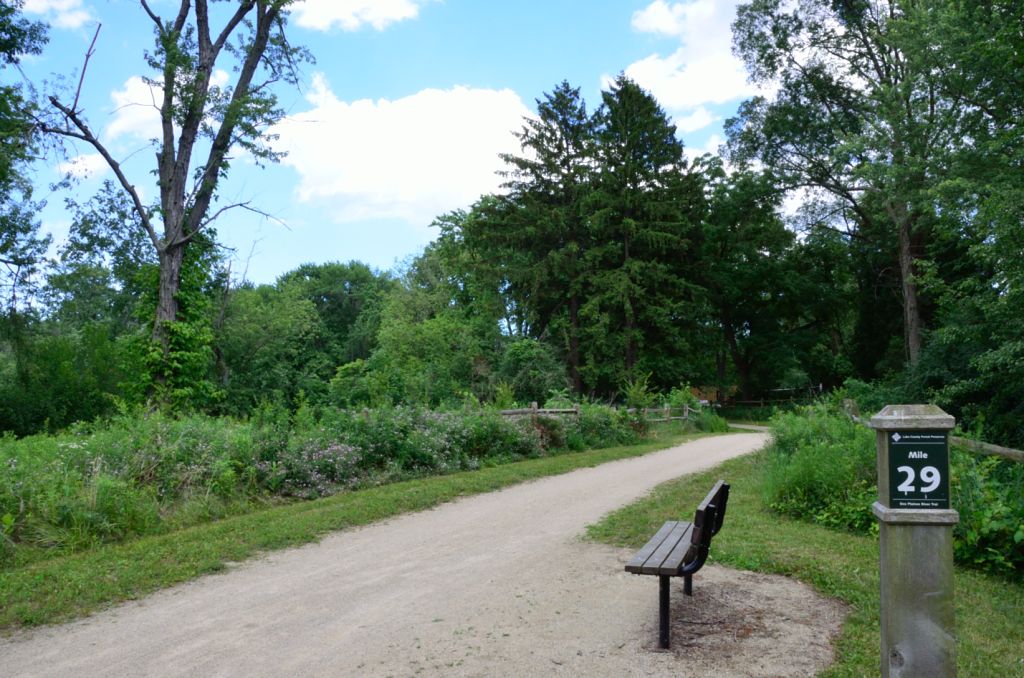
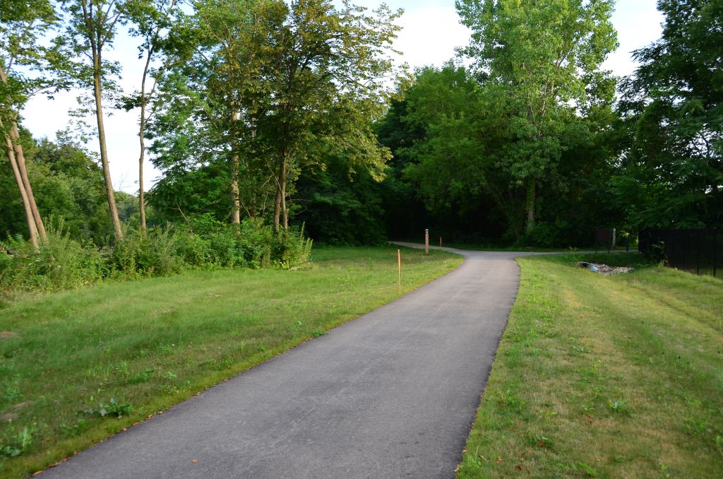
Back to Mile 29 on the actual Des Plains River Trail. This is actually still the Lake County part of the trail.
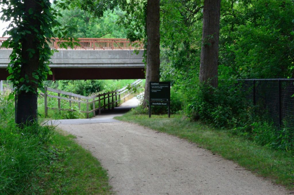
This is coming up to the Deerfield Road underpass on the DPRT. I saw signs that let you know if the underpass is open or not. These underpasses can flood sometimes when the river gets high. No problem at this particular time
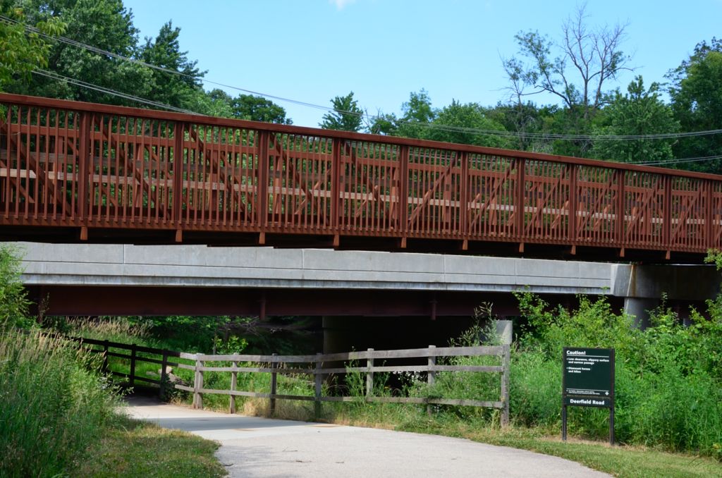
This is looking back at the Deerfield Underpass.
Here's the Photo Tour of the Half Day to Old School Forest Preserve ride from August 16th, 2014. These pages include photos of the DPR Trail in this section along with some nice scenery photos (including a few HDR photos) taken from various locations on the trail.
Old School Trail and MacArthur Woods - Photos 20
Route 60, Wright Woods and Half Day FP - Photos 21
Here's the GPS Map of the ride above.
Here are some Fall Photos of the DPRT from Euclid (or Lake Street) a little east of Prospect Heights south to Golf Road then back north to Milwaukee Ave (from October 9, 2012):
DPRT Fall Photos 17 - Just South of Lake Street
DPRT Fall Photos 18 - Branch to Beck Lake
DPRT Fall Photos 19 - North of Lake Street
Here's the GPS Map of the ride above.
Here's the photo tour of the Des Plaines River Trail from Higgins Road in Park Ridge north to Dundee Road in Wheeling (July, 2012).
The Des Plaines River Trail Photos 12 - Park Ridge Leg
The Des Plaines River Trail Photos 13 - Des Plaines Riverwalk Area
The Des Plaines River Trail Photos 14 - Big Bend Lake to Euclid
The Des Plaines River Trail Photos 15 - To Allgauers Restaurant
The DPRT Photos 16 - To Dam No 1, Wheeling
Here's the GPS Map of the ride above.
Here's the photo tour of the Des Plaines River Trail from Lincolnshire (Routes 21 and 22 going south) to Dundee Road in Wheeling, Il. (June, 2012).
The DPRT Photos 8 - Lincolnshire Marriott Area
The DPRT Photos 9 - Path Extension North of Cubby Bear < You are here
DRPT Past Photos 9a - The OLD Ride along Milwaukee Road
The DPRT Photos 10 - Deerfield Road to Lake Cook Road
The DPRT Photos 11 - County Line Road to Wheeling
Here's the GPS Map of the ride above.
Here's the photo tour of the Des Plaines River Trail, from Route 22 in Half Day (going north) to Libertyville (July, 2005).
Des
Plaines River Trail Photos 4 - Lincolnshire to Wright Woods
Des
Plaines River Trail Photos 5 - Bridge Underpasses and Equestrian
Des Plaines River Trail Photos 6 - North to North Shore Path
DPRT Photos 7 - North Shore Path to Independence Grove
Here's the photo tour of the Des Plaines River Trail, from Wisconsin (going south) to Libertyville (September, 2004).
Des
Plaines River Trail Photos 1 - Van Patton Woods
Des
Plaines River Trail Photos 2 - Mile 5 South to Great America
Des
Plaines River Trail Photos 3 - Mile 11 to Adler Park in Libertyville
Note: Des Plains is a common mi s-spelling for Des Plaines (with the e near the end) so will see some references to Des Plains River Trail on these pages to help with the searches for the trail pages.
Photos © Copyright Rob Chapman, about-bicycles.com. Photos with * Copyright Dale Kiffel.
Half Day to Old School, August 2014
Fall Photos, October,2012
DPRT Photos 17
DPRT Photos 18
DPRT Photos 19
Park Ridge to Wheeling, July 2012.
DPRT Photos 12
DPRT Photos 13
DPRT Photos 14
DPRT Photos 15
DPRT Photos 16
Lincolnshire to Wheeling , June 2012
DPRT Photos 8
DPRT Photos 9
DPRT Photos 10
DPRT Photos 11
Half Day to Libertyville, July
DPRT Photos 4
DPRT Photos 5
DPRT Photos 6
DPRT Photos 7
Wisconsin to Libertyville, September, 2004
DPRT Photos 1
DPRT Photos 2
DPRT Photos 3