Des Plaines River Bike Trail
Lincolnshire to Wright Woods

Although this is photo page 4 in the Des Plaines River Trail photo tour, this is a different ride (from photo page 1-3) and starts at Route 22 in Half Day and shows photos from the trail heading north (now) to Independence Grove (Libertyville). The photo above is the entrance right by the Egg Harbor and Flatlanders restaurants (at Route 22 and 45).
This is one of my favorite places to start on the Lake County section of the DPRT. You can start here and ride north to the trail head, at Russell Road (just south of the Wisconsin border) and back for a nice casual ride of about 50 miles or so... :-) (or you can just ride until you've had enough and head back).
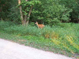
I got lucky here and caught this shot of a deer about 4 feet from the trail. Actually after riding this trial many more times I have found that it is not at all uncommon to see deer along the trail here. It would probably be less common not to see any if you ride the trail in the late afternoon or early evening (or probably in the morning too but I'm not a morning person so I can't say about that).
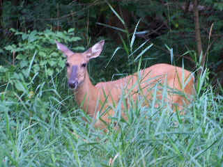
I was able to zoom in and get this before he ran off. Still with my old digital camera so the quality is not great or anything but I still think it was a pretty decent deer photo.
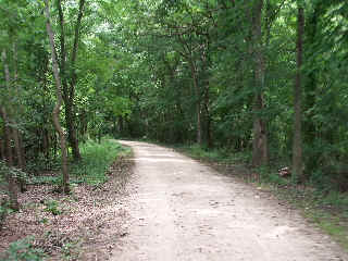
This part of the trail is very wooded and shady. The Des Plaines River Trail (in this area) is one of my favorite trails to ride on hot, sunny summer days. Not only do you get the shade to keep you cooler, there are also quite a few cyclists that do not like to ride on crushed stone trails which cuts down on the trail traffic too.
The wooded areas are interspersed with some open area too so you are not really in the woods the entire time, of course.
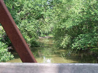
Here's a view of the Des Plaines River, from one of the many bridges on the trail. This is the bridge over the Des Plaines River just before the interesction of the DPRT and Wright Woods.
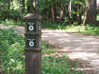
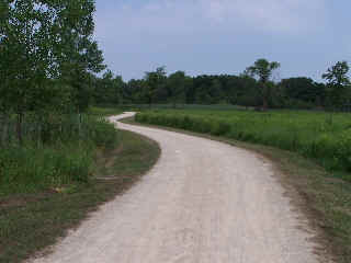
I know this image is not readable online, but this is where the Wright Woods trail splits off from the DPR trail... If you want to do a few more miles, take this cut off. It is a beautiful wooded (and very shady) area.
Here's the Photo Tour of the Half Day to Old School Forest Preserve ride from August 16th, 2014. These pages include photos of the DPR Trail in this section along with some nice scenery photos (including a few HDR photos) taken from various locations on the trail.
Old School Trail and MacArthur Woods - Photos 20
Route 60, Wright Woods and Half Day FP - Photos 21
Here's the GPS Map of the ride above.
Here are some Fall Photos of the DPRT from Euclid (or Lake Street) a little east of Prospect Heights south to Golf Road then back north to Milwaukee Ave (from October 9, 2012):
DPRT Fall Photos 17 - Just South of Lake Street
DPRT Fall Photos 18 - Branch to Beck Lake
DPRT Fall Photos 19 - North of Lake Street
Here's the GPS Map of the ride above.
Here's the photo tour of the Des Plaines River Trail from Higgins Road in Park Ridge north to Dundee Road in Wheeling (July, 2012).
The Des Plaines River Trail Photos 12 - Park Ridge Leg
The Des Plaines River Trail Photos 13 - Des Plaines Riverwalk Area
The Des Plaines River Trail Photos 14 - Big Bend Lake to Euclid
The Des Plaines River Trail Photos 15 - To Allgauers Restaurant
The DPRT Photos 16 - To Dam No 1, Wheeling
Here's the GPS Map of the ride above.
Here's the photo tour of the Des Plaines River Trail from Lincolnshire (Routes 21 and 22 going south) to Dundee Road in Wheeling, Il. (June, 2012).
The DPRT Photos 8 - Lincolnshire Marriott Area
The DPRT Photos 9 - Path along Milwaukee Road
The DPRT Photos 10 - Deerfield Road to Lake Cook Road
The DPRT Photos 11 - County Line Road to Wheeling
Here's the GPS Map of the ride above.
Here's the photo tour of the Des Plaines River Trail, from Route 22 in Half Day (going north) to Libertyville (July, 2005).
Des
Plaines River Trail Photos 4 - Lincolnshire to Wright Woods < You are here
Des
Plaines River Trail Photos 5 - Bridge Underpasses and Equestrian
Des Plaines River Trail Photos 6 - North to North Shore Path
DPRT Photos 7 - North Shore Path to Independence Grove
Here's the photo tour of the Des Plaines River Trail, from Wisconsin (going south) to Libertyville (September, 2004).
Des
Plaines River Trail Photos 1 - Van Patton Woods
Des
Plaines River Trail Photos 2 - Mile 5 South to Great America
Des
Plaines River Trail Photos 3 - Mile 11 to Adler Park in Libertyville
Note: Des Plains is a common mi s-spelling for Des Plaines (with the e near the end) so will see some references to Des Plains River Trail on these pages to help with the searches for the trail pages.
Photos © Copyright Rob Chapman, about-bicycles.com. Photos with * Copyright Dale Kiffel.
Half Day to Old School, August 2014
Fall Photos, October,2012
DPRT Photos 17
DPRT Photos 18
DPRT Photos 19
Park Ridge to Wheeling, July 2012.
DPRT Photos 12
DPRT Photos 13
DPRT Photos 14
DPRT Photos 15
DPRT Photos 16
Lincolnshire to Wheeling , June 2012
DPRT Photos 8
DPRT Photos 9
DPRT Photos 10
DPRT Photos 11
Half Day to Libertyville, July
DPRT Photos 4
DPRT Photos 5
DPRT Photos 6
DPRT Photos 7
Wisconsin to Libertyville, September, 2004