Des Plaines River Trail Photos
North of Lake Street
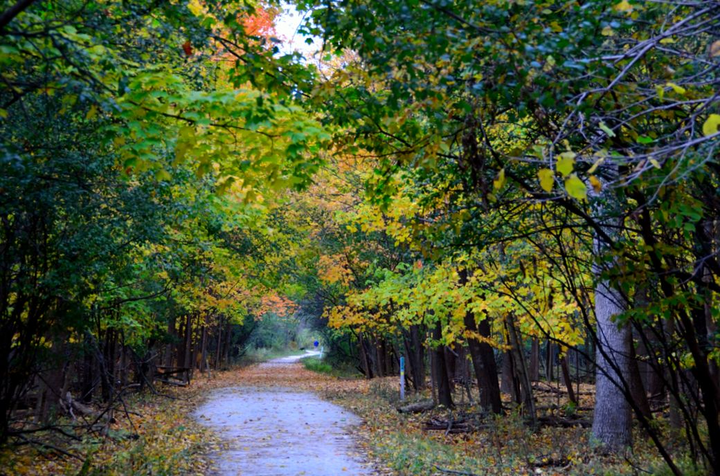
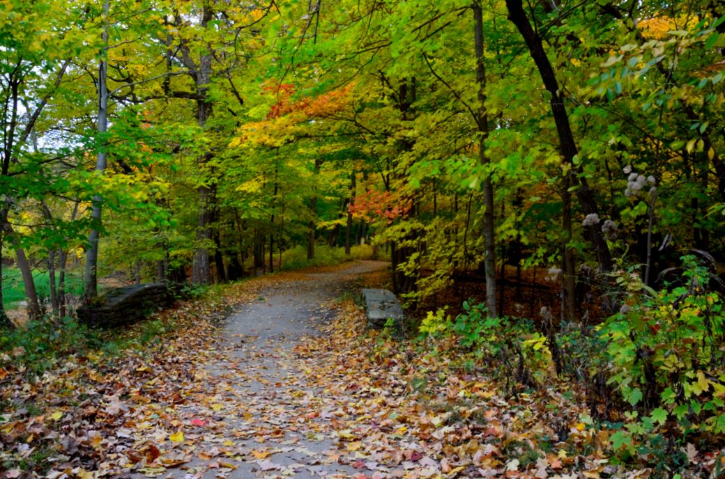
The photo above is from when I got back on to the main Des Plaines River Trail again after taking the side trip to Beck Lake. These photos were from early October and my goal, in addition to documenting more of the trial, was to show how colorful this part of the trail is in the fall.
This is a fairly scenic part of the trail that is just north of Euclid/Lake Street where I started my fall ride and photo tour. I was heading north at this point (the previous photos in this set were south of Euclid/Lake).
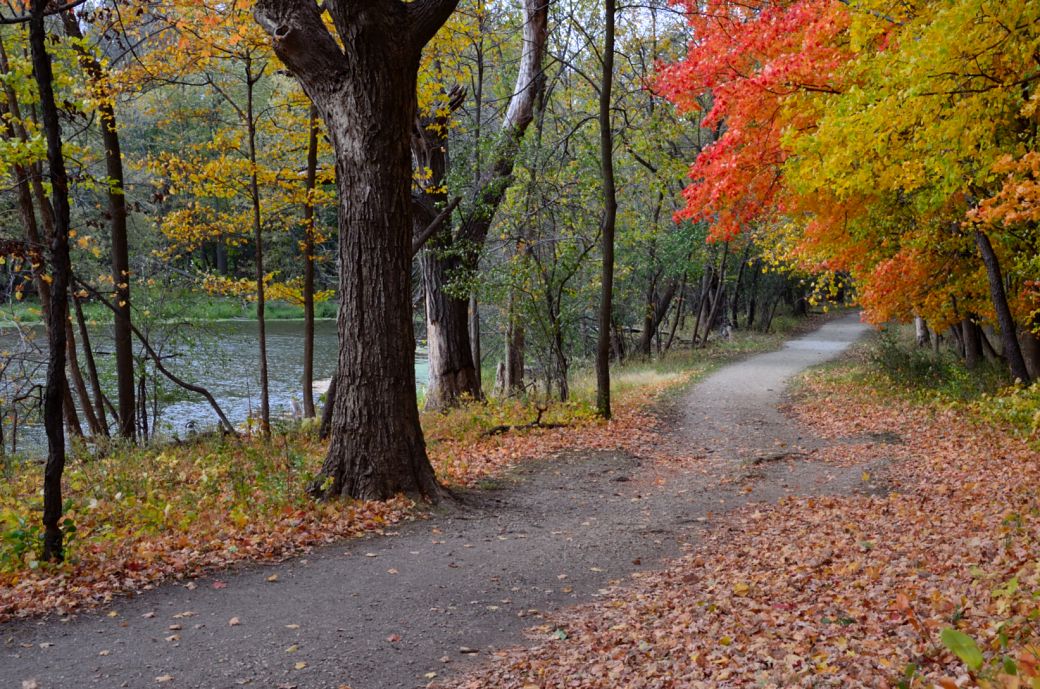
In the fall, this is a beautiful and colorful part of the Des Plaines River Trail. This photo is from just north of Euclid/Lake Street but both sides of Euclid/Lake are heavily wooded and very colorful in the fall. I parked at the Camp Pine Woods forest preserve which is accessible from Euclid just east of the Des Plaines River (on the south side of Euclid).
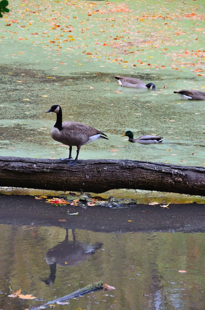
There is a little area here where the geese and ducks like to hang out. The contrast in colors seemed interesting.
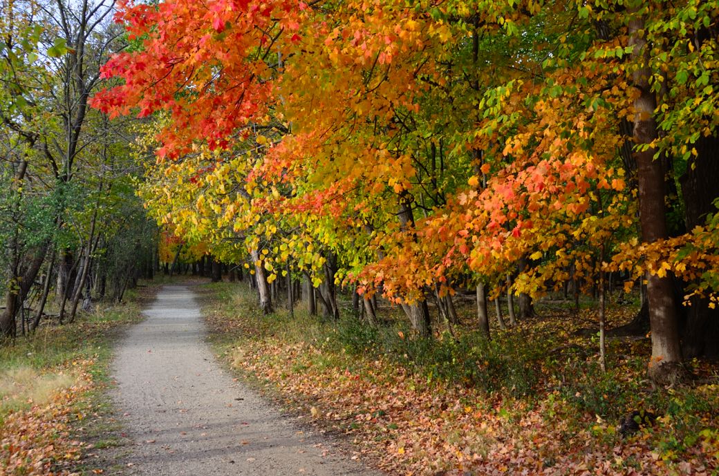
Here's another leaf covered stone bridge just north of Euclid/Lake Street. This was also a very colorful part of the trail at this time of year. This is not far from the other forest preserve parking area that is north of Euclid.
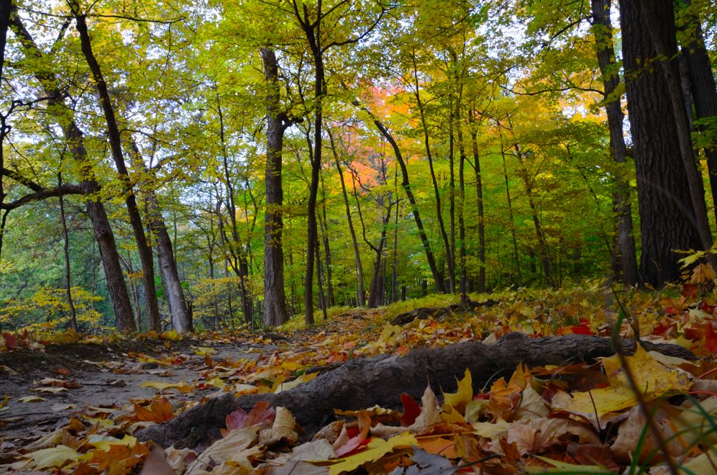
This is actually on a little dirt (mountain like) side trail just off the main Des Plaines River Trail. I thought this was an interesting low view of some of the path and the fall colors.
I didn't actually ride very far on this particular trip for the fall photos just a few miles south and a few miles north of Euclid/Lake Street but as you can see from the links below, the Des Plaines River Trail covers many, many miles and spans multiple counties. Although I like this wooded part of the trail near Euclid there are also some excellent places for fall photos along this trail in Lake County. I hope to get up there soon for some additional fall color photos.
Here's the Photo Tour of the Half Day to Old School Forest Preserve ride from August 16th, 2014. These pages include photos of the DPR Trail in this section along with some nice scenery photos (including a few HDR photos) taken from various locations on the trail.
Old School Trail and MacArthur Woods - Photos 20
Route 60, Wright Woods and Half Day FP - Photos 21
Here's the GPS Map of the ride above.
Here are some Fall Photos of the DPRT from Euclid (or Lake Street) a little east of Prospect Heights south to Golf Road then back north to Milwaukee Ave (from October 9, 2012):
DPRT Fall Photos 17 - Just South of Lake Street
DPRT Fall Photos 18 - Branch to Beck Lake
DPRT Fall Photos 19 - North of Lake Street < You are here
Here's the GPS Map of the ride above.
Here's the photo tour of the Des Plaines River Trail from Higgins Road in Park Ridge north to Dundee Road in Wheeling (July, 2012).
The Des Plaines River Trail Photos 12 - Park Ridge Leg
The Des Plaines River Trail Photos 13 - Des Plaines Riverwalk Area
The Des Plaines River Trail Photos 14 - Big Bend Lake to Euclid
The Des Plaines River Trail Photos 15 - To Allgauers Restaurant
The DPRT Photos 16 - To Dam No 1, Wheeling
Here's the GPS Map of the ride above.
Here's the photo tour of the Des Plaines River Trail from Lincolnshire (Routes 21 and 22 going south) to Dundee Road in Wheeling, Il. (June, 2012).
The DPRT Photos 8 - Lincolnshire Marriott Area
The DPRT Photos 9 - Path along Milwaukee Road
The DPRT Photos 10 - Deerfield Road to Lake Cook Road
The DPRT Photos 11 - County Line Road to Wheeling
Here's the GPS Map of the ride above.
Here's the photo tour of the Des Plaines River Trail, from Route 22 in Half Day (going north) to Libertyville (July, 2005).
Des
Plaines River Trail Photos 4 - Lincolnshire to Wright Woods
Des
Plaines River Trail Photos 5 - Bridge Underpasses and Equestrian
Des Plaines River Trail Photos 6 - North to North Shore Path
DPRT Photos 7 - North Shore Path to Independence Grove
Here's the photo tour of the Des Plaines River Trail, from Wisconsin (going south) to Libertyville (September, 2004).
Des
Plaines River Trail Photos 1 - Van Patton Woods
Des
Plaines River Trail Photos 2 - Mile 5 South to Great America
Des
Plaines River Trail Photos 3 - Mile 11 to Adler Park in Libertyville
Note: Des Plains is a common mi s-spelling for Des Plaines (with the e near the end) so will see some references to Des Plains River Trail on these pages to help with the searches for the trail pages.
Photos © Copyright Rob Chapman, about-bicycles.com. Photos with * Copyright Dale Kiffel.
Half Day to Old School, August 2014
Fall Photos, October,2012
DPRT Photos 17
DPRT Photos 18
DPRT Photos 19
Park Ridge to Wheeling, July 2012.
DPRT Photos 12
DPRT Photos 13
DPRT Photos 14
DPRT Photos 15
DPRT Photos 16
Lincolnshire to Wheeling , June 2012
DPRT Photos 8
DPRT Photos 9
DPRT Photos 10
DPRT Photos 11
Half Day to Libertyville, July
DPRT Photos 4
DPRT Photos 5
DPRT Photos 6
DPRT Photos 7
Wisconsin to Libertyville, September, 2004
DPRT Photos 1
DPRT Photos 2
DPRT Photos 3