Des Plaines River Bike Trail
Bridge Underpasses and Equestrian
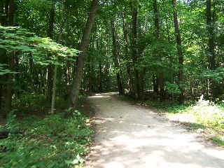
This is where the Des Plaines River Trail passes through Wright Woods on our trip north from Half Day. The DPRT main trail and the trails that branch off into Wright Woods are very woody, shady and scenic. The shade on this trail is great on those hot summer days...
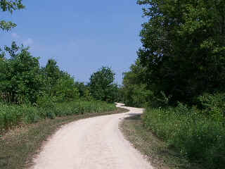
You get out of the woods into the open areas in this area also. This part of the DPRT is one of my favorites and even the open areas are really very nice.
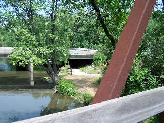
I don't remember which highway underpass this is, but this is pretty typical of the highway crossings along the trail. It is great that you can go so far in this area (the Chicago suburbs) without having to cross the busy roads.
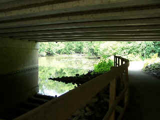
The underpasses will be closed at times though, when the river is high, so if there has been a lot of rain and the rivers are high, you may not be able to get through. I actually prefer riding this trail when it is hot and dry anyway although it can be interesting and quite a challenge to ride this trail when it is wet and the river is high (and flooding).
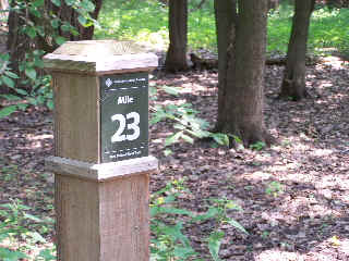
Mile Marker 23 is in another beautiful, wooded and shady area. I believe that this is just north of the Route 60 underpass (photo above). One of the photo techniques that I used to a lot for bike trail photo pages was to get a photo of the mile marker along with the scenery at that location. In this case you don't really see much of the scenery. Hopefully I will get a chance to enhance these photo pages soon.
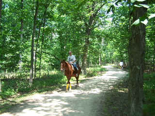
You will run across some horse riders along the trail (and have to dodge some of their left over fuel sometimes too!). Some horses get a little skitish around bike riders but most seem to handle sharing the trail pretty well. I usually take it kind of easy when passing equestrian traffic (from either direction).
Here's the Photo Tour of the Half Day to Old School Forest Preserve ride from August 16th, 2014. These pages include photos of the DPR Trail in this section along with some nice scenery photos (including a few HDR photos) taken from various locations on the trail.
Old School Trail and MacArthur Woods - Photos 20
Route 60, Wright Woods and Half Day FP - Photos 21
Here's the GPS Map of the ride above.
Here are some Fall Photos of the DPRT from Euclid (or Lake Street) a little east of Prospect Heights south to Golf Road then back north to Milwaukee Ave (from October 9, 2012):
DPRT Fall Photos 17 - Just South of Lake Street
DPRT Fall Photos 18 - Branch to Beck Lake
DPRT Fall Photos 19 - North of Lake Street
Here's the GPS Map of the ride above.
Here's the photo tour of the Des Plaines River Trail from Higgins Road in Park Ridge north to Dundee Road in Wheeling (July, 2012).
The Des Plaines River Trail Photos 12 - Park Ridge Leg
The Des Plaines River Trail Photos 13 - Des Plaines Riverwalk Area
The Des Plaines River Trail Photos 14 - Big Bend Lake to Euclid
The Des Plaines River Trail Photos 15 - To Allgauers Restaurant
The DPRT Photos 16 - To Dam No 1, Wheeling
Here's the GPS Map of the ride above.
Here's the photo tour of the Des Plaines River Trail from Lincolnshire (Routes 21 and 22 going south) to Dundee Road in Wheeling, Il. (June, 2012).
The DPRT Photos 8 - Lincolnshire Marriott Area
The DPRT Photos 9 - Path along Milwaukee Road
The DPRT Photos 10 - Deerfield Road to Lake Cook Road
The DPRT Photos 11 - County Line Road to Wheeling
Here's the GPS Map of the ride above.
Here's the photo tour of the Des Plaines River Trail, from Route 22 in Half Day (going north) to Libertyville (July, 2005).
Des
Plaines River Trail Photos 4 - Lincolnshire to Wright Woods
DPRT Photos 5 - Bridge Underpasses and Equestrian < You are here
Des Plaines River Trail Photos 6 - North to North Shore Path
DPRT Photos 7 - North Shore Path to Independence Grove
Here's the photo tour of the Des Plaines River Trail, from Wisconsin (going south) to Libertyville (September, 2004).
Des
Plaines River Trail Photos 1 - Van Patton Woods
Des
Plaines River Trail Photos 2 - Mile 5 South to Great America
Des
Plaines River Trail Photos 3 - Mile 11 to Adler Park in Libertyville
Note: Des Plains is a common mi s-spelling for Des Plaines (with the e near the end) so will see some references to Des Plains River Trail on these pages to help with the searches for the trail pages.
Photos © Copyright Rob Chapman, about-bicycles.com. Photos with * Copyright Dale Kiffel.
Half Day to Old School, August 2014
Fall Photos, October,2012
DPRT Photos 17
DPRT Photos 18
DPRT Photos 19
Park Ridge to Wheeling, July 2012.
DPRT Photos 12
DPRT Photos 13
DPRT Photos 14
DPRT Photos 15
DPRT Photos 16
Lincolnshire to Wheeling , June 2012
DPRT Photos 8
DPRT Photos 9
DPRT Photos 10
DPRT Photos 11
Half Day to Libertyville, July
DPRT Photos 4
DPRT Photos 5
DPRT Photos 6
DPRT Photos 7
Wisconsin to Libertyville, September, 2004