The Des Plaines River Trail
to Allgauers Restaurant
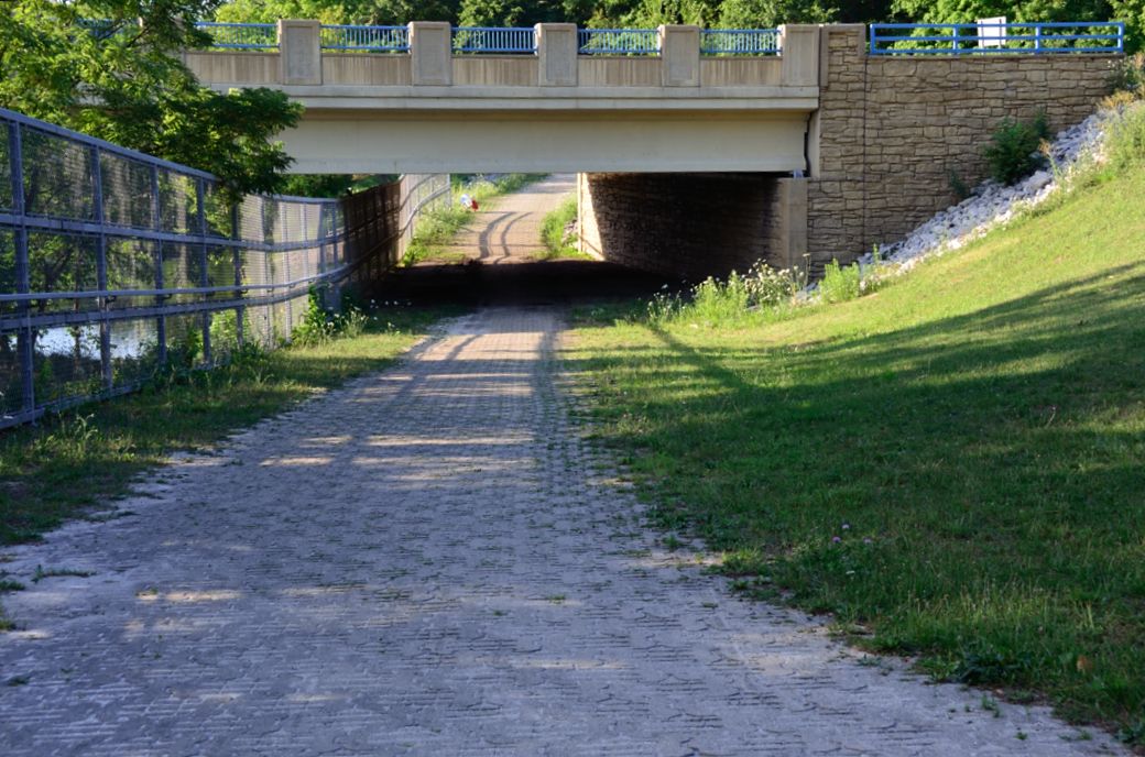
The Des Plaines River Trail goes under Euclid Ave (aka Lake Ave) here at the cement bridge with the blue railings. I have traveled on Euclid many times and am very familiar with this bridge. I just never saw it from this angle before. :-) The forest preserve that you get to from Euclid/Lake is called Camp Pine Woods.
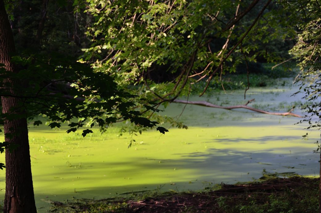
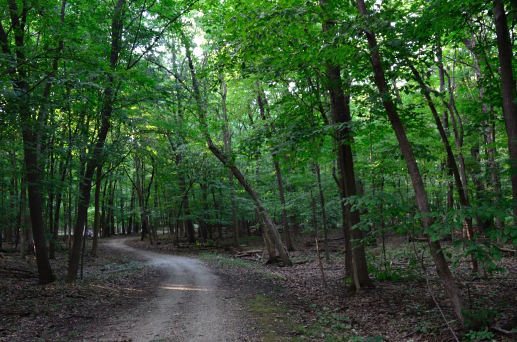
Just north of Euclid we passed through some more thick woods and off to the side of the trail the river was bright green.
There are a number of small stone bridges (as seen above) along this part of the Des Plaines River Trial. I have photographed this part of the trail in the fall and it is really beautiful when the leaves are changing colors (see the "Fall Photos" links below).
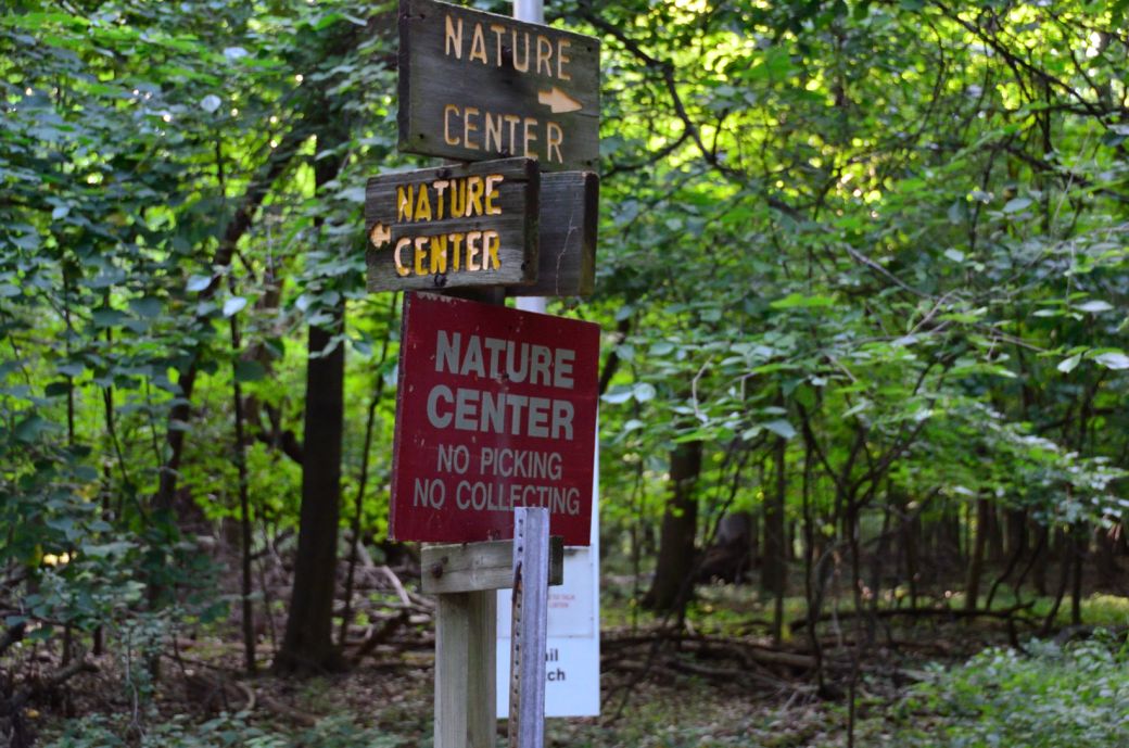
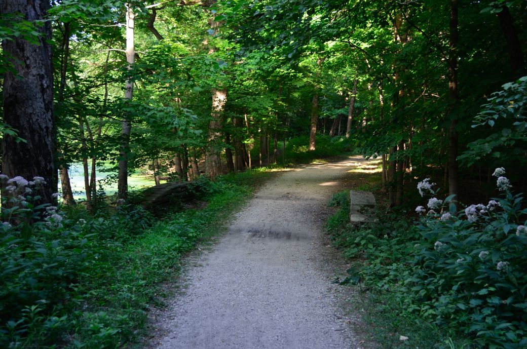
This is where the DPRT intersects with the River Trail Nature Center paths. We took a little ride into the Nature Center area but it was closed and fenced off when we got there. I was hoping to see some of the critters that I believe they have there.
This is how the DPRT looks just before you get to the forest preserve and Milwaukee Road crossing (at Allgauers hotel and restaurant) as you head north.
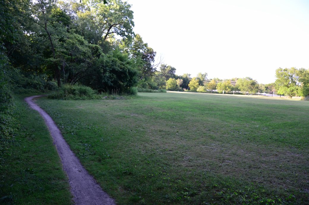
Just before the forest preserve, the DPR Trail passes by a field and becomes a narrow single track.
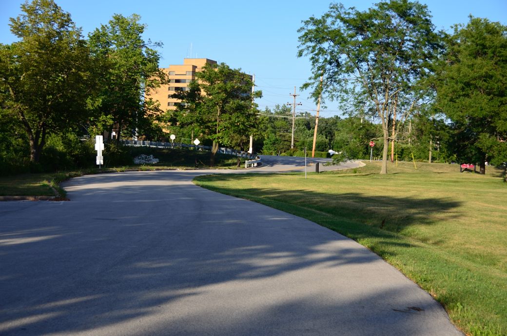
This is where you come off the trail and follow the forest preserve road up to Milwaukee Avenue.
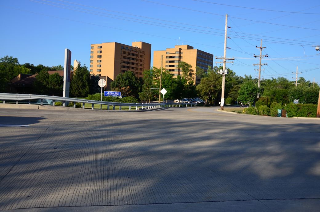
This is where the DPRT crosses busy Milwaukee Avenue at Allgauers. This is not an easy crossing when there is a lot of traffic. The Des Plaines River goes under Milwaukee here and I looked to see if it was possible to cross under and it was just not good. It sure would be nicer (and safer) if they would include a developed underpass here.
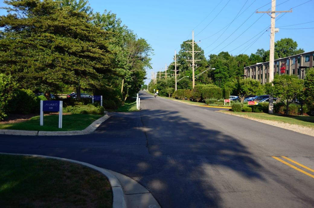
You go a short distance on the road next to Allgauers (it's called Winkleman Road) to get back to the trail again which is in the distance to the left.
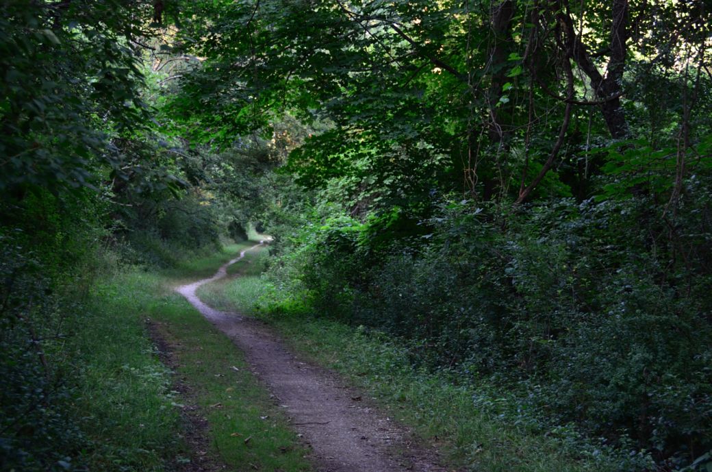
The trail gets narrower and more rugged in this section but I did manage this entire trip on my road bike so it is negotiable (at least in good weather).
Here's the Photo Tour of the Half Day to Old School Forest Preserve ride from August 16th, 2014. These pages include photos of the DPR Trail in this section along with some nice scenery photos (including a few HDR photos) taken from various locations on the trail.
Old School Trail and MacArthur Woods - Photos 20
Route 60, Wright Woods and Half Day FP - Photos 21
Here's the GPS Map of the ride above.
Here are some Fall Photos of the DPRT from Euclid (or Lake Street) a little east of Prospect Heights south to Golf Road then back north to Milwaukee Ave (from October 9, 2012):
DPRT Fall Photos 17 - Just South of Lake Street
DPRT Fall Photos 18 - Branch to Beck Lake
DPRT Fall Photos 19 - North of Lake Street
Here's the GPS Map of the ride above.
Here's the photo tour of the Des Plaines River Trail from Higgins Road in Park Ridge north to Dundee Road in Wheeling (July, 2012).
The Des Plaines River Trail Photos 12 - Park Ridge Leg
The Des Plaines River Trail Photos 13 - Des Plaines Riverwalk Area
The Des Plaines River Trail Photos 14 - Big Bend Lake to Euclid
The Des Plaines River Trail Photos 15 - To Allgauers Restaurant < You are here
The DPRT Photos 16 - To Dam No 1, Wheeling
Here's the GPS Map of the ride above.
Here's the photo tour of the Des Plaines River Trail from Lincolnshire (Routes 21 and 22 going south) to Dundee Road in Wheeling, Il. (June, 2012).
The DPRT Photos 8 - Lincolnshire Marriott Area
The DPRT Photos 9 - Path along Milwaukee Road
The DPRT Photos 10 - Deerfield Road to Lake Cook Road
The DPRT Photos 11 - County Line Road to Wheeling
Here's the GPS Map of the ride above.
Here's the photo tour of the Des Plaines River Trail, from Route 22 in Half Day (going north) to Libertyville (July, 2005).
Des
Plaines River Trail Photos 4 - Lincolnshire to Wright Woods
Des
Plaines River Trail Photos 5 - Bridge Underpasses and Equestrian
Des Plaines River Trail Photos 6 - North to North Shore Path
DPRT Photos 7 - North Shore Path to Independence Grove
Here's the photo tour of the Des Plaines River Trail, from Wisconsin (going south) to Libertyville (September, 2004).
Des
Plaines River Trail Photos 1 - Van Patton Woods
Des
Plaines River Trail Photos 2 - Mile 5 South to Great America
Des
Plaines River Trail Photos 3 - Mile 11 to Adler Park in Libertyville
Note: Des Plains is a common mi s-spelling for Des Plaines (with the e near the end) so will see some references to Des Plains River Trail on these pages to help with the searches for the trail pages.
Photos © Copyright Rob Chapman, about-bicycles.com. Photos with * Copyright Dale Kiffel.
Half Day to Old School, August 2014
Fall Photos, October,2012
DPRT Photos 17
DPRT Photos 18
DPRT Photos 19
Park Ridge to Wheeling, July 2012.
DPRT Photos 12
DPRT Photos 13
DPRT Photos 14
DPRT Photos 15
DPRT Photos 16
Lincolnshire to Wheeling , June 2012
DPRT Photos 8
DPRT Photos 9
DPRT Photos 10
DPRT Photos 11
Half Day to Libertyville, July
DPRT Photos 4
DPRT Photos 5
DPRT Photos 6
DPRT Photos 7
Wisconsin to Libertyville, September, 2004
DPRT Photos 1
DPRT Photos 2
DPRT Photos 3