Des Plaines River
Trail
Mile 5 Marker South to Great America
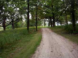
I believe that this is just past the Mile 5 marker. Although this part of the trail is much more open than the trail is further south, there are some patches of woods that you pass through (as in the photo above) also.
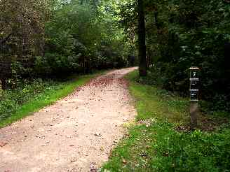
The Mile 7 marker and another more wooded area. One of the techniques that I liked to use back in the old days (I am updating this caption after the fact) was to try to take a lot of the photos at the various mile markers along the way and include the mile marker sign along with the scenery at that place on the trail.
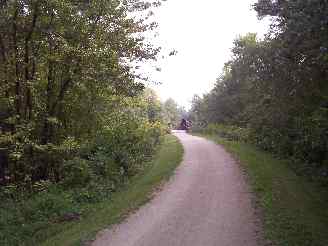
A bridge off in the distance. As I mentioned on the previous photo page for this bike trail photo tour, this was one of the original bike trails that I starting photographing and the quality is poor compared to my newer photo pages (sorry about that) and I do not have the larger photo version links that I do in the newer pages.
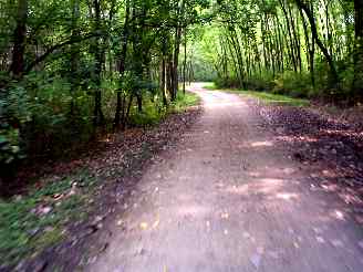
Some of the more typical wooded scenery just past the 7 mile mark. Another thing that I used to do more often was take the photos while I was riding. It looks like this was the case on the photo above.
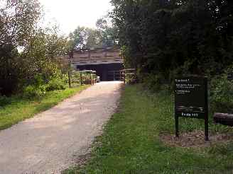
One of the typical highway underpasses... It doesn't look like much, but it sure is nice not to have to stop! Actually the underpasses that go under the highways that the DPRT crosses is one of the best features of this trail (in Lake County). You don't have to stop to cross roads and if you have kids, crossing a lot of major highways is just one less thing to have to worry about.
If you take this bike trail much farther south (the Cook County section) you don't have this benefit as much and have some difficult highway crossings.
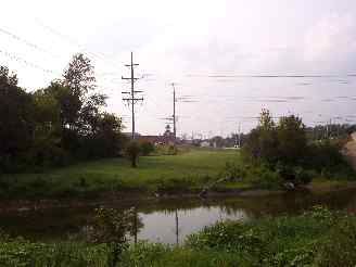
This is the Great America theme park in the background (may not be visible in this photo though). I believe that this is just south of Gurnee Woods Forest Preserve.
Here's the Photo Tour of the Half Day to Old School Forest Preserve ride from August 16th, 2014. These pages include photos of the DPR Trail in this section along with some nice scenery photos (including a few HDR photos) taken from various locations on the trail.
Old School Trail and MacArthur Woods - Photos 20
Route 60, Wright Woods and Half Day FP - Photos 21
Here's the GPS Map of the ride above.
Here are some Fall Photos of the DPRT from Euclid (or Lake Street) a little east of Prospect Heights south to Golf Road then back north to Milwaukee Ave (from October 9, 2012):
DPRT Fall Photos 17 - Just South of Lake Street
DPRT Fall Photos 18 - Branch to Beck Lake
DPRT Fall Photos 19 - North of Lake Street
Here's the GPS Map of the ride above.
Here's the photo tour of the Des Plaines River Trail from Higgins Road in Park Ridge north to Dundee Road in Wheeling (July, 2012).
The Des Plaines River Trail Photos 12 - Park Ridge Leg
The Des Plaines River Trail Photos 13 - Des Plaines Riverwalk Area
The Des Plaines River Trail Photos 14 - Big Bend Lake to Euclid
The Des Plaines River Trail Photos 15 - To Allgauers Restaurant
The DPRT Photos 16 - To Dam No 1, Wheeling
Here's the GPS Map of the ride above.
Here's the photo tour of the Des Plaines River Trail from Lincolnshire (Routes 21 and 22 going south) to Dundee Road in Wheeling, Il. (June, 2012).
The DPRT Photos 8 - Lincolnshire Marriott Area
The DPRT Photos 9 - Path along Milwaukee Road
The DPRT Photos 10 - Deerfield Road to Lake Cook Road
The DPRT Photos 11 - County Line Road to Wheeling
Here's the GPS Map of the ride above.
Here's the photo tour of the Des Plaines River Trail, from Route 22 in Half Day (going north) to Libertyville (July, 2005).
Des
Plaines River Trail Photos 4 - Lincolnshire to Wright Woods
Des
Plaines River Trail Photos 5 - Bridge Underpasses and Equestrian
Des Plaines River Trail Photos 6 - North to North Shore Path
DPRT Photos 7 - North Shore Path to Independence Grove
Here's the photo tour of the Des Plaines River Trail, from Wisconsin (going south) to Libertyville (September, 2004).
Des
Plaines River Trail Photos 1 - Van Patton Woods
Des
Plaines River Trail Photos 2 - Mile 5 South to Great America < You are here
Des
Plaines River Trail Photos 3 - Mile 11 to Adler Park in Libertyville
Note: Des Plains is a common mi s-spelling for Des Plaines (with the e near the end) so will see some references to Des Plains River Trail on these pages to help with the searches for the trail pages.
Photos © Copyright Rob Chapman, about-bicycles.com. Photos with * Copyright Dale Kiffel.
Half Day to Old School, August 2014
Fall Photos, October,2012
DPRT Photos 17
DPRT Photos 18
DPRT Photos 19
Park Ridge to Wheeling, July 2012.
DPRT Photos 12
DPRT Photos 13
DPRT Photos 14
DPRT Photos 15
DPRT Photos 16
Lincolnshire to Wheeling , June 2012
DPRT Photos 8
DPRT Photos 9
DPRT Photos 10
DPRT Photos 11
Half Day to Libertyville, July
DPRT Photos 4
DPRT Photos 5
DPRT Photos 6
DPRT Photos 7
Wisconsin to Libertyville, September, 2004