The Des Plaines River Trail Photos
Park Ridge Leg

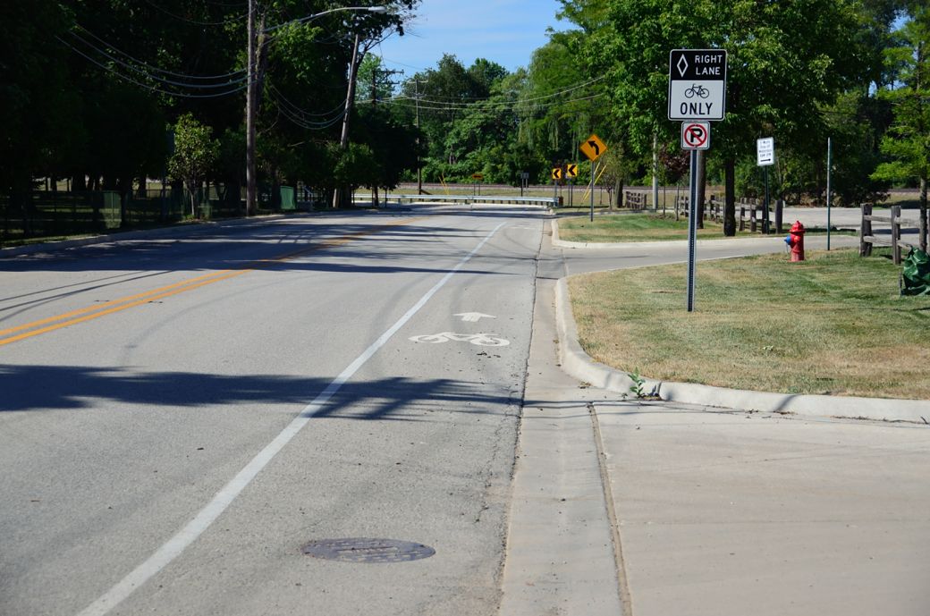
This is where we turned around, near Park Ridge, to head back north on this part of our Des Plaines River Trail bike ride and photo tour.
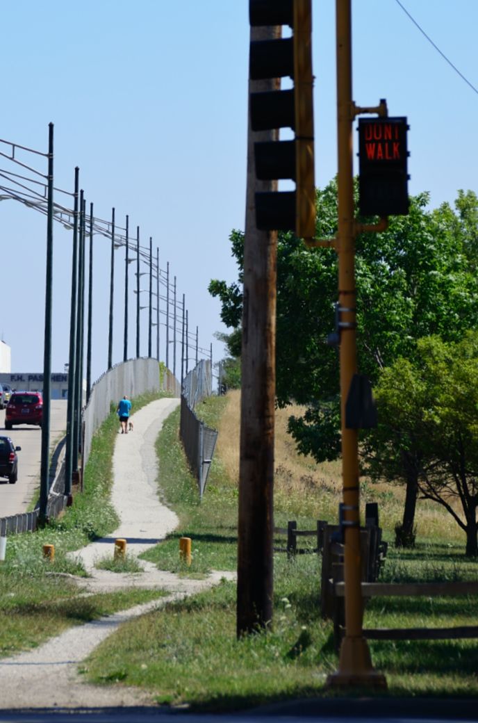
Although I have never ridden any further south on the DPRT, I have heard that it goes all the way to Maywood and it looks like you would go over the expressway here. This is where the Kennedy Expressway merges with 190 to go to Ohare Airport.
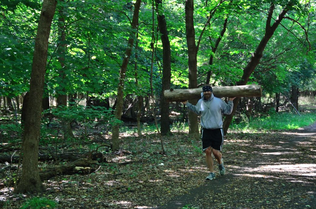
Anyone up for carrying a log on your shoulders and taking a little jog! This is a scene from the Des Plaines River Trail south that I just had to capture. Fortunately for this jogger, the trail is packed down dirt at this point. I mentioned that the log looked heavy as he passed by and he confirmed my observation and replied with "it is"!
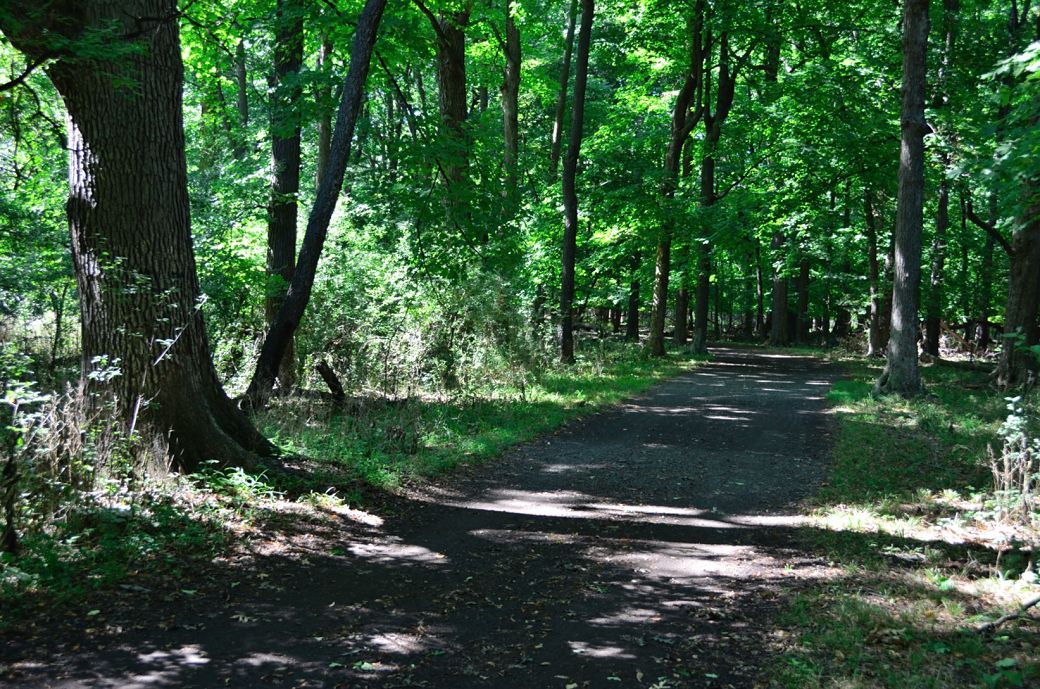
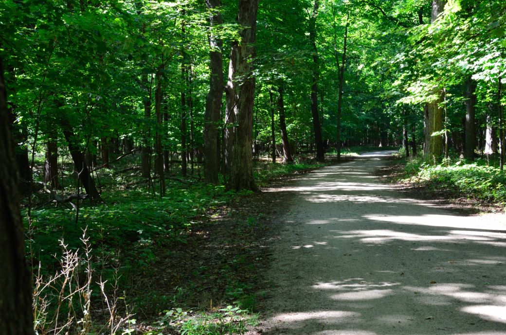
Back to the trail itself, as you can see it is very wooded and shady in this section and the path is mostly packed dirt. This is mostly how it looks after you cross Devon and pass through the Dam #4 Forest Preserve.
Shortly after you cross Touhy Ave the trail opens up to a sunny area with a crushed stone surface. The trail runs next to Talcott Road (on the right) at this point.
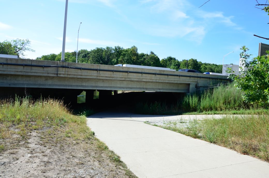
The DPRT runs under the Tri-State tollway (Interstate 294) at this point.
This is the where the Des Plaines River Trail passes through the Iroquois Woods Forest Preserve just before crossing Oakton.
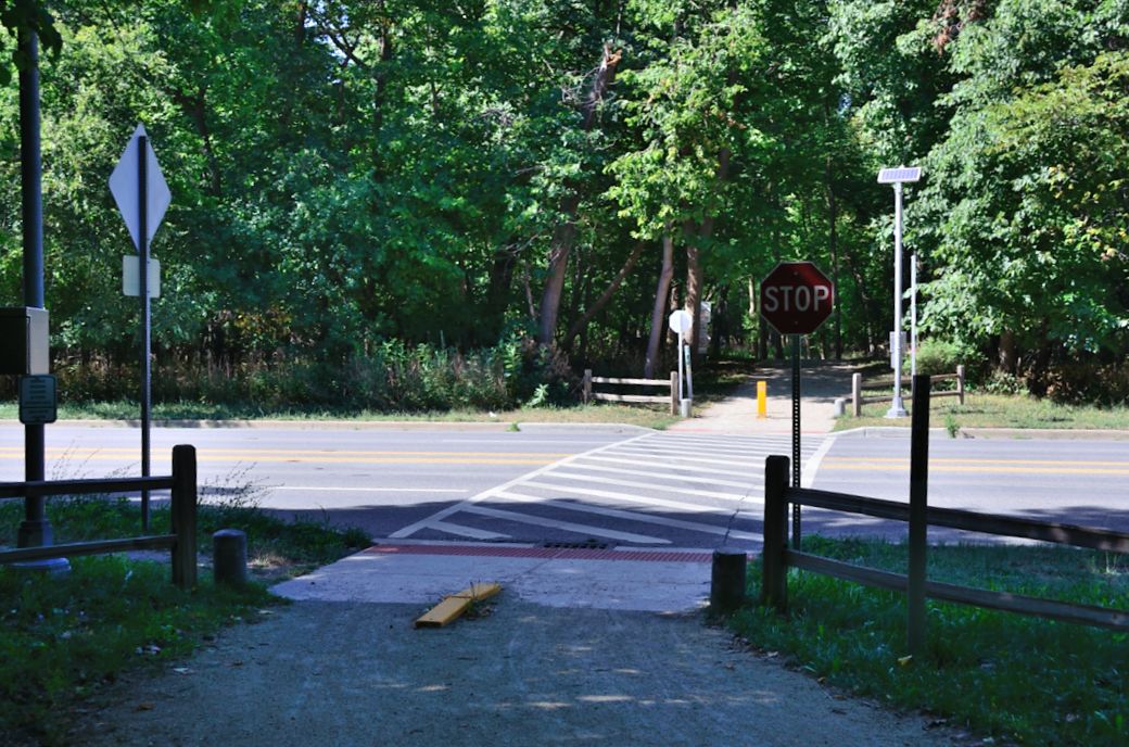
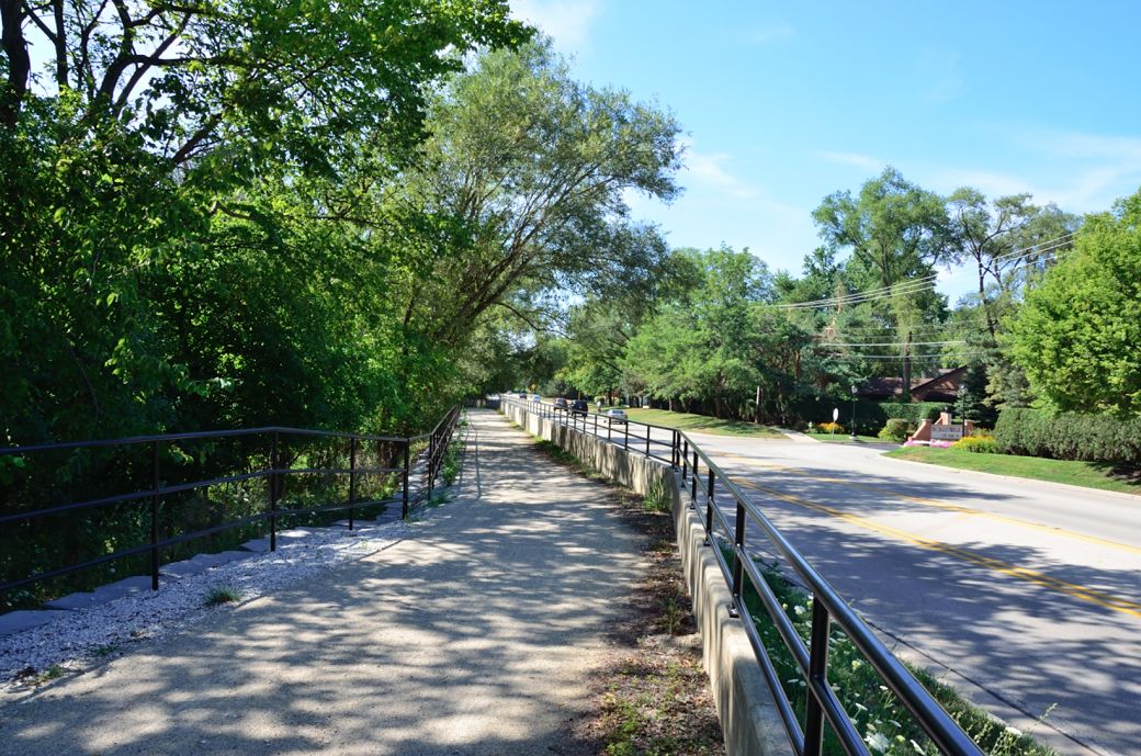
This is where you cross Oakton. Some of the roads can be very difficult to cross especially when there is a lot of traffic and no traffic lights at the trail crossings. Other trail intersections have bridges, tunnels or are at an intersection with a traffic signal.
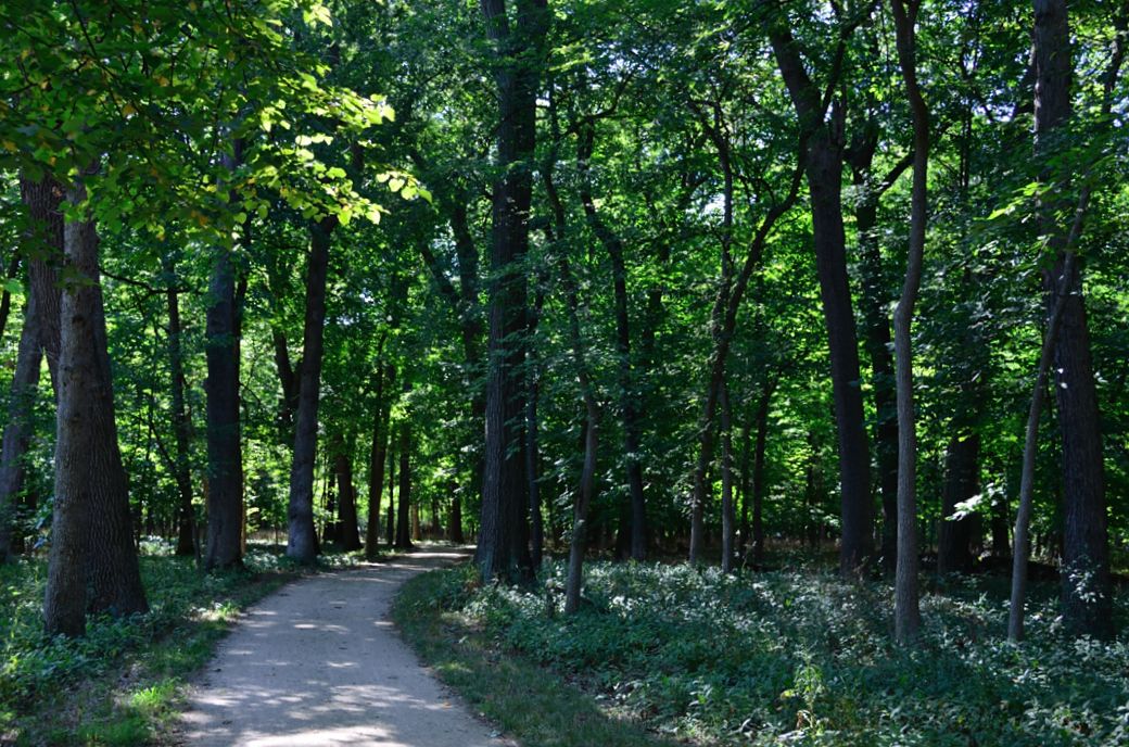
The tall trees and diffused sunlight as the DPR Trail passes through Campground Road Woods

This is the crossing at Algonquin Road and Campground Road. This particular road was actually not too difficult to cross.
You need to follow the bike lake on Campground Road between Campground Road Woods and Northwestern Woods Forest Preserve.
Here's the Photo Tour of the Half Day to Old School Forest Preserve ride from August 16th, 2014. These pages include photos of the DPR Trail in this section along with some nice scenery photos (including a few HDR photos) taken from various locations on the trail.
Old School Trail and MacArthur Woods - Photos 20
Route 60, Wright Woods and Half Day FP - Photos 21
Here's the GPS Map of the ride above.
Here are some Fall Photos of the DPRT from Euclid (or Lake Street) a little east of Prospect Heights south to Golf Road then back north to Milwaukee Ave (from October 9, 2012):
DPRT Fall Photos 17 - Just South of Lake Street
DPRT Fall Photos 18 - Branch to Beck Lake
DPRT Fall Photos 19 - North of Lake Street
Here's the GPS Map of the ride above.
Here's the photo tour of the Des Plaines River Trail from Higgins Road in Park Ridge north to Dundee Road in Wheeling (July, 2012).
The Des Plaines River Trail Photos 12 - Park Ridge Leg < You are here
The Des Plaines River Trail Photos 13 - Des Plaines Riverwalk Area
The Des Plaines River Trail Photos 14 - Big Bend Lake to Euclid
The Des Plaines River Trail Photos 15 - To Allgauers Restaurant
The DPRT Photos 16 - To Dam No 1, Wheeling
Here's the GPS Map of the ride above.
Here's the photo tour of the Des Plaines River Trail from Lincolnshire (Routes 21 and 22 going south) to Dundee Road in Wheeling, Il. (June, 2012).
The DPRT Photos 8 - Lincolnshire Marriott Area
The DPRT Photos 9 - Path along Milwaukee Road
The DPRT Photos 10 - Deerfield Road to Lake Cook Road
The DPRT Photos 11 - County Line Road to Wheeling
Here's the GPS Map of the ride above.
Here's the photo tour of the Des Plaines River Trail, from Route 22 in Half Day (going north) to Libertyville (July, 2005).
Des
Plaines River Trail Photos 4 - Lincolnshire to Wright Woods
Des
Plaines River Trail Photos 5 - Bridge Underpasses and Equestrian
Des Plaines River Trail Photos 6 - North to North Shore Path
DPRT Photos 7 - North Shore Path to Independence Grove
Here's the photo tour of the Des Plaines River Trail, from Wisconsin (going south) to Libertyville (September, 2004).
Des
Plaines River Trail Photos 1 - Van Patton Woods
Des
Plaines River Trail Photos 2 - Mile 5 South to Great America
Des
Plaines River Trail Photos 3 - Mile 11 to Adler Park in Libertyville
Note: Des Plains is a common mi s-spelling for Des Plaines (with the e near the end) so will see some references to Des Plains River Trail on these pages to help with the searches for the trail pages.
Photos © Copyright Rob Chapman, about-bicycles.com. Photos with * Copyright Dale Kiffel.
Half Day to Old School, August 2014
Fall Photos, October,2012
DPRT Photos 17
DPRT Photos 18
DPRT Photos 19
Park Ridge to Wheeling, July 2012.
DPRT Photos 12
DPRT Photos 13
DPRT Photos 14
DPRT Photos 15
DPRT Photos 16
Lincolnshire to Wheeling , June 2012
DPRT Photos 8
DPRT Photos 9
DPRT Photos 10
DPRT Photos 11
Half Day to Libertyville, July
DPRT Photos 4
DPRT Photos 5
DPRT Photos 6
DPRT Photos 7
Wisconsin to Libertyville, September, 2004
DPRT Photos 1
DPRT Photos 2
DPRT Photos 3