About Bicycles Online > Bicycle Touring and Trails > Des Plaines River Trail
The Des Plaines River Bike Trail
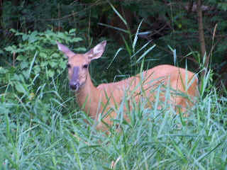 We rode by this deer at the southern end of our trip (close to Half Day) |
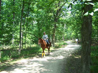 You run across horse back riders occasionally in the woods too... |
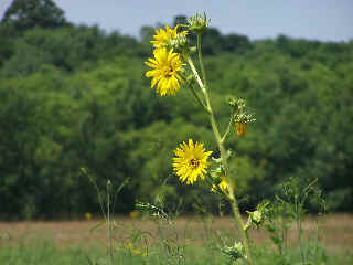 It's a nice mix of wooded, shady areas and open fields and prairies |
The Des Plaines River Trail (Illinois - 60m) I have ridden the Des Plaines River Trail (DPRT) on many different occasions now and have been on trail from the northern trail head (just south of the Wisconsin border) all the way to Park Ridge. The southern part of this trail goes to Maywood I believe.
This is a really nice crushed stone trail with lots of wooded and shaded areas mixed with sunny prairie sections. Traffic on the trail is lighter than most of the trails in this area (probably due to the crushed stone surface).
Most of the highway intersections north of Lincolnshire are bridges or bridge underpasses so you can ride quite a distance, non-stop without having to deal with highway crossings (which is also really nice if you have kids with you).
This article includes first hand descriptions and plenty of photos of the DPRT, from multiple bike trips. The original DPRT ride was from September of 2004 and my most recent ride was from July of 2012.
I have included photos of the most parts of the trail from Park Ridge north to the northern trail head just south of the Wisconsin border. There is a big difference in the photo quality and photo pages with the original photo pages (the northern section) and the newer photo pages (the southern sections).
 One of the openings just south of Lincolnshire One of the openings just south of Lincolnshire |
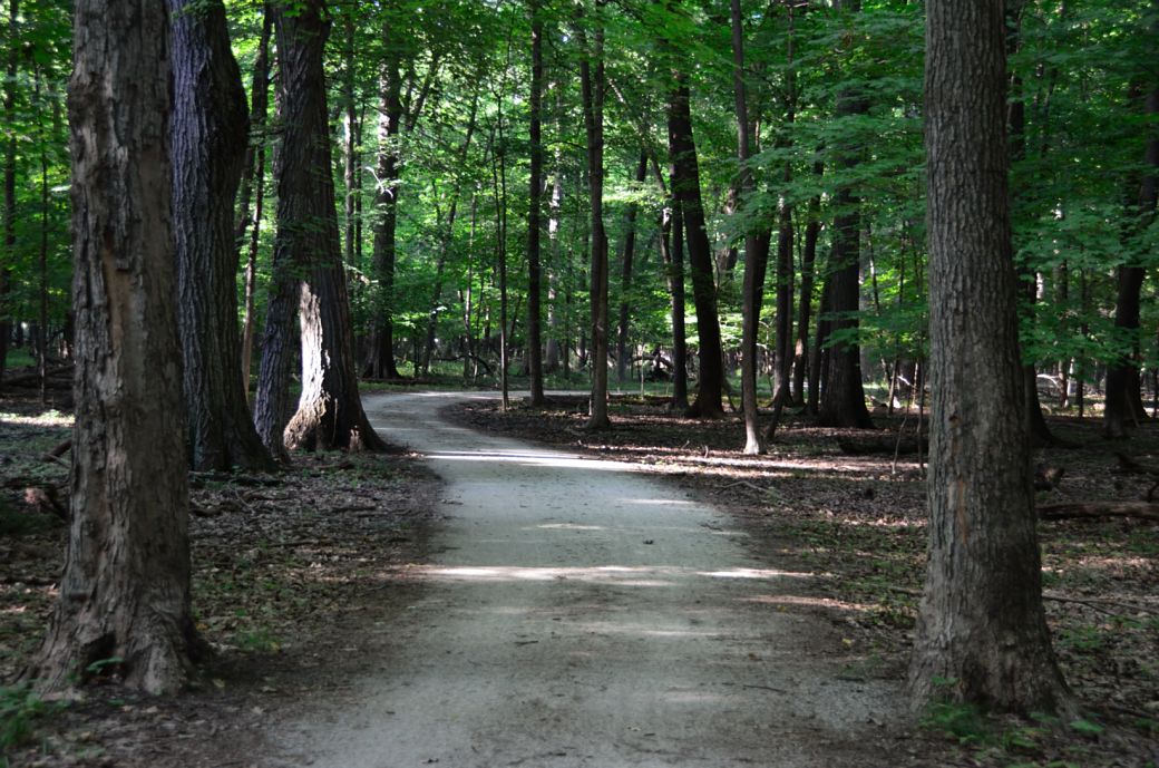 The DPRT winding through the woods The DPRT winding through the woods |
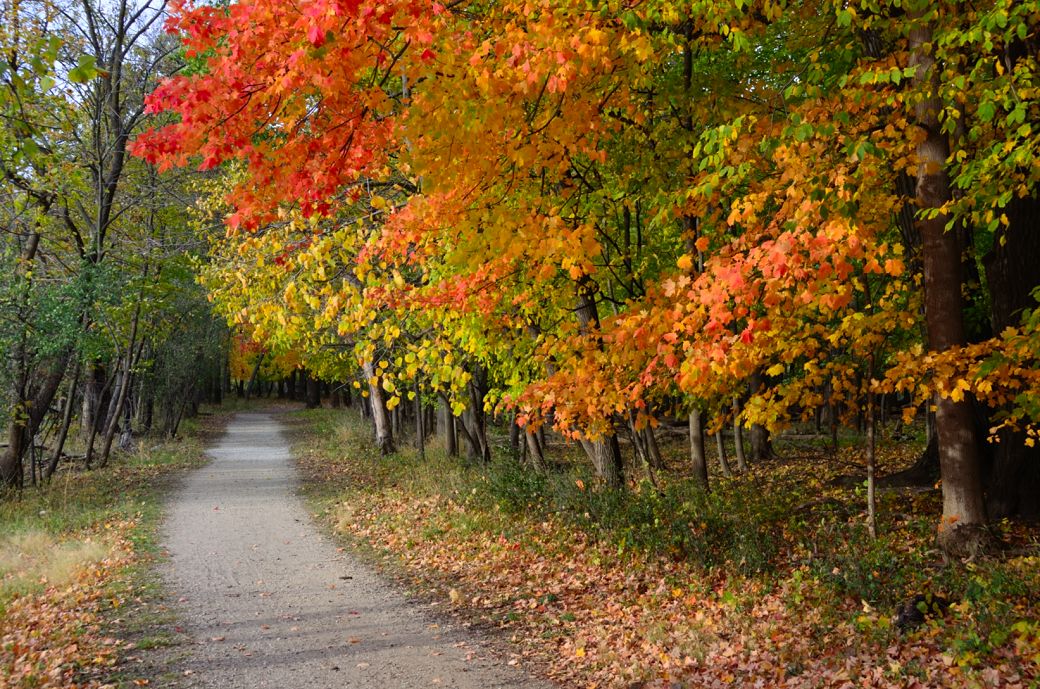 Beautiful fall colors on the DPRT near Lake Ave. Beautiful fall colors on the DPRT near Lake Ave. |
The original photo pages (from 2004) were taken with a digital camera from that era and I kept the photos and page sizes much smaller to allow for dial up internet connections (since that was much more common back then). The newer photo pages (the southern section) were taken with a much better camera, are a little larger and include blowups for each photo.
I am including some of the standard bike trail information and stats but my intent is to capture the look and feel of the trail primarily from first hand descriptions and photos.
The original photos are from a trip that I took, with a friend from Libertyville to Wisconsin and back. I started the pictures from the Mile Zero Marker which on the northern end of the trail. Our trip (both ways) was about 40 miles and were from Mile 0 to about Mile 16.
In the northern section I have included photos of many of the mile markers for a perspective of what different parts of the trail are like at the exact mile marker locations.
I have also included a video of this trail (towards the bottom of this page) that includes the northern section of the Des Plaines River Trail from Half Day (at Route 22) to the Van Patten Woods (Mile 0) just before the Wisconsin border.
Bike Trail Information
Distance: 60 miles (approximately) from Van Patten Woods, just south of the Wisconsin border to Maywood, Illinois. Surface: Mostly crushed limestone although there are some packed dirt parts of the trail in the southern (Cook County) section.
One of the really nice things about the northern (Lake County) part of the trail (from Lincolnshire north) is that you can go a very long distance in the northern Chicago suburbs, without having to stop or cross many major intersections.
Des Plaines River Trail Maps:
The Des Plaines River bike trail spans 2 counties, and both forest preserve districts have different web sites (unfortunately). You can get a map of the northern section from the Lake county forest preserve web site (www.lcfpd.org) and the southern section from the Cook county forest preserve web site (www.fpdcc.com). Both of these sites are great resources for good Adobe bike trail maps.
For my my current rides on the DPRT (the southern sections) I am also including my Bike GPS ride information and interactive map from the Garmin website. The interactive maps are nice since you can resize them to zoom in for detailed information, zoom out for the bigger picture or even use the satellite view to see exactly a specific area is actually like.
Here are some links to the maps.
Des Plaines River Trail North Map (Adobe pdf, Lake County)
Des Plaines River Trail South Map 1 (Adobe pdf, Cook County north)
Des Plaines River Trail South Map 2 (Adobe pdf, Cook County south)See the GPS Map links below under the photo tours for each ride for Interactive Maps of these rides.
Breaks in the Trail:
There is a small 1/4 mile gap in the trail between Aptakisic Road and the Cubby Bear (on Milwaukee Ave) around Lincolnshire but you can get by on a path alongside Milwaukee Road (on the east side) or on the sidewalk on the west side.
South of Willow (Palatine) Road and North of Euclid there is a short break in the trail before you cross Milwaukee Road. If you are heading south on the trail it will end at a small road (it's called Winkleman Road) by Allgauers Restaurant and Hotel.
You will need to go to the right (or west) past Allgauers and cross Milwaukee Road to enter the forest preserve. Take the forest preserve road a short distance and there is a dirt single track path which is where the DPRT continues again (it gets wider again after that section).
This is a great trail for distance riding and is fairly flat, shady and very scenic. Lots of shady, wooded sections mixed with some open prairie sections. Some parts of the trail and some of the highway underpasses do flood (in extremely wet conditions) and may be closed in wet conditions. There are lots of connecting branches that go off into parks and other scenic areas...
I have decided that this is one of my favorite trail in the north and northwest Chicago suburbs for scenery and distance considering that the trail is less crowded than many of the other major trails in the area. I am sure that much of that has to do with the fact that the trail is not paved. I think I would still rate the Fox River and connecting Prairie Trails at the top of my list, but if you are limited to the weekends (when everyone else is out), this one is better due to the crowds (or lack of...).
| . |
Des Plaines River Trail Photos
The photos and trail information below is from a series of bike rides on the Des Plaines River Trail and include all of the Lake County section north to the Wisconsin border and the Cook County part of the trail south to Park Ridge.
I have recently arranged the photos by rides from newest to oldest.
Here's the Photo Tour of the Half Day to Old School Forest Preserve ride from August 16th, 2014. These pages include photos of the DPR Trail in this section along with some nice scenery photos (including a few HDR photos) taken from various locations on the trail.
Old School Trail and MacArthur Woods - Photos 20
Route 60, Wright Woods and Half Day FP - Photos 21
Here's the GPS Map of the ride above.
Here are some Fall Photos of the DPRT from Euclid (or Lake Street) a little east of Prospect Heights south to Golf Road then back north to Milwaukee Ave (from October 9, 2012):
DPRT Fall Photos 17 - Just South of Lake Street
DPRT Fall Photos 18 - Branch to Beck Lake
DPRT Fall Photos 19 - North of Lake Street
Here's the GPS Map of the ride above.
Here's the photo tour of the Des Plaines River Trail from Higgins Road in Park Ridge north to Dundee Road in Wheeling (July, 2012).
The Des Plaines River Trail Photos 12 - Park Ridge Leg
The Des Plaines River Trail Photos 13 - Des Plaines Riverwalk Area
The Des Plaines River Trail Photos 14 - Big Bend Lake to Euclid
The Des Plaines River Trail Photos 15 - To Allgauers Restaurant
The DPRT Photos 16 - To Dam No 1, Wheeling
Here's the GPS Map of the ride above.
Here's the photo tour of the Des Plaines River Trail from Lincolnshire (Routes 21 and 22 going south) to Dundee Road in Wheeling, Il. (June, 2012).
The DPRT Photos 8 - Lincolnshire Marriott Area
The DPRT Photos 9 - Path along Milwaukee Road
The DPRT Photos 10 - Deerfield Road to Lake Cook Road
The DPRT Photos 11 - County Line Road to Wheeling
Here's the GPS Map of the ride above.
Here's the photo tour of the Des Plaines River Trail, from Route 22 in Half Day (going north) to Libertyville (July, 2005).
Des
Plaines River Trail Photos 4 - Lincolnshire to Wright Woods
Des
Plaines River Trail Photos 5 - Bridge Underpasses and Equestrian
Des Plaines River Trail Photos 6 - North to North Shore Path
DPRT Photos 7 - North Shore Path to Independence Grove
Here's the photo tour of the Des Plaines River Trail, from Wisconsin (going south) to Libertyville (September, 2004).
Des
Plaines River Trail Photos 1 - Van Patton Woods
Des
Plaines River Trail Photos 2 - Mile 5 South to Great America
Des
Plaines River Trail Photos 3 - Mile 11 to Adler Park in Libertyville
Note: Des Plains is a common mi s-spelling for Des Plaines (with the e near the end) so will see some references to Des Plains River Trail on these pages to help with the searches for the trail pages.
Photos © Copyright Rob Chapman, about-bicycles.com. Photos with * Copyright Dale Kiffel.
I hope you enjoy this tour and hope it inspires you to take the trail(s) in the spring, summer or fall (when it is cool and dry preferably) and/or provides a nice memory of your trips in the winter when you may not be able to get out there and enjoy it (as much anyway).
I've kept the format to medium sized and medium quality photos split into multiple pages to keep the download times reasonable for all connections, including dial ups. The photos (with a few exceptions are sequential going from Wisconsin to Libertyville (for now... more to come (south of this section) soon!)...
Note: Des Plains is a common mis-spelling for Des Plaines (with the e near the end) so you will see some references to Des Plains River Trail on these pages to help with the searches for the trail pages.
| . |
**** Des Plaines River Bike Trail Video ****
The Des Plaines River Trail (DPRT) North Video
This video contains scenes from the northern section of the Des Plaines River Trail from Half Day (at Route 22) to the Van Patten Woods (Mile 0) just before the Wisconsin border. The ride is about 27 miles each way (54 miles total) and the video (18.5 minutes) is from September, 2009.
- Bike Computers
- Bicycle GPS
- Bicycle Bags
- Bicycle Clothing
- Bicycle Lights
- Bicycle Locks
- Bike Parts
- Bikes
- Kids Bikes
- Exercise Bikes
- Bike Trainers
- Bicycle Car Racks
- Bicycle Hydration
- Bicycle Accessories
- Bike Blog
- Algonquin Road Trail
- Busse Woods Trail
- Chain O'Lakes Trail
- Chicago Lakefront Trail
- Deer Grove Bike Path
- Des Plaines River Trail
- Evanston Lakefront
- Fox River Trail
- Great River Trail, Illinois
- Great Western Trail
- Green Bay Bike Trail
- Hennepin Canal Trail
- I&M Canal Bike Trail
- Illinois Prairie Path
- Illinois State Beach Bike Path
- Inverness Trail
- Jane Addams Trail
- Kankakee River Trail
- Long Prairie Trail
- Millennium Trail
- Moraine Hills Trails
- North Branch Trail
- North Shore Bike Path
- Old Plank Road Trail
- Palatine Trail
- Paul Douglas Trail
- Poplar Creek Trail
- Prairie Trail
- Prospect Heights Trail
- Randall Road Trail
- River Bend Trail
- Robert McClory Bike Path
- Silver Glen Trail
- Skokie Valley Trail
- Thorn Creek Trail
- Virgil Gilman Trail
- Wauponsee Glacial Trail
- 400 State Trail
- Ahnapee Bike Trail
- Badger State Trail
- BATS Crystal Lake Trail
- Cannonball Path
- Elroy Sparta Trail
- Great-River-Trail
- Kenosha Trail
- LaCrosse-River-Trail
- Military Ridge Trail
- Oak Leaf Trail
- Peninsula State Park Trail
- Red Cedar Trail
- Root River and Racine Trails
- Seven Waters Trail
- White River Trail