The Moraine Hills Bike Trails
The Moraine Hills State Park is located south-east of Mchenry and north-west of Island Lake in Illinois and has a little over 11 miles of scenic biking (walking and jogging) paths that take you to the Fox River and McHenry Dam on the south and west, through a number of wetlands, marshes and nature preserves, into the Northern Woods area in the north and around Lake Defiance on the east side of the park.
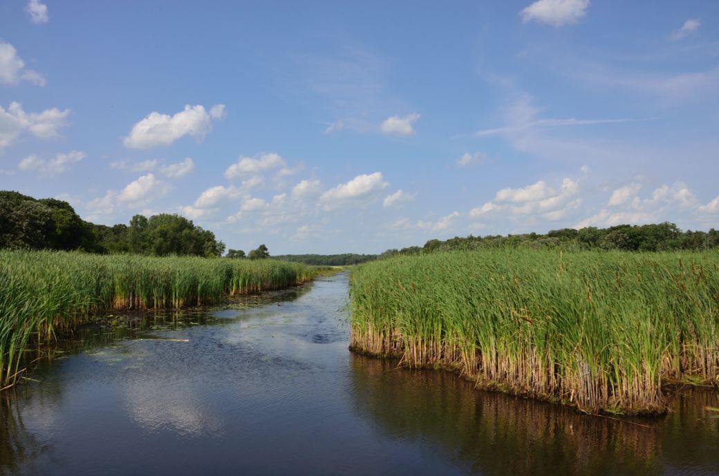 A wetlands scene and stream leading into Moraine Hills Park as seen from the River Road Trail. |
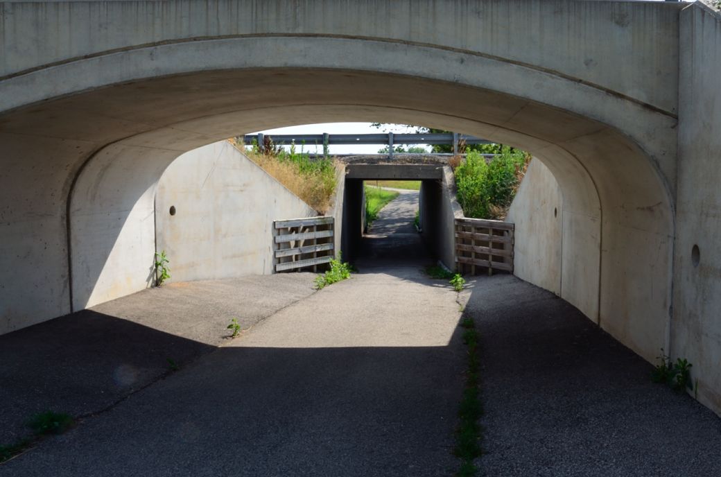 The Moraine Hills Bike Path tunnel under River Road heading towards the McHenry Dam. |
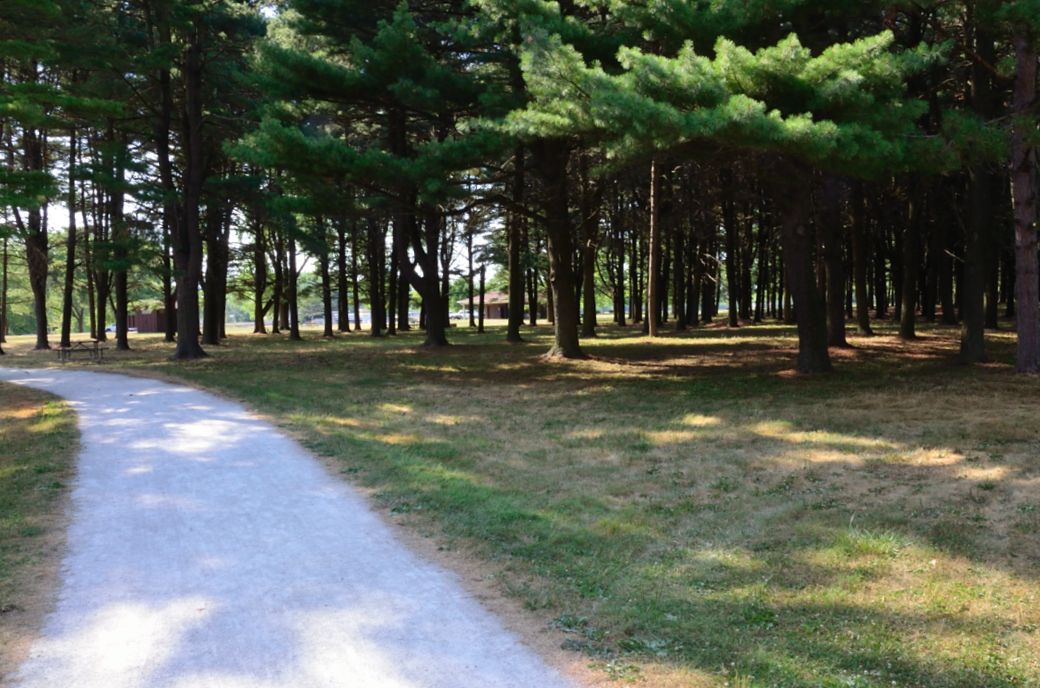 The Moraine Hills path and woods just before the McHenry Dam. |
This quite a diverse area with wetlands, hills and fairly thick wooded areas. The Moraine Hills Trail itself is mostly crushed stone but some parts of the trail that are paved.
I rode the Moraine Hills Bike Trails on a very hot day in July after we had been experiencing a drought for quite a while. Although the park was still very scenic, I'm sure that the wetlands are more, well... wet (of course) and greener during more normal conditions.
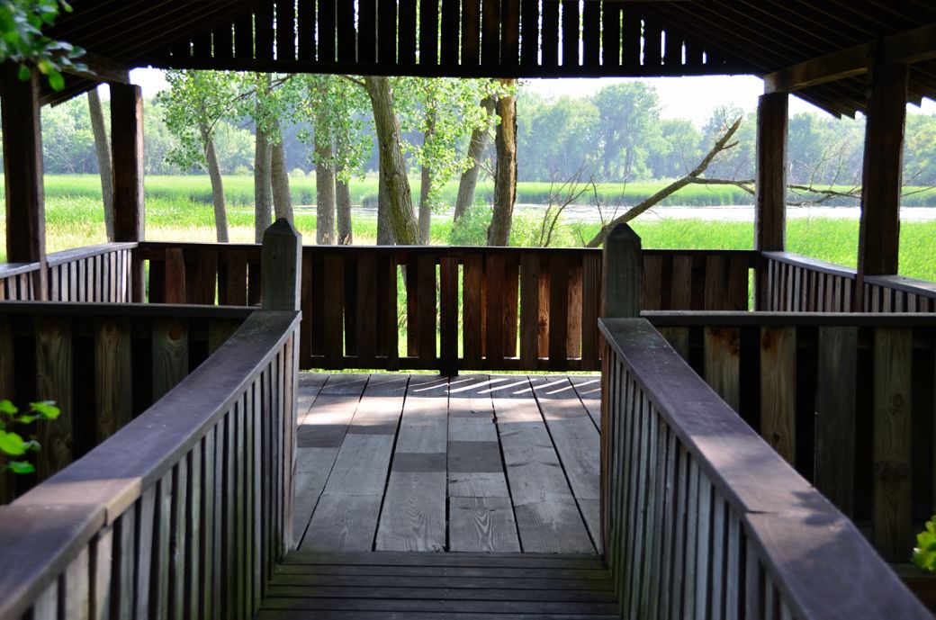 The Black Tern Marsh Viewing Platform along the Moraine Hills Trail. |
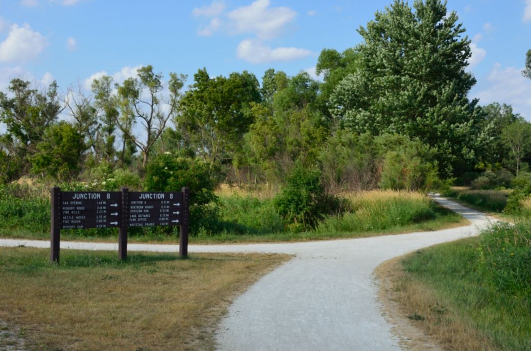 Junction B southwest of Lake Defiance |
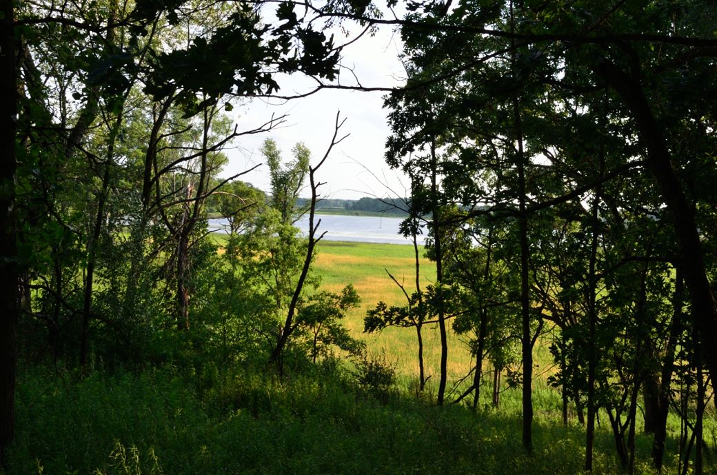 A view of Lake Defiance in the distance as seen from the Moriane Hills trail. |
My Ride on the Moraine Hills Bike Paths
I parked at the Pike Marsh parking area off of River Road (which is just off of Route 176) in the south-eastern part of the park. There was a booth as you enter the park but it was abandoned and there were no fees. The sign said that the park closes at 9:00pm and had a reminder not to get locked in.
As usual, I had my camera and Gamin Edge 800 GPS bike computer in order to post the photos, map and ride data for this bike path. They also had some free (and handy) maps of the park and trails at the park entrance (which I have copied and posted below, even though my map got a little "worn" from being in my pocket).
At the beginning of my ride, I actually rode on what I found out later was called the River Road Trail. This trail goes alongside of River Road and is a nice ride until you run into the intersection of River and Miller Roads (where there is a lot of traffic and you have to cross the Fox River). Well I turned around and got back on to the Moraine Hills Trails but, as you will see on the GPS map I had about a 3 mile detour (1.5 miles each way).
I am including a copy of the Moraine Hills State Park Map (pdf) that I picked up at the entrance of the park and also the GPS map of my ride via the GarminConnect website.
Here is the link to the Moraine Hills State Park Map - PDF Format
Below is a map of the Moraine Hills Bike Paths with a link to the GarminConnect site so you can review the route, map, connecting trails and surrounding area. If you take the map link to the Garmin site, you can zoom-in, zoom-out, move around or switch to the satellite view as you wish.
The Moraine Hills Bike Paths Map

© Copyright Garmin and Microsoft.
(click on map to see full map/ride details)
| . |
Here's the photo tour of the Moraine Hills Bike Paths from Pike Marsh, down the River Road Trail, back to the Moraine Hills Trail to the Fox River and the McHenry Dam, north past Yellow Head Marsh through the Northern Woods, around Leatherleaf Bog and then around Lake Defiance and back from July, 2012.
Moraine Hills Paths Photo Page 1 - Pike Marsh to Tunnel
Moraine Hills Paths Photo Page 2 - McHenry Dam to Black Tern Marsh
Moraine Hills Paths Photo Page 3 - Viewing Platform to Northern Woods
Moraine Hills Paths Photo Page 4 - Northern Woods to Lake Defiance
Moraine Hills Paths Photo Page 5 - Opossum Run to Pine Marsh Junction
Enjoy your ride...
- Bike Computers
- Bicycle GPS
- Bicycle Bags
- Bicycle Clothing
- Bicycle Lights
- Bicycle Locks
- Bike Parts
- Bikes
- Kids Bikes
- Exercise Bikes
- Bike Trainers
- Bicycle Car Racks
- Bicycle Hydration
- Bicycle Accessories
- Bike Blog
- Algonquin Road Trail
- Busse Woods Trail
- Chain O'Lakes Trail
- Chicago Lakefront Trail
- Deer Grove Bike Path
- Des Plaines River Trail
- Evanston Lakefront
- Fox River Trail
- Great River Trail, Illinois
- Great Western Trail
- Green Bay Bike Trail
- Hennepin Canal Trail
- I&M Canal Bike Trail
- Illinois Prairie Path
- Illinois State Beach Bike Path
- Inverness Trail
- Jane Addams Trail
- Kankakee River Trail
- Long Prairie Trail
- Millennium Trail
- Moraine Hills Trails
- North Branch Trail
- North Shore Bike Path
- Old Plank Road Trail
- Palatine Trail
- Paul Douglas Trail
- Poplar Creek Trail
- Prairie Trail
- Prospect Heights Trail
- Randall Road Trail
- River Bend Trail
- Robert McClory Bike Path
- Silver Glen Trail
- Skokie Valley Trail
- Thorn Creek Trail
- Virgil Gilman Trail
- Wauponsee Glacial Trail
- 400 State Trail
- Ahnapee Bike Trail
- Badger State Trail
- BATS Crystal Lake Trail
- Cannonball Path
- Elroy Sparta Trail
- Great-River-Trail
- Kenosha Trail
- LaCrosse-River-Trail
- Military Ridge Trail
- Oak Leaf Trail
- Peninsula State Park Trail
- Red Cedar Trail
- Root River and Racine Trails
- Seven Waters Trail
- White River Trail