About Bicycles Online > Bicycle Touring and Trails > Prospect Heights Trail
The Prospect Heights Trail
and Lake Arlington
Small bridge across McDonald Creek just east of Schoenbeck Road |
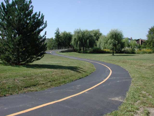
Lake Arlington on the Prospect Heights Trail |
Article and Photos by Howard Lange
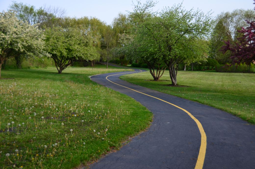
The Prospect Heights trail is a short pleasant trail of about 5 miles that begins across the street from the Prospect Heights Metra station at Wolf and Camp McDonald road and pretty much follows the Com Ed power line easement to Schoenbeck Road about 1/4 mile north of Palatine Road. Busy Palatine Road is crossed on an overpass alongside the CN RR tracks. Route 83 can be a difficult crossing depending on the time of day.
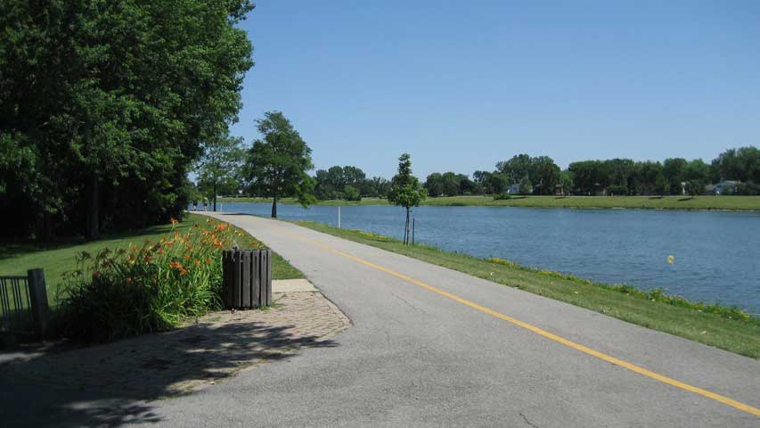
If you cross Schoenbeck road and continue west along the asphalt path/sidewalk for 1/4 mile you can turn north (1/8 mile) to Lake Arlington which has a bike/walk path of about 1.5 miles around the lake. On a nice weekend there is a lot of foot traffic, There is a side path along the northern path which takes you over small bridges and through a shaded area. I often continue from the west end of the lake at Windsor Drive along sidewalks and short paths to Arlington Heights road, crossing at the pedestrian light by the church 1/4 mile south of Hintz road and continue on to the intersection of Hintz and Rand road and then wind through local streets under route 53 and on to the start of the Palatine trail.
From the start of the Prospect Heights Metra station you can go south on a short park trail, cross McDonald Creek and then to Euclid and Sycamore by the swimming pool. In the summer time the pool is open as well as the refreshment stand.
The trail begs being extended south from the Metra station along the ComEd easement to Rand and Golf roads. The same holds for the power line easement from Windsor Drive to the Rand and Hintz road intersection.
Howard Lange
Prospect Heights and Lake Arlington Trails
Contrast Between Nature and Industry
 The Scenic Prospect Heights Trail just east of Schoenbeck Road |
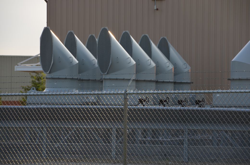 The Power Plant on the Prospect Height Trail |
 A view of the Power Plant as seen from the trail |
Article and Photos by Rob Chapman
We rode the Prospect Heights Trail (PHT) in early May of 2016. This was after the first article on this page, by Howard Lang, was posted. The article above introduces the trail and has some good information on it. I took quite a few more photos and have some maps that I wanted to post also.
I am including photos of the trail that loops around Lake Arlington also since these trails are right next to each other and there is an easy connection to the Lake Arlington trail which makes for a nice ride.
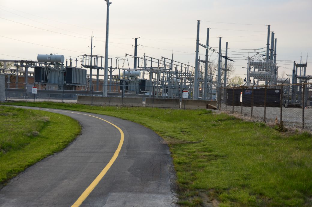
My first impression of the Prospect Heights Trail (and the Lake Arlington loop) was that it was truly a contrast between Industry and Nature. The Lake Arlington loop is very scenic although it gets really crowded at times. The Prospect Heights Trail runs along the power line easement mostly so you have the power line towers along most of the trail. This is pretty common with a lot of bike trails and is just a little less than scenic.
The big difference with the PHT and other trails that run along power lines is that it also runs right next to the power plant east of Wheeling Road and north of Palatine Road. Now most of us would not consider the power plant as scenic at all but that does not mean that it is not aesthetically pleasing.
The photos below include a page on Lake Arlington (beautiful and scenic), a page on the power plant (not scenic at all but interesting and shows the another aspect of the trail) and finally the last page of the trail south of Palatine Road (a little more scenic).
The Prospect Heights and Lake Arlington Trail Maps
I like to include the Google Maps version of the trail so you can get right to it without having to search for it and you can and zoom in and out as you like. I am also including my GPS map on the Garmin Connect SIte of our ride on these trails. You can see how to connect the trails with this map although it also has a wrong turn.
Each map has different features that can be helpful so you can take your pick of which one you like the best.
Here is the GPS Map of Our Ride on the PHT and Lake Arlington Trails through the GarminConnect site.
Here is the Google Maps version of the PHT and Lake Arlington Trails.
| . |
Prospect Heights and Lake Arlington Trails Photo Tour
Here's the photo tour of the Prospect Heights and Lake Arlington Trails with plenty of photos and first hand riding details. This ride was from May, 2016.
Prospect Heights Trail Home < you are here
Prospect Heights Trail Photos 1 - Lake Arlington and NW PHT
Prospect Heights Trail Photos 2 - Power Plant along the PHT
Prospect Heights Trail Photos 3 - South of Palatine Road
Photos in the Photo Tour © Copyright Rob Chapman, about-bicycles.com.
- Bike Computers
- Bicycle GPS
- Bicycle Bags
- Bicycle Clothing
- Bicycle Lights
- Bicycle Locks
- Bike Parts
- Bikes
- Kids Bikes
- Exercise Bikes
- Bike Trainers
- Bicycle Car Racks
- Bicycle Hydration
- Bicycle Accessories
- Bike Blog
The PHT Photos1
The PHT Photos2
The PHT Photos3
- Algonquin Road Trail
- Busse Woods Trail
- Chain O'Lakes Trail
- Chicago Lakefront Trail
- Deer Grove Bike Path
- Des Plaines River Trail
- Evanston Lakefront
- Fox River Trail
- Great River Trail, Illinois
- Great Western Trail
- Green Bay Bike Trail
- Hennepin Canal Trail
- I&M Canal Bike Trail
- Illinois Prairie Path
- Illinois State Beach Bike Path
- Inverness Trail
- Jane Addams Trail
- Kankakee River Trail
- Long Prairie Trail
- Millennium Trail
- Moraine Hills Trails
- North Branch Trail
- North Shore Bike Path
- Old Plank Road Trail
- Palatine Trail
- Paul Douglas Trail
- Poplar Creek Trail
- Prairie Trail
- Prospect Heights Trail
- Randall Road Trail
- River Bend Trail
- Robert McClory Bike Path
- Silver Glen Trail
- Skokie Valley Trail
- Thorn Creek Trail
- Virgil Gilman Trail
- Wauponsee Glacial Trail
- 400 State Trail
- Ahnapee Bike Trail
- Badger State Trail
- BATS Crystal Lake Trail
- Cannonball Path
- Elroy Sparta Trail
- Great-River-Trail
- Kenosha Trail
- LaCrosse-River-Trail
- Military Ridge Trail
- Oak Leaf Trail
- Peninsula State Park Trail
- Red Cedar Trail
- Root River and Racine Trails
- Seven Waters Trail
- White River Trail