The Badger State Trail
The Badger State Trail in Wisconsin runs north from the Illinois/Wisconsin state line ~ where the trail connects to the Jane Addams Trail ~ to Fitchburg, Wisconsin which is located just south of Madison.
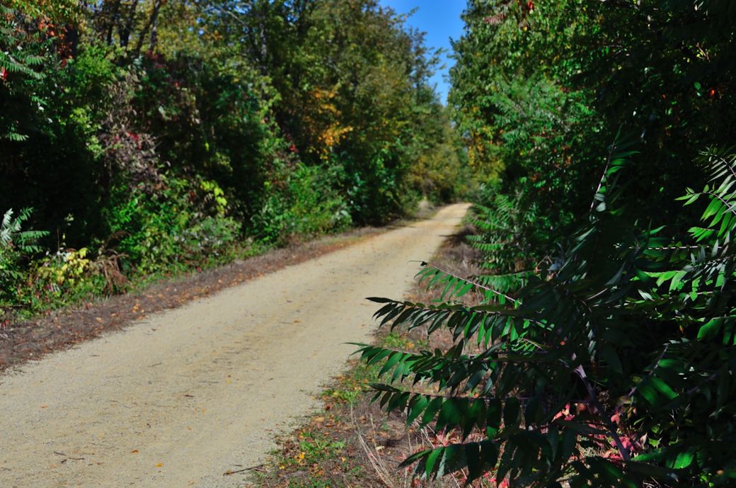 A view of the Badger State Trail just north of Monroe, Wi. |
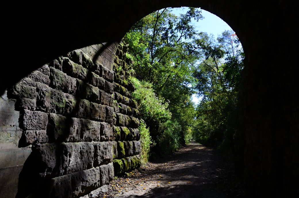
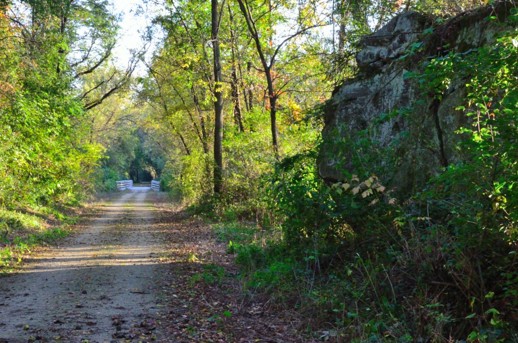 One of the rock walls that you ride by on the side of the trail . |
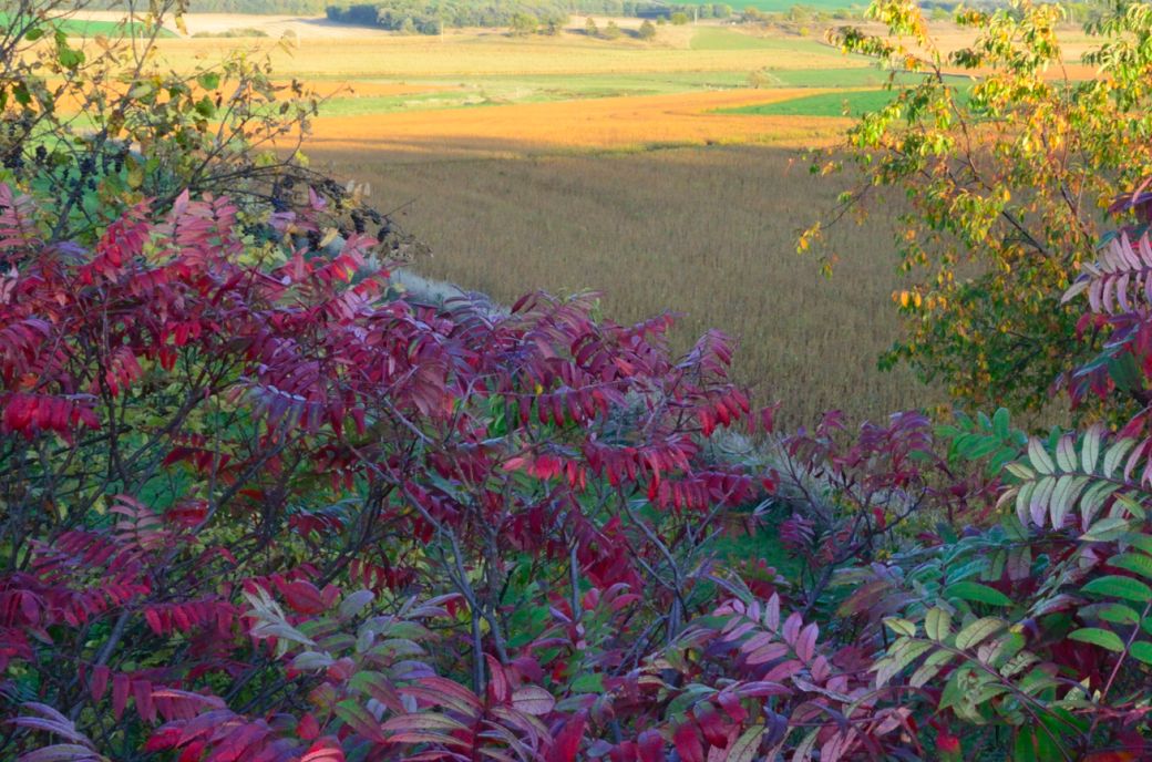 A view from one of the ridges looking down to the fields below. |
The trail passes through or by a number of small Wisconsin towns but is mostly rural and scenic. The majority of the trail is crushed stone except for the far northern section, near Fitchburg, which is paved.
The Badger State Trail (BST) is a rails-to-trails project so the trail is very flat with only gradual inclines and declines. This also explains the rock wall sections of the trail that you go through.
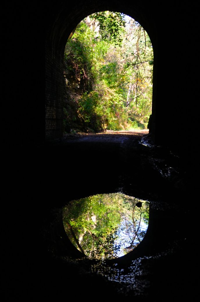
The highlight of this trail is the tunnel located a little less than 4 miles south of Belleville, Wisconsin. You will need to bring a light with you in order to pass through the tunnel (or at least to see anything as you pass through the tunnel).
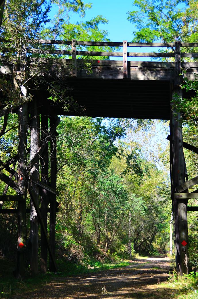 The tall bridge on the Badger State Trail located just north of Monticello |
|
|
My Ride(s) on the Badger State Trail
I originally discovered the Badger State Trail when I rode the Jane Addams Trail from Freeport, Illinois to the Wisconsin state line then continued on to Monroe, Wisconsin. This was in October of 2010 and I have wanted to ride the rest of the trail since then.
See the Jane Addams Trail Info and Photo Tour for first hand information in this Illinois trail.
Later I heard about the tunnel and finally got to ride most of the rest of the trail (well at least the southern section up to Belleville) in October of this year (2013).
I have included some of the most basic information on the trail on this page and on the photo tour pages but you can get most of this information on other more official websites.
I really like to include personal experiences and different and interesting photos from the trails to give you a feel for what the trails are like and what the highlights are. I carry a better camera and more advanced electronics on my bike rides these days in order to get better photos and information ~ Like a Nikon DSLR camera, a Garmin Edge Bike Computer and my iPhone.
The photos that I have included on the Photo Tour below include photos that were meant to give you a feel for the trail and to point out things that you may want to be aware of but I have also included some photos that were meant to be a little more artistic and to give you a little different perspective on the trail and its surroundings. For example, I have included quite a few different photos of the tunnel, many from the inside, to try and capture what it is like as you pass through the tunnel and look out from inside.
There is a gradual decline heading north between Monroe and Monticello so heading north is much easier than heading south between these 2 towns. Then there is another incline (no as much though) as you approach the tunnel.
I also rode the northern end of the trail from Whalen Road to Madison (or Fitchburg) where the trail ends in the Bike Roundabout Trail Intersection where it meets 4 other trails.
The only part of the trail not included in the photo tour and ride report is about a 9 mile section from Belleville north to Whalen Road.
The Badger State Trail Maps
I am including the Google Maps version of the trail, so you can get right to it without having to search for it, a map from WIsconsin DNR site and I am also including my GPS maps of my rides on the Garmin Connect SIte,
The best overall map of the Badger State Trail that I have found online, aside from simply zooming in on an area with Google Maps ~ which by the way is a great method for checking out bike trails and routes ~ is the PDF formatted trail map on the Wisconsin DNR site.
See The Badger State Trail Map to view this map.
The Badger State Trail Interactive Google Map
Here is the Google Maps version of the Badger State Trail.
The Badger State Trail Interactive GPS Map.
Note that I added Lap markers on the October, 2013 map the start and end of the tunnel so if you check the little box above the map that says "Laps", the tunnel is between laps 2 and 3.
Here is the October 2013 GPS Map of my Ride on the Badger Trail on the GarminConnect site.
Here is the June 2018 GPS Map of our Ride on the Badger Trail (and 4 other connecting trails) on the GarminConnect site.
| . |
Badger State Trail Trail Photo Tour
Here's the photo tour of the Badger State Trail from the Illinois/Wisconsin border, through the Tunnel and to the town of Belleville, Wisconsin. This ride was from October, 2013.
Badger State Trail Home < you are here
Badger State Trail Photos 1 - Wisconsin Border and Monroe
Badger State Trail Photos 2 - Sugar River Trail to the Tunnel
Badger State Trail Photos 3 - Inside the Tunnel
Badger State Trail Photos 4 - Tunnel to Belleville and Back
Here's the photo tour of the Badger State Trail from Whalen Road (north of Belleville) to the northern end of the trail at the Bike Roundabout in Madison. This ride was from June 2018..
Enjoy your ride...
- Bike Computers
- Bicycle GPS
- Bicycle Bags
- Bicycle Clothing
- Bicycle Lights
- Bicycle Locks
- Bike Parts
- Bikes
- Kids Bikes
- Exercise Bikes
- Bike Trainers
- Bicycle Car Racks
- Bicycle Hydration
- Bicycle Accessories
- Bike Blog
The BST Photos1
The BST Photos 2
The BST Photos 3
The BST Photos 4
The BST Photos 5
- Algonquin Road Trail
- Busse Woods Trail
- Chain O'Lakes Trail
- Chicago Lakefront Trail
- Deer Grove Bike Path
- Des Plaines River Trail
- Evanston Lakefront
- Fox River Trail
- Great River Trail, Illinois
- Great Western Trail
- Green Bay Bike Trail
- Hennepin Canal Trail
- I&M Canal Bike Trail
- Illinois Prairie Path
- Illinois State Beach Bike Path
- Inverness Trail
- Jane Addams Trail
- Kankakee River Trail
- Long Prairie Trail
- Millennium Trail
- Moraine Hills Trails
- North Branch Trail
- North Shore Bike Path
- Old Plank Road Trail
- Palatine Trail
- Paul Douglas Trail
- Poplar Creek Trail
- Prairie Trail
- Prospect Heights Trail
- Randall Road Trail
- River Bend Trail
- Robert McClory Bike Path
- Silver Glen Trail
- Skokie Valley Trail
- Thorn Creek Trail
- Virgil Gilman Trail
- Wauponsee Glacial Trail
- 400 State Trail
- Ahnapee Bike Trail
- Badger State Trail
- BATS Crystal Lake Trail
- Cannonball Path
- Elroy Sparta Trail
- Great-River-Trail
- Kenosha Trail
- LaCrosse-River-Trail
- Military Ridge Trail
- Oak Leaf Trail
- Peninsula State Park Trail
- Red Cedar Trail
- Root River and Racine Trails
- Seven Waters Trail
- White River Trail