The Oak Leaf Bike Trail
Milwaukee Area
The Oak Leaf Trail (OLT) actually includes quite a few different bike trails in the Milwaukee and South Milwaukee, Wisconsin areas. The entire trail and connecting parkway roads are paved.
 This part of the trail is right next to Lake Michigan near Cudahy, WIsconsin. |
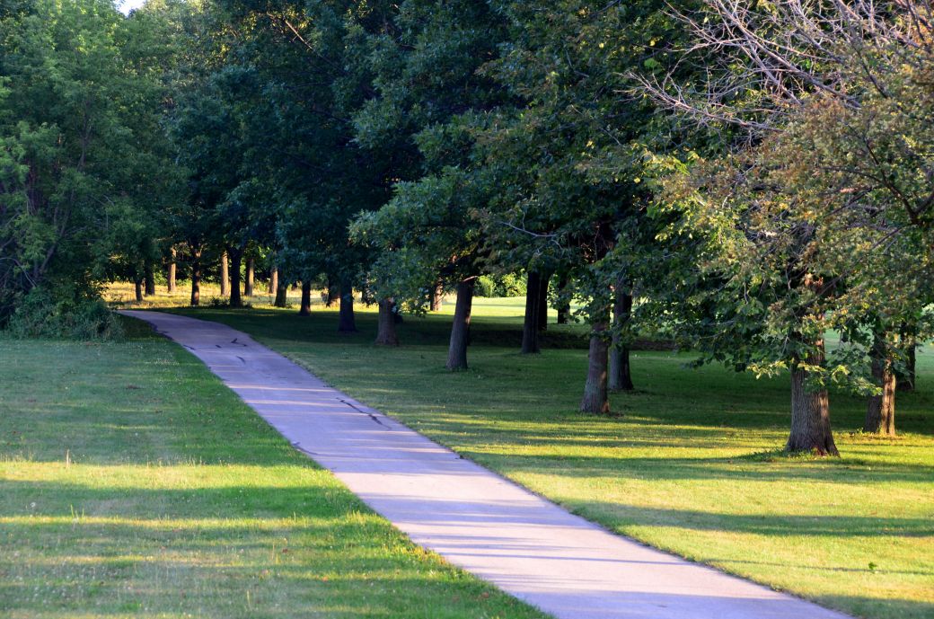
 The trail passes through some large parks near South Milwaukee, Wis. and along Lake Michigan. |
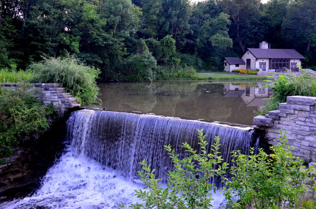 The photo above is a waterfall at the southern entrances to Grant Park and the Oak Leaf Parkway. |
The southern most part of the trail, near the Root River and 7 mile road, is fairly straight and flat and passes through some wooded areas as well as some open areas.
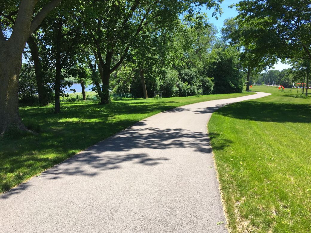
As you go further north on the trail it runs along Lake Michigan and through some nice parks and along the beach until you get to the southern part of Milwaukee.
This Southern Wisconsin bike trail is a pretty easy day trip from the Chicagoland area. You can take I94 north to 7 Mile Road east to get to the southern most part of the trail. You can then go north on the trail all the way to Milwaukee.
There are quite a few sections or branches of this trail North, South and West of Milwaukee. Our rides on this trail (so far) include the south eastern parts of the trail around South Milwaukee and the north eastern parts of the trail from just north of Milwaukee and along the Milwaukee River.
Below are the summaries of these parts of the Oak Leaf Trails.
Southeastern Oak Leaf Trail |
Our Ride on the Southeastern Oak Leaf Bike Trail(s)
We started our ride on this trail at the southern most part of the trail just off of County Line Road (see the GPS and Google map links below). There is a small parking area off of this road that is right on the trail.
The first part of the trail, from this point, is pretty straight and flat and is pretty easy to follow. There are a few trail intersection that you need to look our for in order to stay on the main trail if you want to continue north and east to the Lake Michigan part of the trail ~ which was my goal.
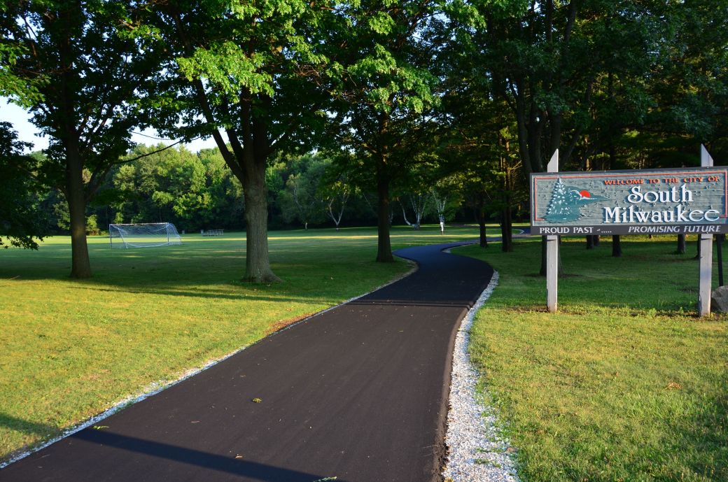
The trail itself ends at one point at the northern end (away from Lake Michigan) but you can easily get on to the Oak Creek Parkway ~ which is also a nice ride ~ to loop around the town of South Milwaukee and get back on to the section of the Oak Leaf Trail that continues north along Lake Michigan.
The Oak Creek Parkway section is north of Rawson Ave and south of College Ave. I actually took a wrong turn here on our way north and went through South Milwaukee on our way to the lake.
On our trip back to the southern end of the trail, where we started, I took the Oak Creek Parkway around South Milwaukee the way that I intended to when I planned the ride. I got back on the actual trail at the northern end of the parkway. This was a really nice way to go ~ See the GPS map below for this route (on the way back).
Unfortunately, we got a late start for this ride, and although I thought that I had enough time to make it to the far northern end of the trail ~ just south of Milwaukee ~ after we rode about 16 miles we had to turn back due to the looming sunset. Our entire ride was 32 miles.
The far northern end of the trail, that we missed on this ride, goes right along the beach of Lake Michigan. I'll be sure to leave enough time to do this part of the trail on our next ride here!
The Southeastern Oak Leaf Trail(s) and Oak Creek Parkway Maps
I originally found this trail using Google Maps "Bicycling" option. When you zoom way in you get the trail names. Then I did some internet searches for additional trail information.
I am including 2 different map formats so you can take your pick.
Here's a Google Maps link to the Southeastern Oak Leaf Trail and surrounding area.
And I also had my GPS bike computer with me, of course, so here is the GPS Map of Our Southeastern Ride through the GarminConnect site.
The Photo Tours below includes the details of our rides and plenty of first-hand ride information to go along with the photos of the parts of the Oak Leaf Trail that we have ridden so far.
Southeastern Oak Leaf Trail Photo Tour
Here's the photo tour of the Oak Leaf Bike Trail from Cudahy, Wisconsin, just south of Milwaukee, along the Oak Creek Parkway around the city of South Milwaukee to the southern most part of the trail at County Line Road. This ride was from August, 2015.
Oak Leaf Trail Home < you are here
Oak Leaf Trail Photos 1 - Lake Michigan, Cudahy
Oak Leaf Trail Photos 2 - Grant Park
Oak Leaf Trail Photos 3 - Oak Creek Parkway
Northeastern Oak Leaf Trail |
Our Ride on the Northeastern Oak Leaf Bike Trail(s)
This is where the Oak Leaf Trail runs next to the Milwaukee River
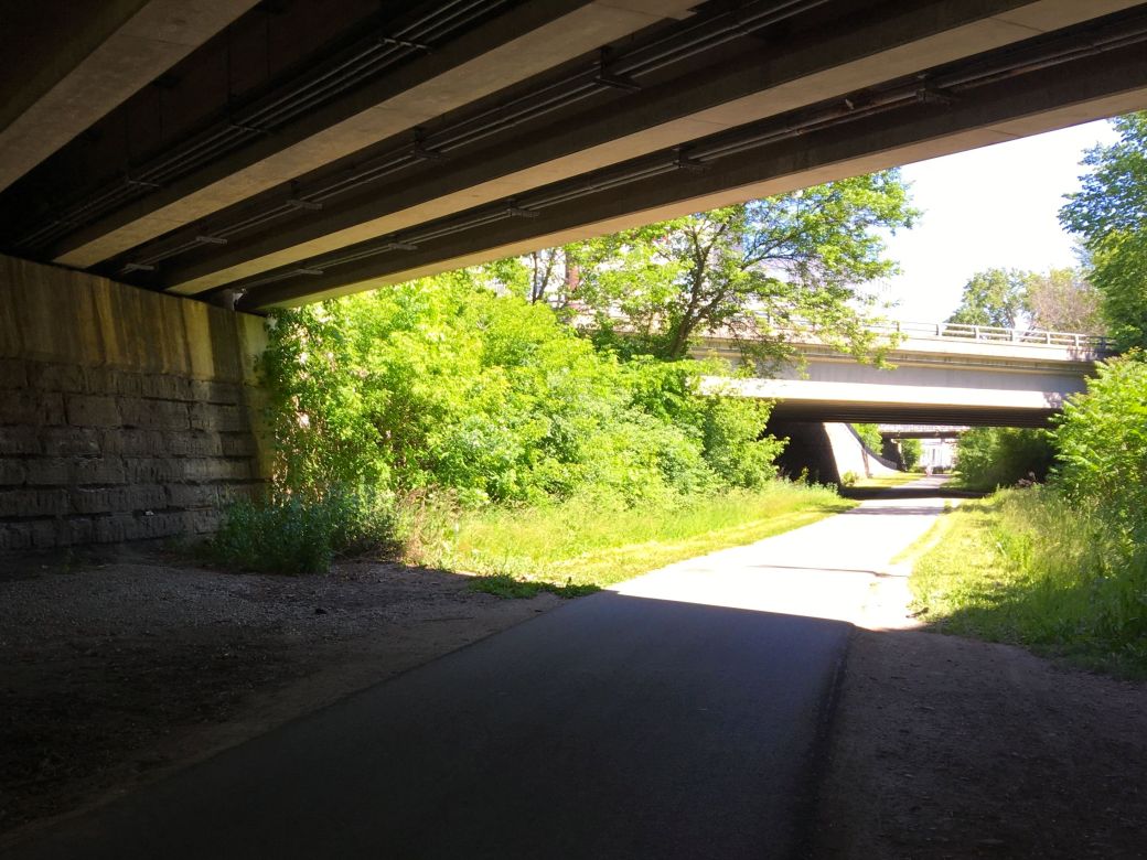
Going under the bridges near the University of WIsconsin north of Milwaukee
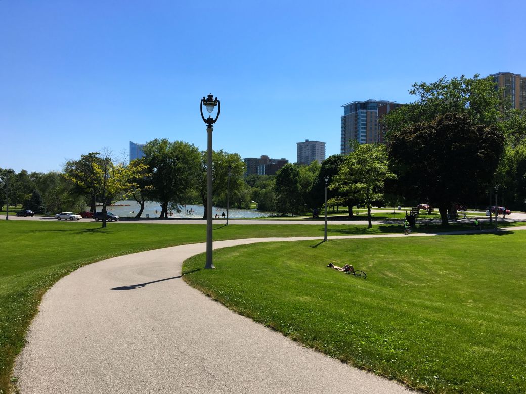
Coming into the crowded beach area north of Milwaukee.
We started our ride on this part of the trail at Lake Park, just north of Milwaukee. My idea was to ride south along the beach on Lake Michigan to where the trail connects to the part that branches off north and east from there and ride the parts of the trail that go along the Milwaukee River.
We did exactly as I described above but if I were to ride this part of the trail again, I would skip the part that goes along the beach on Lake Michigan unless maybe it was not a very good day for the beach. We rode the trail on a nice, sunny summer day and the beach area was really crowded and not much fun to ride when you just poke along and try to dodge people on the path. I don't know, maybe this would be nicer on a colder day...
The part of the trail that runs next to the Milwaukee River is very nice. The winding part of the path that is closest to the river is the most scenic in this area. This part is nice for a slower, casual ride.
The main trail that is a little away from the river and that heads north is better to go a little faster and cover more miles. The part that we rode was paved and flat but not that scenic since it follows the power lines.
We did not go all that far on our ride but you can take this part of the trail north Brown Deer Road where it connects to the Brown Deer Trail and keep going north to connecting trails almost all the way to Sheboygan, Wisconsin which is about 60 miles from Milwaukee - so as you can see you can go a long way on these trails.
The Northeastern Oak Leaf Trail Maps
I am including 2 different map formats once again so you can take your pick.
Here's a Google Maps link to the Northeastern Oak Leaf Trail and surrounding area.
Here is the GPS Map of Our Northeastern Ride through the GarminConnect site.
Note: I made a mistake on resetting my GPS trip meter and it connected the end of our ride in Milwaukee to where I turned it on again at home so you need to go to the Milwaukee part and Zoom Way In to see the actual ride.
Northeastern Oak Leaf Trail Photo Tour
Here's the photo tour of the Oak Leaf Bike Trail Northern sections from Lake Park North of Milwaukee, along the beach area on Lake Michigan, north and along the Milwaukee River parts of the trail. This ride was from June 2017.
Oak Leaf Trail Home < you are here
Oak Leaf Trail NE Photos 1 - Silver Spring to Milwaukee River
Oak Leaf Trail NE Photos 2 - Milwaukee River to Lake Michigan
All Photos © Copyright Rob Chapman, about-bicycles.com.
- Bike Computers
- Bicycle GPS
- Bicycle Bags
- Bicycle Clothing
- Bicycle Lights
- Bicycle Locks
- Bike Parts
- Bikes
- Kids Bikes
- Exercise Bikes
- Bike Trainers
- Bicycle Car Racks
- Bicycle Hydration
- Bicycle Accessories
- Bike Blog
Southeast Leg
The OLT SE Photos
The OLT SE Photos2
The OLT SE Photos3
Northeast Leg
The OLT NE Photos1
The OLT NE Photos2
- Algonquin Road Trail
- Busse Woods Trail
- Chain O'Lakes Trail
- Chicago Lakefront Trail
- Deer Grove Bike Path
- Des Plaines River Trail
- Evanston Lakefront
- Fox River Trail
- Great River Trail, Illinois
- Great Western Trail
- Green Bay Bike Trail
- Hennepin Canal Trail
- I&M Canal Bike Trail
- Illinois Prairie Path
- Illinois State Beach Bike Path
- Inverness Trail
- Jane Addams Trail
- Kankakee River Trail
- Long Prairie Trail
- Millennium Trail
- Moraine Hills Trails
- North Branch Trail
- North Shore Bike Path
- Old Plank Road Trail
- Palatine Trail
- Paul Douglas Trail
- Poplar Creek Trail
- Prairie Trail
- Prospect Heights Trail
- Randall Road Trail
- River Bend Trail
- Robert McClory Bike Path
- Silver Glen Trail
- Skokie Valley Trail
- Thorn Creek Trail
- Virgil Gilman Trail
- Wauponsee Glacial Trail
- 400 State Trail
- Ahnapee Bike Trail
- Badger State Trail
- BATS Crystal Lake Trail
- Cannonball Path
- Elroy Sparta Trail
- Great-River-Trail
- Kenosha Trail
- LaCrosse-River-Trail
- Military Ridge Trail
- Oak Leaf Trail
- Peninsula State Park Trail
- Red Cedar Trail
- Root River and Racine Trails
- Seven Waters Trail
- White River Trail