The Kankakee River Trail
The Kankakee River Trail (KRT) is approximately 11 miles long from the northwest end of the trail ~ just south of Wilmington, Illinois ~ through the Kankakee River State Park to the southeast end of the trail ~ just west of Bourbonais, Illinois. Most of the trail is paved except for about 3 miles of crushed stone at the southeast end of the trail.
Prior to riding this trail I read some articles on the internet that described the trail as very hilly. I did not think that was the case. Although there are a few small hills on the trail I would say that it is mostly flat.
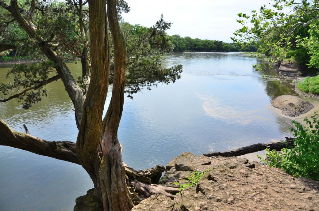 This is a view of the Kankakee River ~ with a weathered tree hanging on to one of the steep cliffs. |
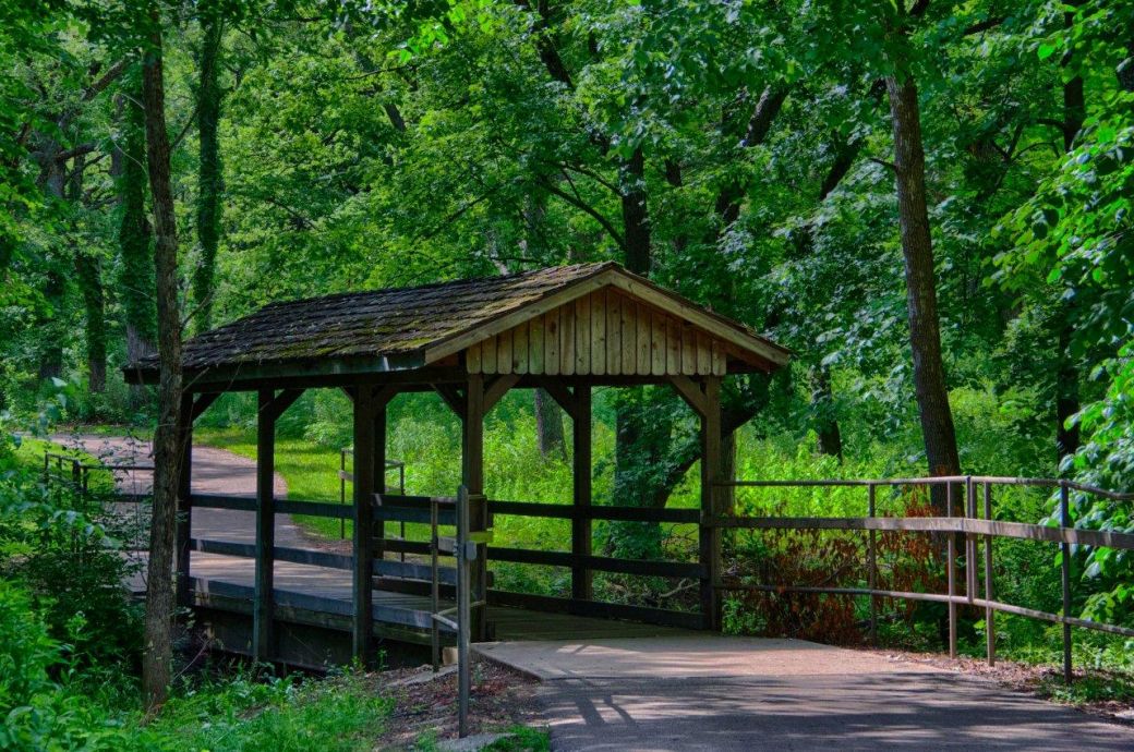 This covered bridge crosses a stream close to a scenic viewing area on the Kankakee River. |
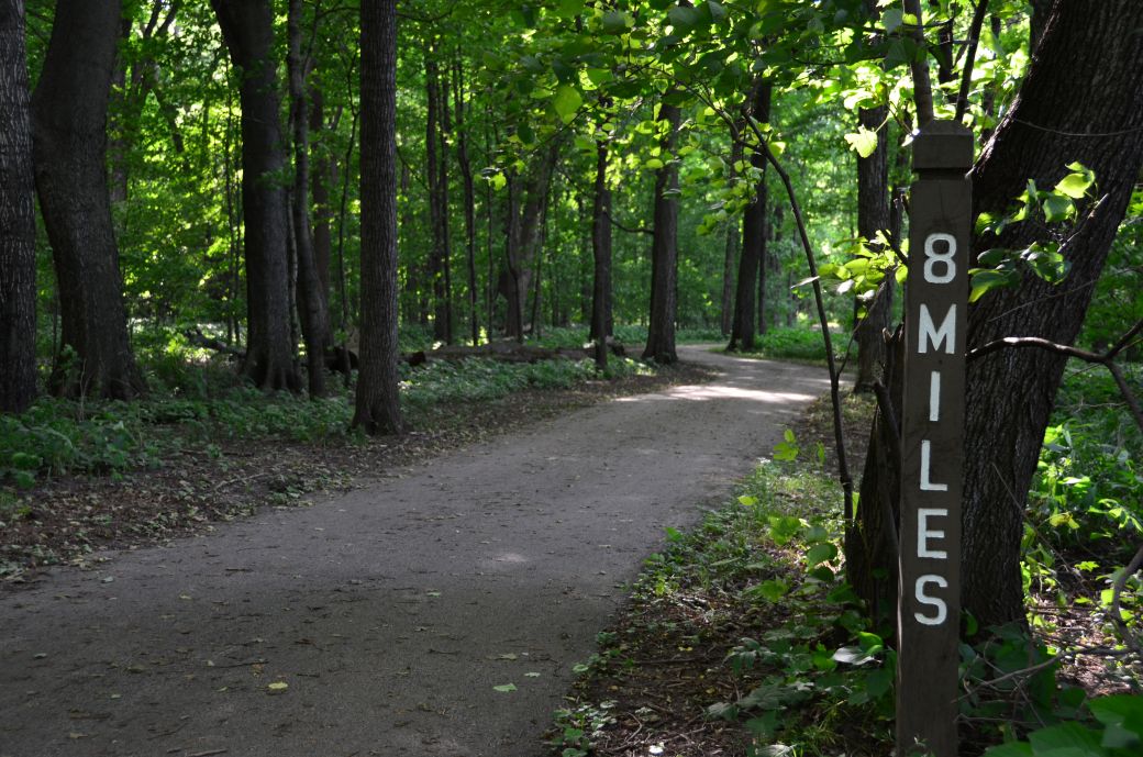 Although most of the trail goes through wooded areas, the northwest end of the trail has these beautiful tall trees. |
This Illinois bike trail is a pretty easy day trip from the Chicagoland area since it is about 20 miles south of Joliet. There is parking at both ends of the trail and a number of places along the trail. There are also plenty of benches and picnic tables along the trail.
The trail runs along the Kankakee River and there are many scenic views of the river from the trail. There is also a nice viewing platform just south of the covered bridge shown in the photo above where you can get a very nice view of the Kankakee River.
Our Ride on the Kankakee River Trail
We started our trip at the northwest end of the trail just southwest of Wilmington along route 102. I didn't locate parking before our ride and wasn't even sure exactly where the trail started but once we got on route 102 south from Wilmington it was easy to find.
We rode the entire trail, both ways, since it is not that long. My bike computer had 22 miles on the trip meter at the end of our ride. I started taking photos ~ for the photo tour below ~ on the way back so the pictures are pretty much southeast to northwest.
A lot of the trail was wooded and there were nice views of the river at many places along the trail. There was a narrow suspension bridge (the green bridge in the photo tour) that crossed Rock Creek at about the half way point.
There was a nice viewing platform with views of the river and the cliffs along the river. This was just southeast of the covered bridge and before a fairly large park by the river.
There was also an abandoned campground ~ Kankakee River State Park ~ closer to the northwestern end of the trail where we stopped for a break. I am not sure why the campground was not open but was thinking maybe that had to do with all the Illinois budget problems that they are having. Maybe it's something else, I'm just speculating.
The Photo Tour below includes more details of our ride and plenty of first-hand ride information to go along with the photos of the KRT.
The Kankakee River Trail Maps
I found this trail using Google Maps with the Bike Trail option enabled then did a little additional research after I found it. I like to include the Google Maps version of the trail ~ so you can get right to it without having to search and zoom in ~ in addition to my GPS map on the Garmin Connect SIte.
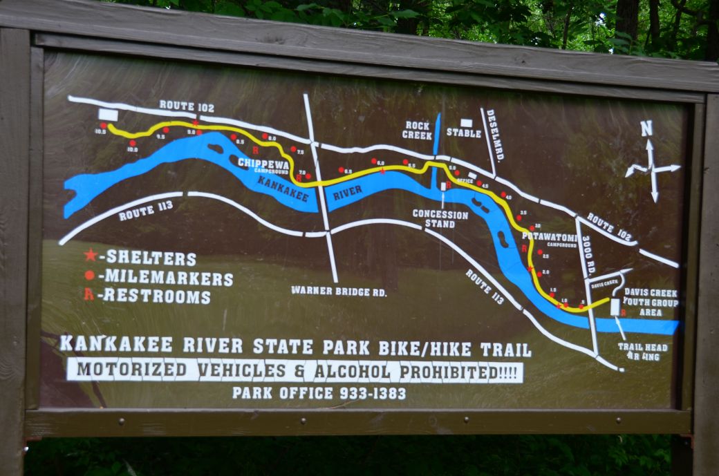
In this case I also took a photo of the map that was on a large sign at the southeast end of the trail too.
Each map has different features that can be helpful so you can take your pick of which one you like the best.
Here's the Kankakee River Trail map from the sign posted at the end of the trail. Click on the map photo to see the larger version.
(Click here or on the map for the full size version).
Here is the GPS Map of Our Ride on the Kankakee River Trail through the GarminConnect site.
Here is the Google Maps version of the Kankakee River Trail.
| . |
Kankakee River Trail Photo Tour
Here's the photo tour of the Kankakee River Trail with plenty of first hand riding details. This ride was from June, 2016.
Kankakee River Trail Home < you are here
Kankakee River Trail Photos 1 - Starting at Davis Campground
Kankakee River Trail Photos 2 - Viewing Platform and Covered Bridge
Kankakee River Trail Photos 3 - Suspension Bridge to Tall Trees
Photos © Copyright Rob Chapman, about-bicycles.com.and Dale Kiffel.
- Bike Computers
- Bicycle GPS
- Bicycle Bags
- Bicycle Clothing
- Bicycle Lights
- Bicycle Locks
- Bike Parts
- Bikes
- Kids Bikes
- Exercise Bikes
- Bike Trainers
- Bicycle Car Racks
- Bicycle Hydration
- Bicycle Accessories
- Bike Blog
The KRT Photos1
The KRT Photos2
The KRT Photos3
- Algonquin Road Trail
- Busse Woods Trail
- Chain O'Lakes Trail
- Chicago Lakefront Trail
- Deer Grove Bike Path
- Des Plaines River Trail
- Evanston Lakefront
- Fox River Trail
- Great River Trail, Illinois
- Great Western Trail
- Green Bay Bike Trail
- Hennepin Canal Trail
- I&M Canal Bike Trail
- Illinois Prairie Path
- Illinois State Beach Bike Path
- Inverness Trail
- Jane Addams Trail
- Kankakee River Trail
- Long Prairie Trail
- Millennium Trail
- Moraine Hills Trails
- North Branch Trail
- North Shore Bike Path
- Old Plank Road Trail
- Palatine Trail
- Paul Douglas Trail
- Poplar Creek Trail
- Prairie Trail
- Prospect Heights Trail
- Randall Road Trail
- River Bend Trail
- Robert McClory Bike Path
- Silver Glen Trail
- Skokie Valley Trail
- Thorn Creek Trail
- Virgil Gilman Trail
- Wauponsee Glacial Trail
- 400 State Trail
- Ahnapee Bike Trail
- Badger State Trail
- BATS Crystal Lake Trail
- Cannonball Path
- Elroy Sparta Trail
- Great-River-Trail
- Kenosha Trail
- LaCrosse-River-Trail
- Military Ridge Trail
- Oak Leaf Trail
- Peninsula State Park Trail
- Red Cedar Trail
- Root River and Racine Trails
- Seven Waters Trail
- White River Trail