The North Shore Bike Path
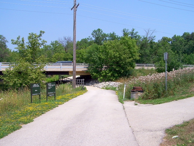 The intersection of the North Shore Bike Path and the Des Plaines River Trail (west) |
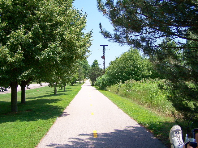 Riding east on the trail parallel to route 176 |
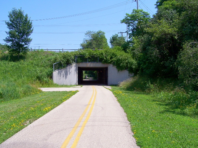 The North Shore Bike Path just before meeting up with the Green Bay Trail (east) |
The North Shore Bike Path (19 miles) is a great East-West bike trail that connects to some of the nicest North-South bike trails in the North and Northwest suburban area of Chicago. With this east/west connection, you can ride an incredible number of miles of some on the best bike trails in the Chicagoland area.
There are not nearly as many East-West trails in the northern suburbs as there are North-South trails so this is a very important trail if you want to cover a lot of miles or need a connection to some of the other trails in the area.
The North Shore Trail mostly runs parallel to route 176 and connects the Des Plaines River Trail on the West with the Skokie Valley Trail and the Green Bay Bike Trail (also called the Robert McClory Bike path) on the East end. You can go almost 40 miles on the Des Plains River Trail and another 30 miles or so on the Green Bay/ Robert McClory trails... and who knows how much more on the other connecting trails!
This trail makes it possible to plan great bike trips to various locations in the Chicagoland area... all on bike trails and without ever having to ride on busy streets or to ride all day or even take multiple day trips in the area.
North Shore Bike Trail Map
Here's a map of the Western Leg of the North Shore Bike Path with a link to the GarminConnect site so you can review the route, map, connecting trails and surrounding areas.
Note: The part of the trail highlighted in red is just the western end of the trail from Mundelein to the Des Plaines River Trail (I did not have my bike GPS computer for the earlier rides, from the DPRT to Lake Bluff).
You can, however enlarge the mapped area and follow the remainder of the trail and see the connecting trails and intersections although you may need to switch from Bing map view to Google map view to see the remainder of the trail.
GPS MAP - North Shore Bike Path, West End
| . |
North Shore Bike Path Photos
Here's the Photo Tour starting at the Western End of the Trail near Carmel Catholic High School in Mundelein, Illinois to the Des Plaines River Trail - May 5th 2014.
Here's a photo tour of the North Shore Bike Path from the Old School Trail (Libertyville) to the Green Bay Trail (Lake Bluff).
The North Shore Bike Path Photo Tour - From the Old School Trail (Libertyville) to the Green Bay Trail (Lake Bluff) - July 4th 2006 (mostly).
North Shore Bike Path Photos 1 - From the Old School Trail
North Shore Bike Path Photos 2 - From Lambs Farm
North Shore Bike Path Photos 3 -Ride Along Route 176
North Shore Bike Path Photos 4 - To the Robert McClory Trail
Our NS Bike Path Trips
The photos in the photo tour section for this trail is actually a composite of 4 different rides that we did (when I had my camera or phone with me).
- I took the pictures at the Des Plaines River Trail intersection photos when I was doing the DPRT photo pages.
- I took the Green Bay, Robert McClory bike trail intersection photos when I was doing the article on the Green Bay Trail.
- I did the main photos when I was traveling from Libertyville to Glenview on the fourth of July weekend (2006) .
- The photos starting from the western end of the trail in Mundelein were from my 5/5/2014 ride.
The Ride is the Destination
- Bike Computers
- Bicycle GPS
- Bicycle Bags
- Bicycle Clothing
- Bicycle Lights
- Bicycle Locks
- Bike Parts
- Bikes
- Kids Bikes
- Exercise Bikes
- Bike Trainers
- Bicycle Car Racks
- Bicycle Hydration
- Bicycle Accessories
- Bike Blog
- Algonquin Road Trail
- Busse Woods Trail
- Chain O'Lakes Trail
- Chicago Lakefront Trail
- Deer Grove Bike Path
- Des Plaines River Trail
- Evanston Lakefront
- Fox River Trail
- Great River Trail, Illinois
- Great Western Trail
- Green Bay Bike Trail
- Hennepin Canal Trail
- I&M Canal Bike Trail
- Illinois Prairie Path
- Illinois State Beach Bike Path
- Inverness Trail
- Jane Addams Trail
- Kankakee River Trail
- Long Prairie Trail
- Millennium Trail
- Moraine Hills Trails
- North Branch Trail
- North Shore Bike Path
- Old Plank Road Trail
- Palatine Trail
- Paul Douglas Trail
- Poplar Creek Trail
- Prairie Trail
- Prospect Heights Trail
- Randall Road Trail
- River Bend Trail
- Robert McClory Bike Path
- Silver Glen Trail
- Skokie Valley Trail
- Thorn Creek Trail
- Virgil Gilman Trail
- Wauponsee Glacial Trail
- 400 State Trail
- Ahnapee Bike Trail
- Badger State Trail
- BATS Crystal Lake Trail
- Cannonball Path
- Elroy Sparta Trail
- Great-River-Trail
- Kenosha Trail
- LaCrosse-River-Trail
- Military Ridge Trail
- Oak Leaf Trail
- Peninsula State Park Trail
- Red Cedar Trail
- Root River and Racine Trails
- Seven Waters Trail
- White River Trail