The White River Bicycle Trail
The White River Trail (WRT) actually has an East leg and West leg that head out of Burlington, Wisconsin. The west leg goes out to Elkhorn, Wi and the East leg heads out toward Union Grove. The west leg is more popular and most sites refer to that one and often do not even mention the eastern part of the trail.
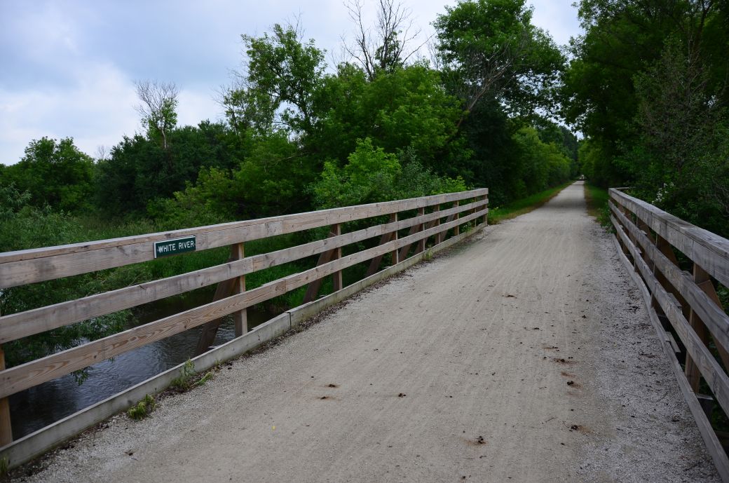 The bridge in the photo above is on the White River Trail as is crosses... what else... The White River. |
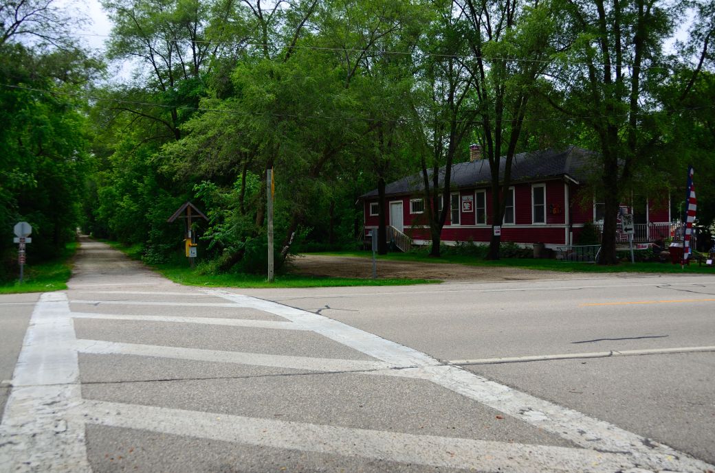 This is where the White River Trail goes by the Pedal and Cup restaurant near Springfield, Wi. |
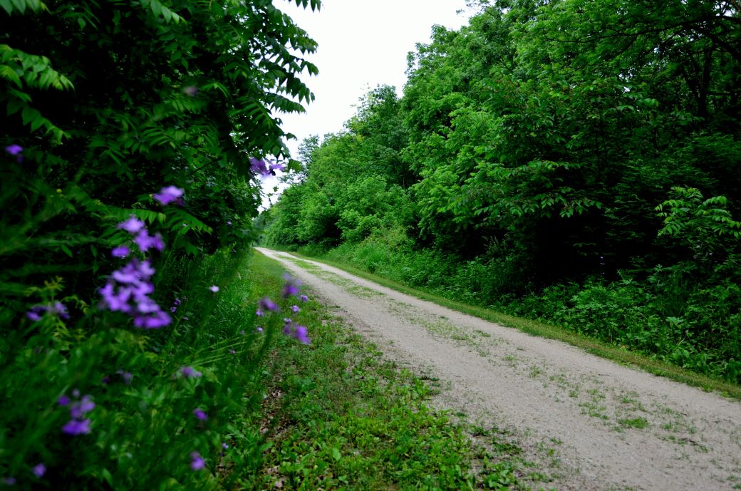 Above is a photo of a stretch of the eastern part of the trail east of Burlington. |
This Southern Wisconsin bike trail is a pretty easy day trip from the Chicagoland area. We started our trip in Burlington, Wi. which is just a little north east of Lake Geneva and is a convenient place to get on either side of the trail or to get on to the Seven Waters Trail.
We rode both legs of the WRT ~ to each end and back ~ and we ended up riding a total of 38 miles. I'm sure there is a way to ride through Burlington from the west side of the trail to the east side but we packed up our bikes and drove through town so we really did two separate rides (same day, same trail).
Both sides of the trail are crushed stone and pretty straight and flat. It's nice that you can do almost 40 miles on the White River Trail alone but there is also a connection to the Seven Waters Trail in Burlington too. So if you have the time, you can ride quite a few miles on these trails.
The western part of the trail passes through a couple of small towns and is more interesting than the eastern part of the trail. This is a Wisconsin State Trail so there is a fee and pass required for this one although I never saw anyone checking for it. The daily pass rate (as of June 2015) is $4. The yearly rate is $20.
Our Ride(s) on the White River Bike Trails
I was looking for some new southern Wisconsin trails that would not take a lot of driving time to get to and would be long enough to make it worth the drive. The WRT in Burlington, Wisconsin was a good choice for that.
I also saw that you can get on the Seven Waters Trail (SWT) in Burlington heading northeast towards Milwaukee. I was hoping to ride a little of that trail too but we ran out of time and energy before we were able to ride that one.
I did however discover that you can actually ride on trails from the east leg of the WRT through part of Burlington to the Seven Waters Trail as you can see on the map below.
We parked at the east side of the western trail leg just off of Spring Valley Road in Burlington. We rode to the end of the western leg of the trail ~ near Elkhorn ~ and back which was about 23 miles. This part of the trail was more interesting than the east leg of the trail with the towns that you pass through and the Pedal & Cup restaurant, with its acoustic guitar player right on the trail (see the photo tour below for more on this).
After riding the west leg of the trail, we drove across town and parked at Bushnell Park to get on and ride the East Leg of the WRT since we could not find a trail or an easy way to get there from where we were.
First we explored a short single track branch of the trail that went out to this old, abandoned railway bridge that crossed the Fox River. Then we got back on the main trail again and headed east to the end of the trail near (but not into) Union Grove.
The Photo Tour below includes the details of our ride and plenty of first-hand ride information to go along with the photos of both sides of the WRT..
The White River and Seven Waters Bike Maps
I originally found this trail using the Google Maps "Bicycling" option. When you zoom way in you get the trail names. Then I did some internet searches for additional trail information.
As I mentioned above, the sites that I found for the WRT all just referenced the west leg of the trail and there was no information on the east leg. They would say that the trail is 11 miles (one way) when you can actually do almost a 40 mile ride if you do both sides of the trail (and both ways, of course).
I also wanted to find a way to connect to the Seven Waters Trail and although I could not find a good map online, there was actually a very good map outside at the park that we stopped at in Burlington. I took a photo of this map with my phone.
This map shows the White River Trail and the connection to the Seven Waters Trail through Burlington. I highlighted the trails in yellow.
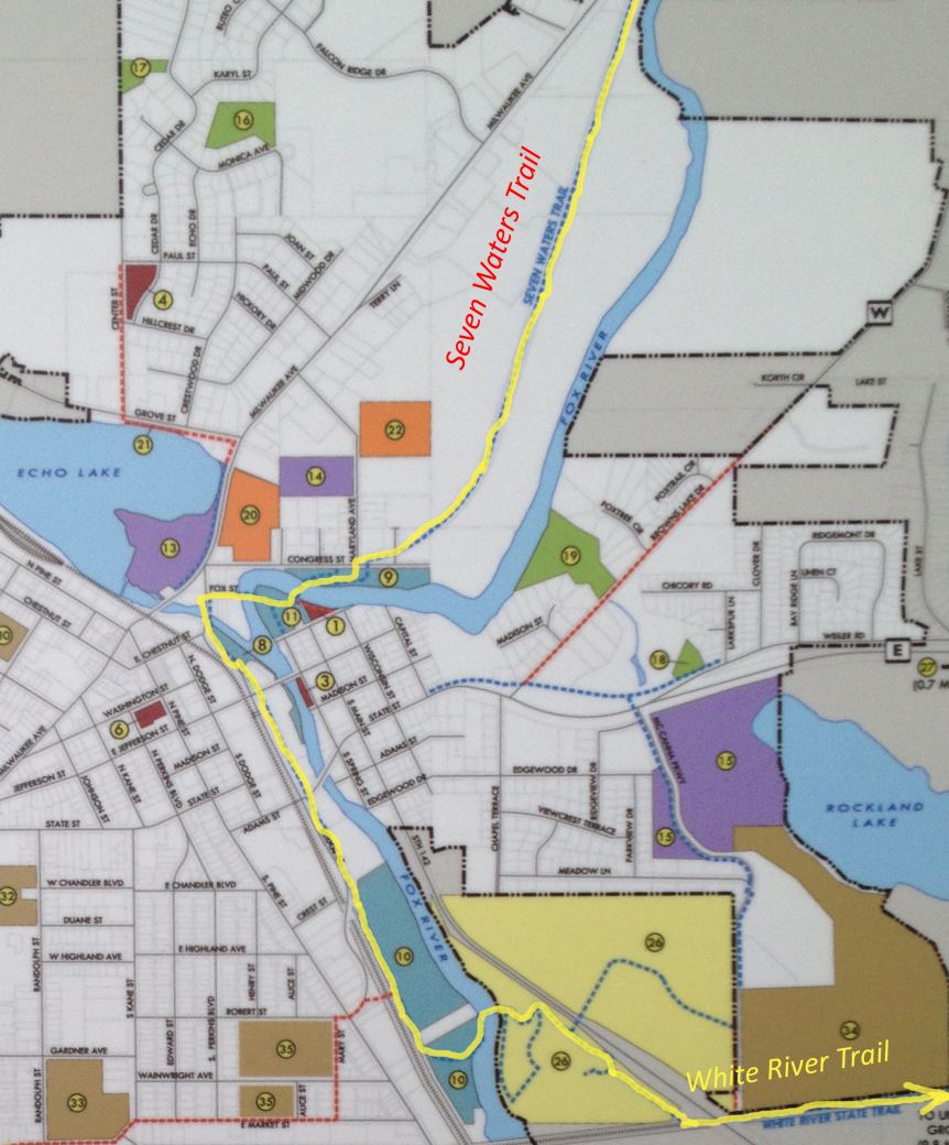
(Click <here> or on the map for the full size version).
And I did have my GPS bike computer with me, of course, so here is the GPS Map of Our Ride through the GarminConnect site.
I included both sides of the trail in the same "trip" on my bike computer although we drove from the west leg, through Burlington, to the East Leg. I turned my GPS off when we drove there but since it is included in the same "trip" on my bike computer there is a straight line connecting the 2 legs of the trail from after I turned it back on again (so that is not part of the ride).
| . |
White River Trail Photo Tour
Here's the photo tour of the White River Bike Trail including the west and east legs of the trail out of Burlington, Wisconsin. This ride was from June, 2015.
White River Trail Home < you are here
White River Trail Photos 1 - Burlington to Elkhorn
White River Trail Photos 2 - Through Springfield and Lyons
White River Trail Photos 3 - Old Railway Bridge and East Leg
- Bike Computers
- Bicycle GPS
- Bicycle Bags
- Bicycle Clothing
- Bicycle Lights
- Bicycle Locks
- Bike Parts
- Bikes
- Kids Bikes
- Exercise Bikes
- Bike Trainers
- Bicycle Car Racks
- Bicycle Hydration
- Bicycle Accessories
- Bike Blog
The WRT Photos1
The WRT Photos2
The WRT Photos3
- Algonquin Road Trail
- Busse Woods Trail
- Chain O'Lakes Trail
- Chicago Lakefront Trail
- Deer Grove Bike Path
- Des Plaines River Trail
- Evanston Lakefront
- Fox River Trail
- Great River Trail, Illinois
- Great Western Trail
- Green Bay Bike Trail
- Hennepin Canal Trail
- I&M Canal Bike Trail
- Illinois Prairie Path
- Illinois State Beach Bike Path
- Inverness Trail
- Jane Addams Trail
- Kankakee River Trail
- Long Prairie Trail
- Millennium Trail
- Moraine Hills Trails
- North Branch Trail
- North Shore Bike Path
- Old Plank Road Trail
- Palatine Trail
- Paul Douglas Trail
- Poplar Creek Trail
- Prairie Trail
- Prospect Heights Trail
- Randall Road Trail
- River Bend Trail
- Robert McClory Bike Path
- Silver Glen Trail
- Skokie Valley Trail
- Thorn Creek Trail
- Virgil Gilman Trail
- Wauponsee Glacial Trail
- 400 State Trail
- Ahnapee Bike Trail
- Badger State Trail
- BATS Crystal Lake Trail
- Cannonball Path
- Elroy Sparta Trail
- Great-River-Trail
- Kenosha Trail
- LaCrosse-River-Trail
- Military Ridge Trail
- Oak Leaf Trail
- Peninsula State Park Trail
- Red Cedar Trail
- Root River and Racine Trails
- Seven Waters Trail
- White River Trail