The Military Ridge Trail, Wisconsin
The Military Ridge Trail is a 40 mile trail that runs from Madison to Dodgeville, Wisconsin. The majority of the trail (from Verona to Dodgeville) is crushed stone but the eastern end of the trail (3 1/2 miles from Verona, Wi to Madison) is paved.
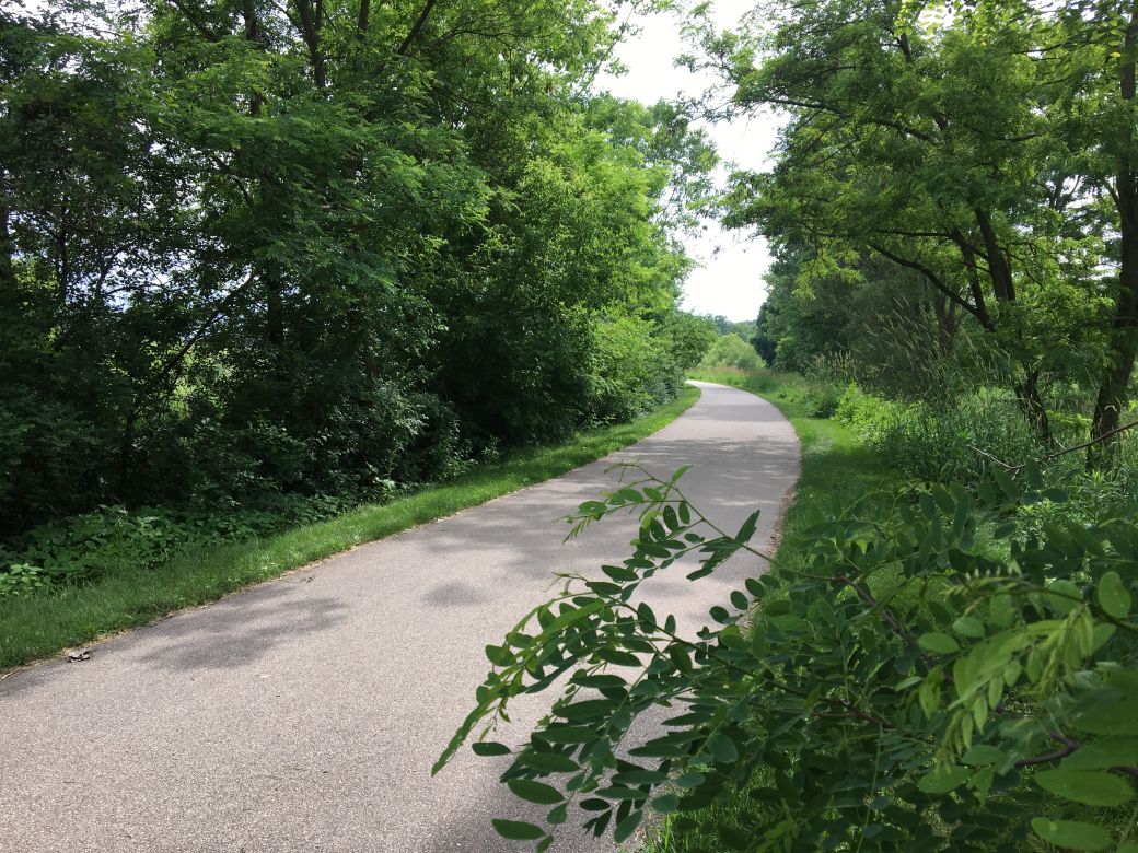 The paved part of the Military Ridge Trail just south of the bike roundabout. |
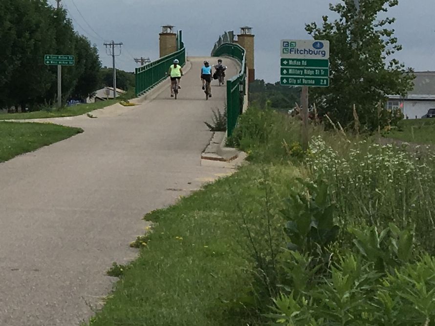 The Military Ridge Trail bridge over McKee Road. |
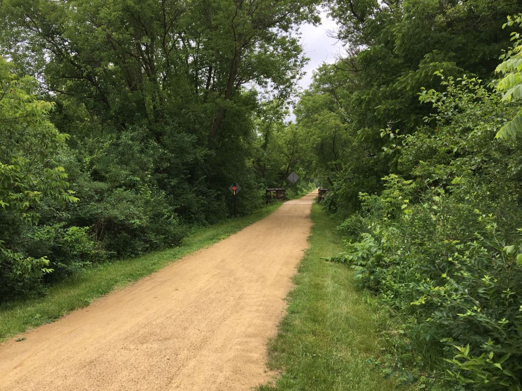 The begriming of the crushed stone part of the trail starting in Verona, Wi. |
Our Ride on the Military Ridge Trail Bike Trail
At the time of this update this article includes the Military Ridge Trail ride report and photos from Madison to Verona Wisconsin only. I hope to ride and report on the remainder of the trail soon.
We started our ride on the Military Ridge Trail (MRT) in Verona, Wisconsin, just southwest of Madison, and actually intended to ride the trail west toward Dodgeville.
We only made it about 3 1/2 miles before we ran into a tunnel that went under Hwy 151/18 that was flooded pretty badly. We decided not to attempt riding through the flood in this case and turned around to go back to Verona to look for another place to ride.
Since we could not get past the flooded area on the MRT going west, we ended up riding the eastern, paved part of the Military Ridge Trail as well as 4 other trails on this one ride!
There are many trails that connect to the Military Ridge Trail and 4 trails that connect to this trail at the bike roundabout trail intersection in Madison (or Fitchburg, it's right on the border of these towns).
The photo tour (below) starts from the Bike Roundabout, multi-trail intersection in Madison on our way back (southeast) to Verona. Although this is a very small part of the trail, it does include good information about this part of the trail and about the connecting trails in this area. I hope to ride the rest of the trail soon so stay tuned! :-)
The Military Ridge Trail Maps
I am including the Google Maps version of the trail, so you can get right to it without having to search and zoom in. I am also including my GPS map on the Garmin Connect SIte,
Each map has different features that can be helpful so you can take your pick of which one you like the best.
Here is the Google Maps version of the Military Ridge Trail.
Here is the GPS Map of Our Ride on the Military Ridge Trail (and 4 other trails) through the GarminConnect site.
Google Street/Trail View - I also generated this Google Street View 3D spherical image at the Multi-Trail Intersection so you can see what the trail intersection looks like here. After viewing the image, close the image with the " X" to see the map location..
Google Photo Sphere of the Bike Roundabout or Multi-Trail Intersection.
| . |
Military Ridge Trail Photo Tour
Here's the photo tour of the Military Ridge Trail with plenty of first hand riding details. This ride was from June, 2018.
Military Ridge Trail Bike Trail Home < you are here
Photos © Copyright Rob Chapman, about-bicycles.com. Photos with * Copyright Dale Kiffel.
- Bike Computers
- Bicycle GPS
- Bicycle Bags
- Bicycle Clothing
- Bicycle Lights
- Bicycle Locks
- Bike Parts
- Bikes
- Kids Bikes
- Exercise Bikes
- Bike Trainers
- Bicycle Car Racks
- Bicycle Hydration
- Bicycle Accessories
- Bike Blog
- Algonquin Road Trail
- Busse Woods Trail
- Chain O'Lakes Trail
- Chicago Lakefront Trail
- Deer Grove Bike Path
- Des Plaines River Trail
- Evanston Lakefront
- Fox River Trail
- Great River Trail, Illinois
- Great Western Trail
- Green Bay Bike Trail
- Hennepin Canal Trail
- I&M Canal Bike Trail
- Illinois Prairie Path
- Illinois State Beach Bike Path
- Inverness Trail
- Jane Addams Trail
- Kankakee River Trail
- Long Prairie Trail
- Millennium Trail
- Moraine Hills Trails
- North Branch Trail
- North Shore Bike Path
- Old Plank Road Trail
- Palatine Trail
- Paul Douglas Trail
- Poplar Creek Trail
- Prairie Trail
- Prospect Heights Trail
- Randall Road Trail
- River Bend Trail
- Robert McClory Bike Path
- Silver Glen Trail
- Skokie Valley Trail
- Thorn Creek Trail
- Virgil Gilman Trail
- Wauponsee Glacial Trail
- 400 State Trail
- Ahnapee Bike Trail
- Badger State Trail
- BATS Crystal Lake Trail
- Cannonball Path
- Elroy Sparta Trail
- Great-River-Trail
- Kenosha Trail
- LaCrosse-River-Trail
- Military Ridge Trail
- Oak Leaf Trail
- Peninsula State Park Trail
- Red Cedar Trail
- Root River and Racine Trails
- Seven Waters Trail
- White River Trail