The Seven Waters Trail
The Seven Waters Trail (SWT) heads north ~ and a little east ~ out of Burlington, WIsconsin to a little past Wind Lake. This trail is is a variety of crushed stone, paved trails, abandoned roads and side roads and runs parallel to or close to Route 36 in most places. The series of trails is approximately 16 miles each way.
An interesting side trip is The Bunker VFW post in Rochester, Wis. You can see the tail of a fighter jet from the trail as you ride by. We rode around the corner to check out the military equipment on display and it was pretty interesting. You can see this in the photo pages for this trail.
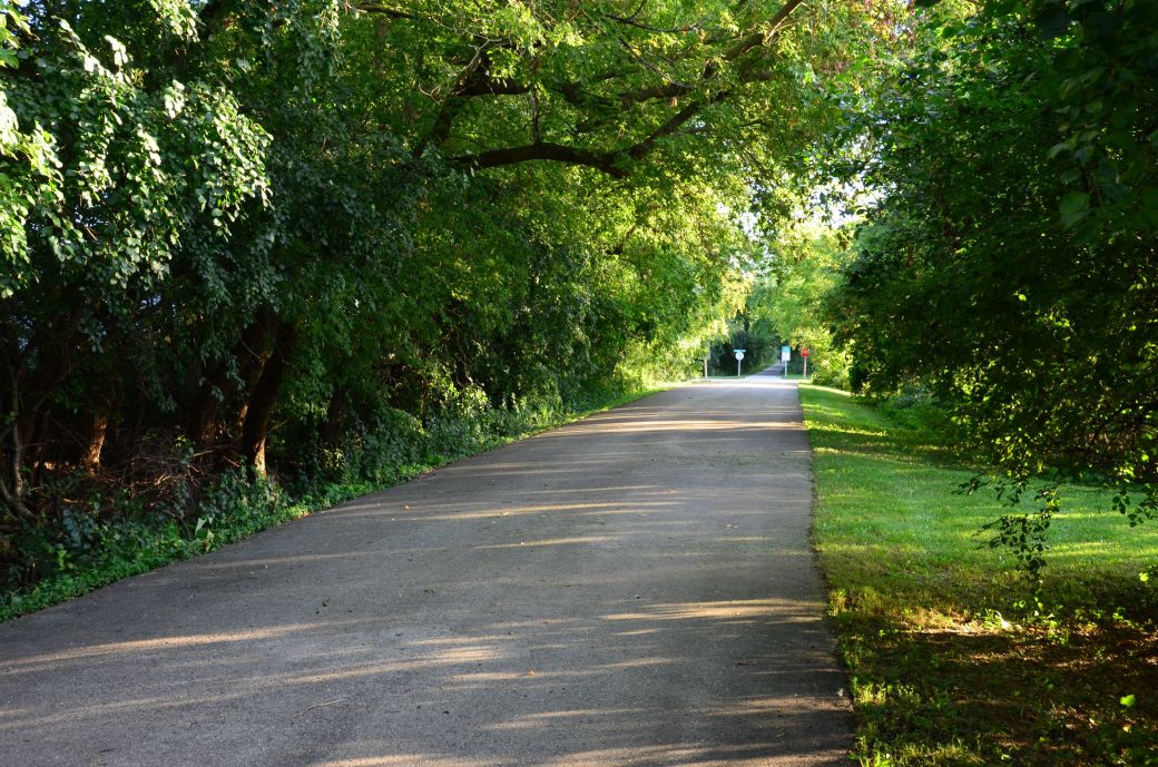 The photo above shows one of the wooded parts of the trail at the northern end just south of Wind Lake |
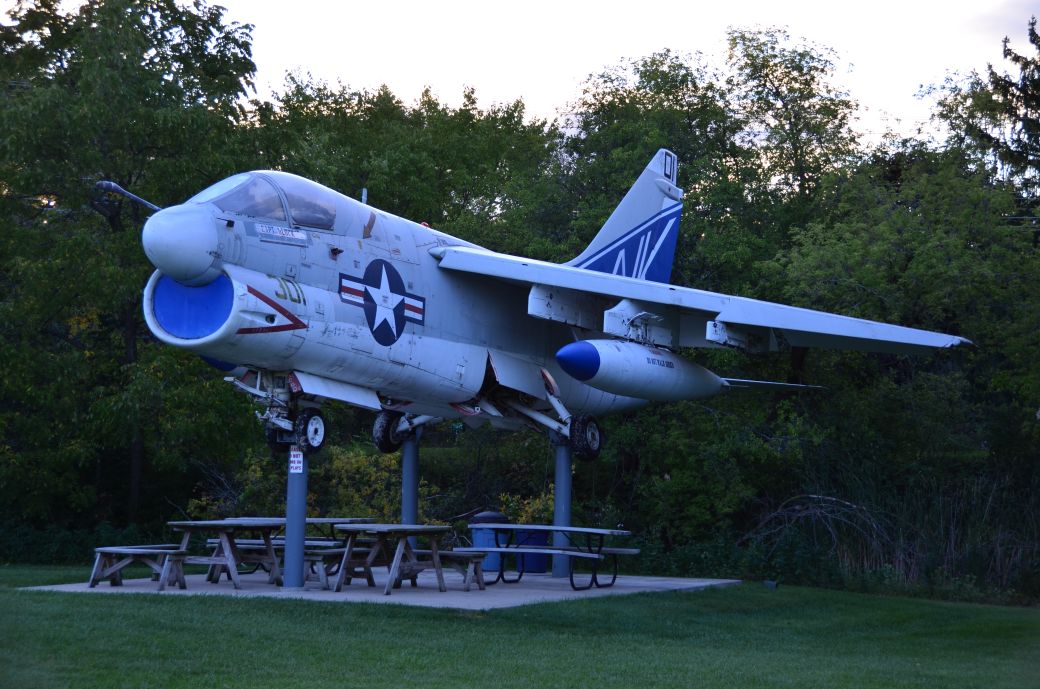 This fighter jet is on display at The Bunker in Rochester, Wi, and you see the tail of the jet from the trail |
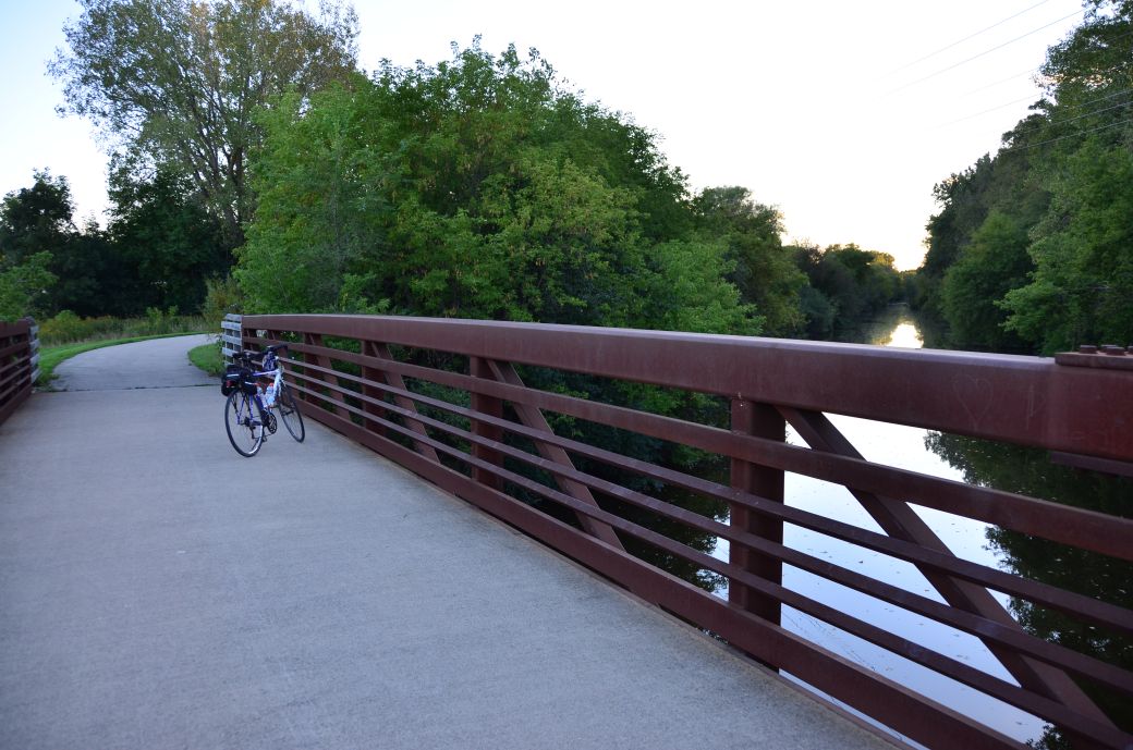 The SWT has a variety of surfaces and scenery including bridges over the Fox River and other waterways. The SWT has a variety of surfaces and scenery including bridges over the Fox River and other waterways. |
I have also seen this trail called the Norway Trail, the Burlington-Norway Trail and the rather generic Racine County Trail. Many of the signs on the trail just say Racine County Trail but I have seen it called the Seven Waters Trail in reliable places like Google Maps and the sign at Jucker Park in Burlington, where we parked, and will be using that name.
This bike trail is an easy day trip from the Chicagoland area. It is about an hour and a half drive from where we live in the northwest suburbs.
Our Ride on the Seven Waters Trail
We started our trip at Wehmhoff Jucker Park in Burlington which is at the southern end of the trail where the Fox River meets up with Echo Lake. BTW: This is the same Fox River that flows down to Illinois, into the Chain-of-Lakes and into Algonquin, Il where it meets up with the Fox River Trail also documented on this site.
We followed the trail north to where it crosses the expressway (Route 36 or Milwaukee Ave.) then through Saller Woods to a side road then through Case Eagle Park (there are signs to help you follow the trail).
The first part of the trail was open, bright and sunny then going through the woods was very dark and shaded. I mention this because I thought that the trail had quite a variety of scenes and I wondered if I was still on the same trail.
After the wooded areas we went past an open park area and dog park south of Rochester then past The Bunker VFW post ~ the jet photos also in Rochester ~ then through Waterford and to the town of Norway or Wind Lake. The fairly large lake is also called Wind Lake, of course.
I believe that the SWT actually ends at Wind Lake Road, where the Penny Bar is. but we continued north on a side road (Loomis Rd.) to Oak Ln and crossed Milwaukee Ave to continue north on what is mostly called the Norway Trail. It was nice to extend our ride a little but the northern part of our ride ~ north of Penny Bar ~ was not all that great.
The Photo Tour below includes more details of our ride and plenty of first-hand ride information to go along with the photos. I took the photos on the way back, starting south of Wind Lake. There is also a short YouTube video that I put together (linked to below).
The Seven Waters Trail Maps
I found this trail using Google Maps with the Bike Trail option enabled then did a little additional research after I found it. I like to include the Google Maps version of the trail ~ so you can get right to it without having to search and zoom in ~ in addition to my GPS map on the Garmin Connect SIte and a photo of a map that I took in Burlington at Juker Park.
Each map has different features that can be helpful so you can take your pick of which one you like the best.
Here's the Seven Waters Trail map from the sign posted at Wehmhoff Jucker Park in Burlington. Note: You can also get on the White River Trail in Burlington. Click on the map photo to see the larger version.
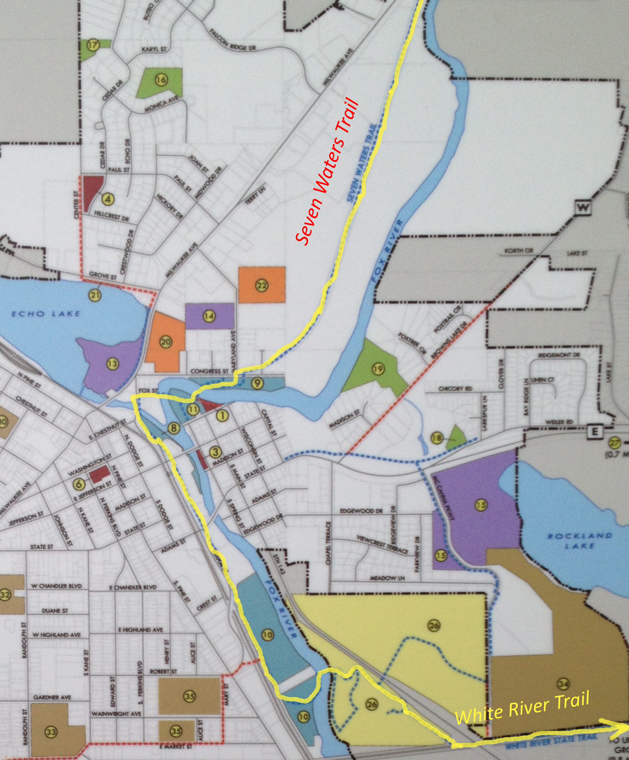
(Click here or on the map for the full size version).
Here is the GPS Map of Our Ride on the Seven Waters Trail through the GarminConnect site.
Here is the Google Maps version of the Seven Waters Trail.
| . |
Seven Waters Trail Photo Tour
Here's the photo tour of the Seven Waters Trail with plenty of first hand riding details. This ride was from September, 2016.
Seven Waters Trail Home < you are here
Seven Waters Trail Photos 1 -Wind Lake to The Bunker
Seven Waters Trail Photos 2 - Rochester to Saller Woods
Seven Waters Video on YouTube
Here's the video ot the Seven Waters Trail that I posted on YouTube
Photos © Copyright Rob Chapman, about-bicycles.com
- Bike Computers
- Bicycle GPS
- Bicycle Bags
- Bicycle Clothing
- Bicycle Lights
- Bicycle Locks
- Bike Parts
- Bikes
- Kids Bikes
- Exercise Bikes
- Bike Trainers
- Bicycle Car Racks
- Bicycle Hydration
- Bicycle Accessories
- Bike Blog
The SWT Photos1
The SWT Photos2
- Algonquin Road Trail
- Busse Woods Trail
- Chain O'Lakes Trail
- Chicago Lakefront Trail
- Deer Grove Bike Path
- Des Plaines River Trail
- Evanston Lakefront
- Fox River Trail
- Great River Trail, Illinois
- Great Western Trail
- Green Bay Bike Trail
- Hennepin Canal Trail
- I&M Canal Bike Trail
- Illinois Prairie Path
- Illinois State Beach Bike Path
- Inverness Trail
- Jane Addams Trail
- Kankakee River Trail
- Long Prairie Trail
- Millennium Trail
- Moraine Hills Trails
- North Branch Trail
- North Shore Bike Path
- Old Plank Road Trail
- Palatine Trail
- Paul Douglas Trail
- Poplar Creek Trail
- Prairie Trail
- Prospect Heights Trail
- Randall Road Trail
- River Bend Trail
- Robert McClory Bike Path
- Silver Glen Trail
- Skokie Valley Trail
- Thorn Creek Trail
- Virgil Gilman Trail
- Wauponsee Glacial Trail
- 400 State Trail
- Ahnapee Bike Trail
- Badger State Trail
- BATS Crystal Lake Trail
- Cannonball Path
- Elroy Sparta Trail
- Great-River-Trail
- Kenosha Trail
- LaCrosse-River-Trail
- Military Ridge Trail
- Oak Leaf Trail
- Peninsula State Park Trail
- Red Cedar Trail
- Root River and Racine Trails
- Seven Waters Trail
- White River Trail