The Little Miami Scenic Trail
The Little Miami Scenic Trail is a beautiful 78 mile paved trail that runs from Urbana, Ohio (northeast of Dayton) to the outskirts of Cincinnati. The trail mostly follows the Little Miami River.
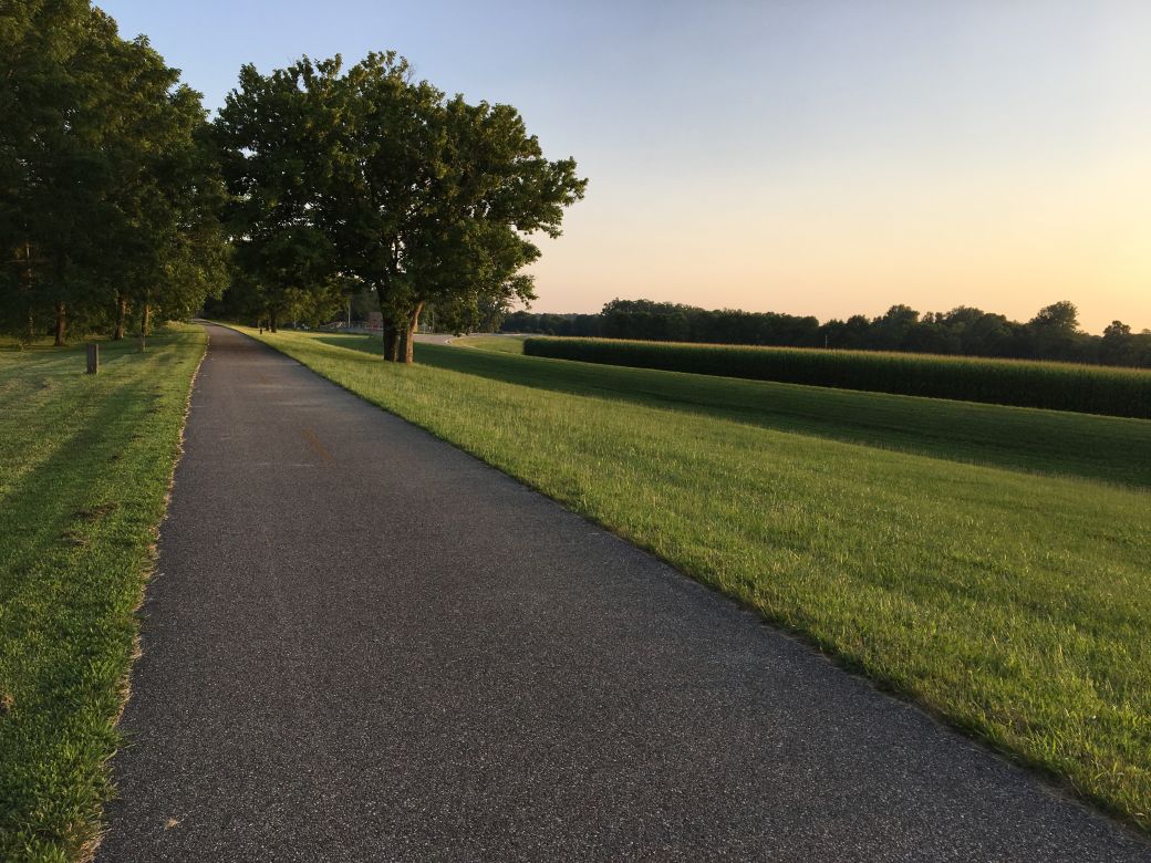 An open part of the Little Miami Scenic Trail near sunset.. |
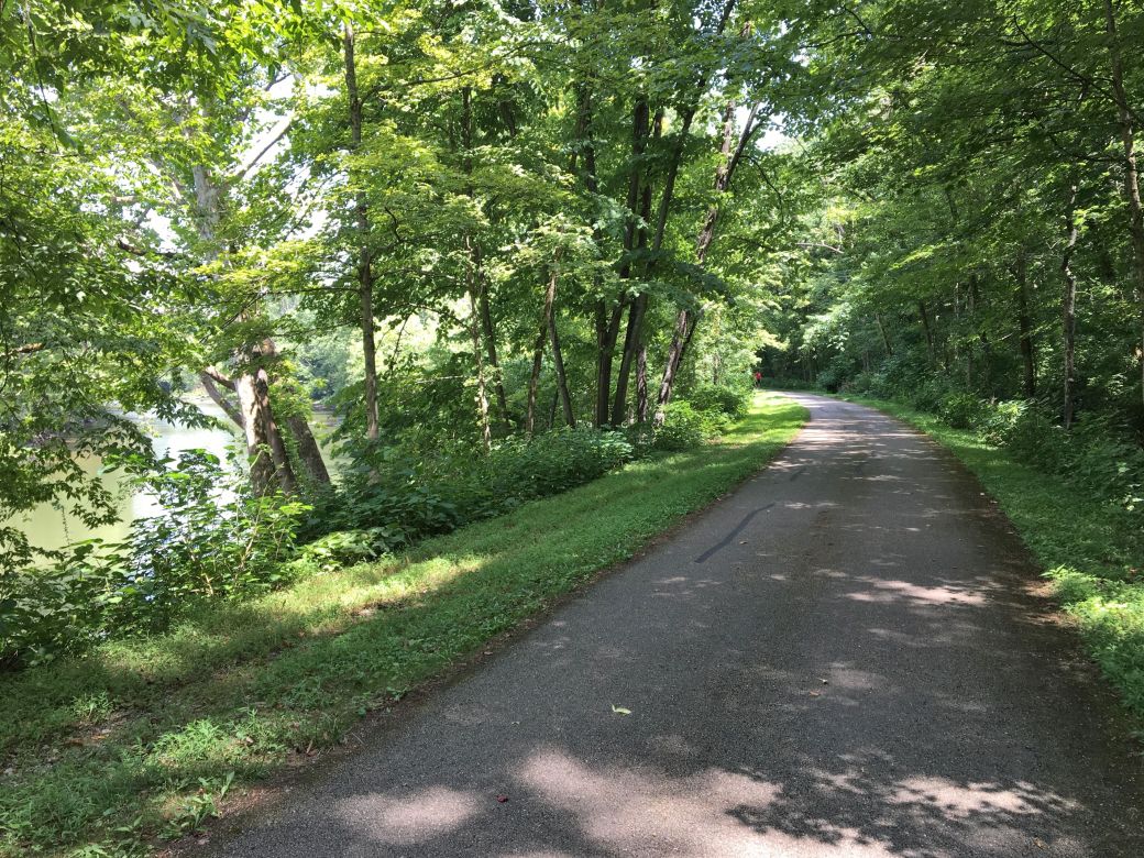 A view of the Little Miami River from the trail |
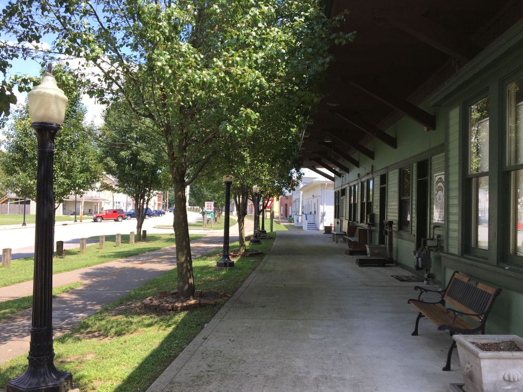 The old train station right next to the trail. Truly a rails-to-trails conversion. |
The Little Miami Scenic Trail (LMST) is a rails-to-trails conversion and is therefore mostly flat and fairly straight in most places. The trail makes its way through the Ohio countryside and through quite a few small towns. Some of the towns on the trail are barely more than an intersection of a couple of roads while others are a little bigger and great places to visit and/or take a break.
My Ride on the Little Miami Scenic Trail
I drove to Xenia where I stayed and started my first ride on the trail from there. I rode the trail from Xenia to South Lebanon with 2 round trip rides over a 2 day time frame. This was a total of 71 miles of riding but since each ride was round trip I only saw 35+ miles of the trail.
I started my first ride a little late since this was after I drove over 5 1/2 hours and then found a hotel and checked in. So even though my rides were in the middle of July and sunset was pretty late I did not have as much time as I would have liked for my first ride. I was however able to get an earlier start on day 2 and cover a lot more miles.
So my ride on day 1 started in Xenia and I rode to just north of Corwin (approx 14 miles each way). I actually took a wrong turn in Xenia since there are quite a few bike trails in that town and the LMST was not marked clearly.
I found out later that most of these trails have number designations on the trail signs (rather than names in some cases) which is OK if you know the key but I did not have that at first. Fortunately I got a good (paper) map of the bike trails in the area from the hotel where I was staying and it had the number designations.
FYI: The Little Miami Scenic Trail is designated as Trail #1 and Trail #3 on the trail signs. This is also very confusing since Trail #3 is also called the Simon Kenton Trail on the northern section and Trail #1 is also called the Ohio to Erie Trail in the south Sheesh! You might want to have a map handy when going through Xenia.
Anyway, back to the day 1 ride, I loved the trail in this area and it was flat and in great shape. After Xenia there were only a few very small towns on this part of the trail. I rode the trail on weekdays and although there were other riders out at the time the trail was not crowded at all.
On my day 2 ride I parked in Corwin, which has a great parking area for trail users that is right next to the trail. I rode a little north to the place where I turned around the day before then south through Corwin again and eventually to South Lebanon which was about a 21 mile ride one way.
Between the towns of Oregonia and Morrow the trail passes under an incredibly tall interstate bridge. This was the tallest bridge that I had even been under on a bike trail and I took some vertical panoramic photos of it on the way back (in the photo tour below). Later I looked it up and found out that it is called the Jeremiah Morrow bridge and is for Interstate 71.
I had much more time for this ride and I really loved the town of Morrow. Morrow is a quaint little town that has an old train station from when the trail was rails. There are also some shops, a few places to eat, places to take a break and an old railcar on display. I took quite a few photos here and have included many of them in the photo tour below.
The Little Miami Scenic Trail Maps
I am including the Google Maps version of the trail ~ so you can get right to it without having to search and zoom in ~ in addition to my GPS maps on the Garmin Connect SIte.
Each map has different features that can be helpful so you can take your pick of which one you like the best.
Here is the GPS Map of My Day 1 Ride on the Little Miami Scenic Trail through the GarminConnect site.
Here is the GPS Map of My Day 2 Ride on the Little Miami Scenic Trail through the GarminConnect site.
Here is the Google Maps version of the Little Miami Scenic Trail.
Note: I actually took some Google Maps spherical photos of the trail for a 3D (spherical actually) view as I often do but when I got back and uploaded them they do not show up on Google Maps. Why? Well, I didn't realize that Google already has the entire Little Miami Scenic Trail cataloged as a Street View route!
This is a pretty cool way to see the trail online to explore before you go there. At this time Google only has this for a very few selected trails. To view the Trail in Street View (actually Trail View) just go to the trail on Google Maps (you can use the link above for that if you like) then select the Street View option for the trail.
| . |
Little Miami Scenic Trail Photo Tour
Here's the photo tour of the Little Miami Scenic Trail with plenty of first hand riding details. This ride was from July 24th and 25th, 2019.
Little Miami Scenic Trail Home < you are here
LMST Photos 1 - Corwin, Xenia then South Lebanon
LMST Photos 2 - South Lebanon to Morrow
LMST Photos 3 - Morrow to Corwin
Photos © Copyright Rob Chapman, about-bicycles.com.
- Bike Computers
- Bicycle GPS
- Bicycle Bags
- Bicycle Clothing
- Bicycle Lights
- Bicycle Locks
- Bike Parts
- Bikes
- Kids Bikes
- Exercise Bikes
- Bike Trainers
- Bicycle Car Racks
- Bicycle Hydration
- Bicycle Accessories
- Bike Blog
The LMST Photos1
The LMST Photos2 The LMST Photos3
- Algonquin Road Trail
- Busse Woods Trail
- Chain O'Lakes Trail
- Chicago Lakefront Trail
- Deer Grove Bike Path
- Des Plaines River Trail
- Evanston Lakefront
- Fox River Trail
- Great River Trail, Illinois
- Great Western Trail
- Green Bay Bike Trail
- Hennepin Canal Trail
- I&M Canal Bike Trail
- Illinois Prairie Path
- Illinois State Beach Bike Path
- Inverness Trail
- Jane Addams Trail
- Kankakee River Trail
- Long Prairie Trail
- Millennium Trail
- Moraine Hills Trails
- North Branch Trail
- North Shore Bike Path
- Old Plank Road Trail
- Palatine Trail
- Paul Douglas Trail
- Poplar Creek Trail
- Prairie Trail
- Prospect Heights Trail
- Randall Road Trail
- River Bend Trail
- Robert McClory Bike Path
- Silver Glen Trail
- Skokie Valley Trail
- Thorn Creek Trail
- Virgil Gilman Trail
- Wauponsee Glacial Trail
- 400 State Trail
- Ahnapee Bike Trail
- Badger State Trail
- BATS Crystal Lake Trail
- Cannonball Path
- Elroy Sparta Trail
- Great-River-Trail
- Kenosha Trail
- LaCrosse-River-Trail
- Military Ridge Trail
- Oak Leaf Trail
- Peninsula State Park Trail
- Red Cedar Trail
- Root River and Racine Trails
- Seven Waters Trail
- White River Trail