The Thorn Creek Trail
The Thorn Creek Trail is an all paved trail ~ about 17 miles long ~ that runs from just southwest of Lansing, Indiana at the northern end of the trail through many wooded forest preserves to a little past Sauk Trail Woods.
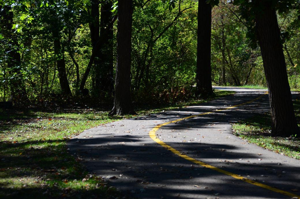 The Thorn Creek Trail in Sweet Woods where we started our ride. |
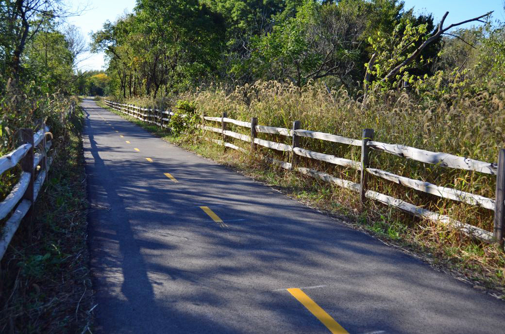 The new section of the Old Plank Road that now connects to the Thorn Creek Trail. |
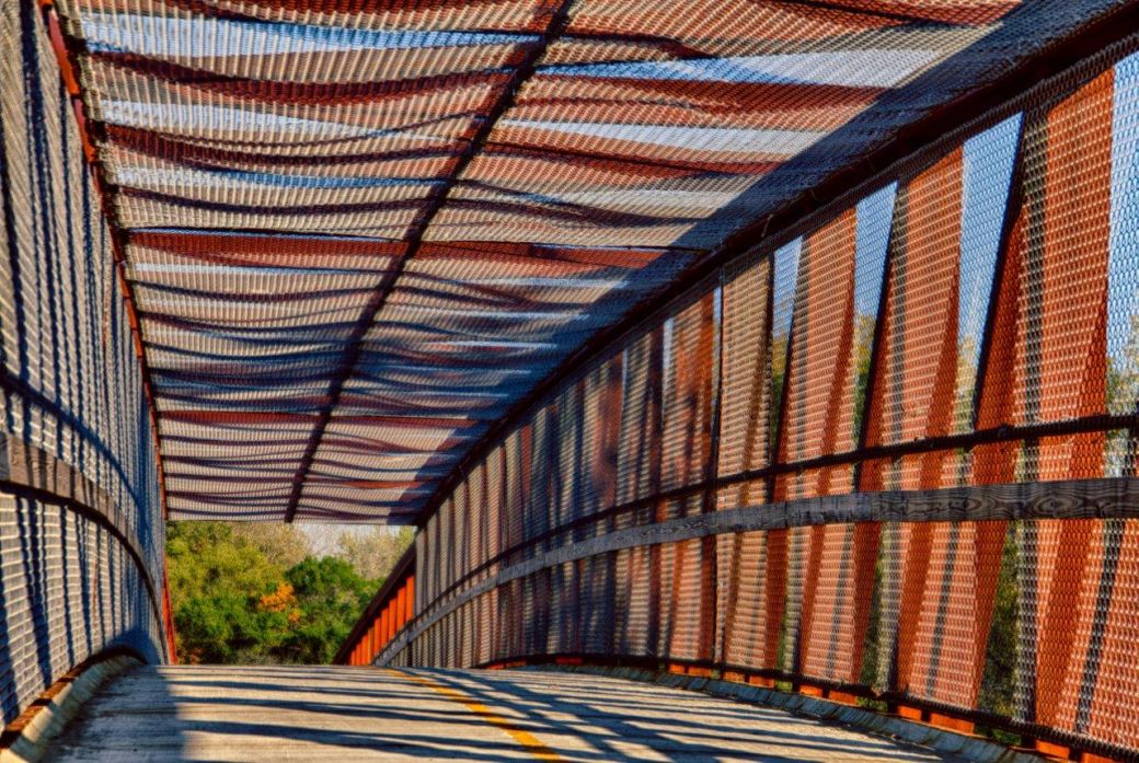 * *The bridge over the railroad tracks in the late evening sunlight. |
The Thorn Creek Trail (TCT) is located just south of Chicago near Glenwood, Chicago Heights and Park Forest. This is a very nice all paved and mostly wooded trail that is about 17 miles one way and now connects to the Old Plank Road Trail (OPRT) which gives to the option to ride at least 65 miles round trip.
The OPRT connection was completed in 2015 and the two trails now allow you to ride from near Lansing, Indiana to Joliet, Illinois with a side trip to the Sauk Trail Woods.
Our Ride on the Thorn Creek Trail
We started our ride at Sweet Woods forest preserve just off of Cottage Grove Avenue north of Glenwood, Illinois. There are many places to get on the trail but this one worked well for us.
We rode the eastern part of the trail first since we were pretty close the the northeast end of the trail which is pretty close to the Indiana state line. I took the initial photos after we turned around and headed back to Sweet Woods.
After that we rode to Sauk Trail Woods which is pretty close to the southwest end of the trail. I took the next round of photos and the video after we turned around and came back from that end of the trail.
We took a little side trip on the new part of the Old Plank Road Trail since this was not complete back in October of 2015 when we rode most of the rest of the OPRT. It is really nice that these trails connect now which gives you the option to take a really long ride on all paved trails.
The Thorn Creek Trail Maps
I like to include the Google Maps version of the trail ~ so you can get right to it without having to search and zoom in ~ in addition to my GPS map on the Garmin Connect SIte and a photo of a map that I took at the northeast end of the trail in Lansing Woods.
Each map has different features that can be helpful so you can take your pick of which one you like the best.
Here's the Thorn Creek Trail map from the sign posted at the northeast end of the trail in Lansing Woods. Click on the map photo to see the larger version.
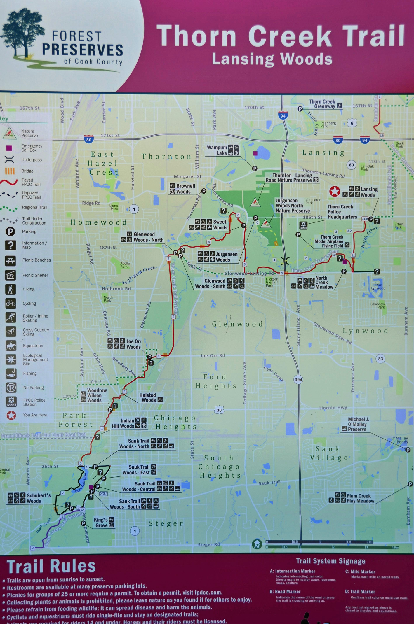
(Click here or on the map for the full size version).
Here is the GPS Map of Our Ride on the Thorn Creek Trail through the GarminConnect site.
Here is the Google Maps version of the Thorn Creek Trail.
| . |
Thorn Creek Trail Photo Tour
Here's the photo tour of the Thorn Creek Trail with plenty of first hand riding details. This ride was from October, 2016.
Thorn Creek Trail Home < you are here
Thorn Creek Trail Photos 1 - Northeast Part of the Trail
Thorn Creek Trail Photos 2 - Sauk Trail Woods to OPRT
Thorn Creek Trail Photos 3 - Back to Sweet Woods
Thorn Creek Trail Video on YouTube
Here's the video of the Thorn Creek Trail that I posted on YouTube.
Photos © Copyright Rob Chapman, about-bicycles.com. Photos with * Copyright Dale Kiffel.
- Bike Computers
- Bicycle GPS
- Bicycle Bags
- Bicycle Clothing
- Bicycle Lights
- Bicycle Locks
- Bike Parts
- Bikes
- Kids Bikes
- Exercise Bikes
- Bike Trainers
- Bicycle Car Racks
- Bicycle Hydration
- Bicycle Accessories
- Bike Blog
The TCT Photos1
The TCT Photos2
The TCT Photos3
- Algonquin Road Trail
- Busse Woods Trail
- Chain O'Lakes Trail
- Chicago Lakefront Trail
- Deer Grove Bike Path
- Des Plaines River Trail
- Evanston Lakefront
- Fox River Trail
- Great River Trail, Illinois
- Great Western Trail
- Green Bay Bike Trail
- Hennepin Canal Trail
- I&M Canal Bike Trail
- Illinois Prairie Path
- Illinois State Beach Bike Path
- Inverness Trail
- Jane Addams Trail
- Kankakee River Trail
- Long Prairie Trail
- Millennium Trail
- Moraine Hills Trails
- North Branch Trail
- North Shore Bike Path
- Old Plank Road Trail
- Palatine Trail
- Paul Douglas Trail
- Poplar Creek Trail
- Prairie Trail
- Prospect Heights Trail
- Randall Road Trail
- River Bend Trail
- Robert McClory Bike Path
- Silver Glen Trail
- Skokie Valley Trail
- Thorn Creek Trail
- Virgil Gilman Trail
- Wauponsee Glacial Trail
- 400 State Trail
- Ahnapee Bike Trail
- Badger State Trail
- BATS Crystal Lake Trail
- Cannonball Path
- Elroy Sparta Trail
- Great-River-Trail
- Kenosha Trail
- LaCrosse-River-Trail
- Military Ridge Trail
- Oak Leaf Trail
- Peninsula State Park Trail
- Red Cedar Trail
- Root River and Racine Trails
- Seven Waters Trail
- White River Trail